")
")
 |
Geosite ID: PSt10 Name: Ilhéu da Cal Thematic category: Paleontology |
 |
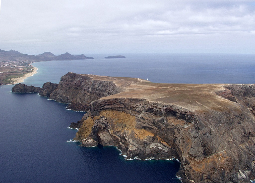
Municipality: Porto Santo Civil parish: Porto Santo Location area: 10-1000 ha Coordinates(1):33°00'09.02'' N 16°23'16.97'' W Altitude: 0 m Accessibility: Easy Distance to nearest paved road: 6,4 nmi Conditions of observation: Satisfactory (1) Coordinates of the geosite and / or the best viewpoint |
Brief description
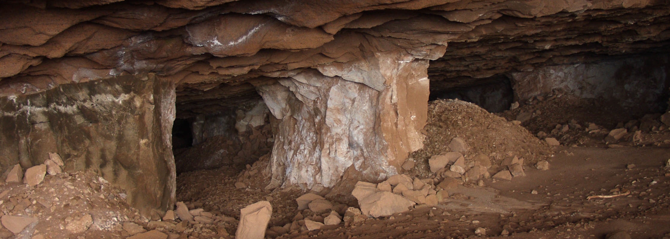
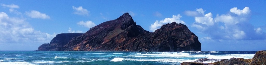
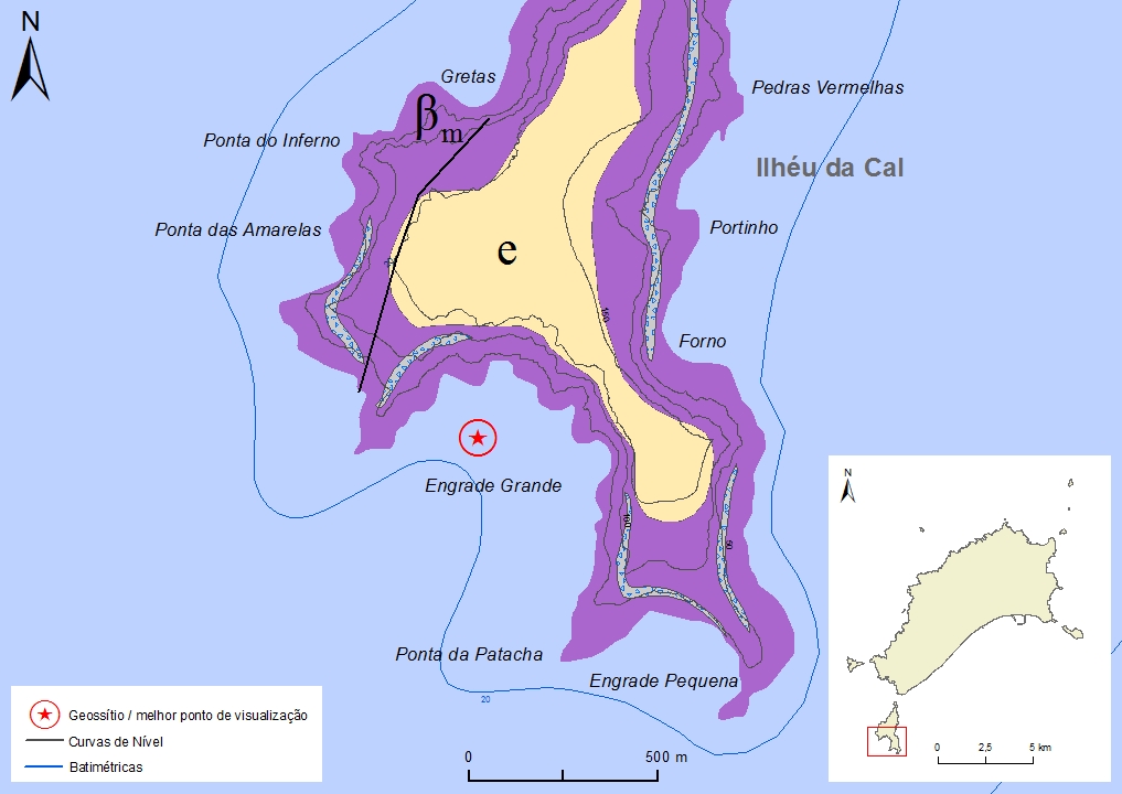
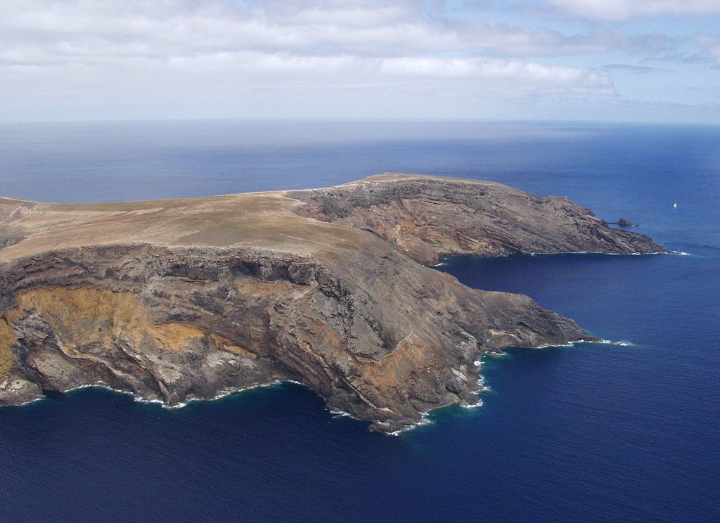
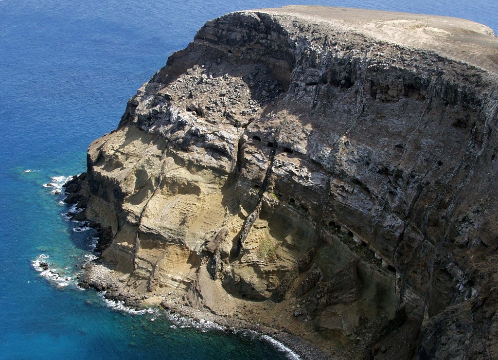
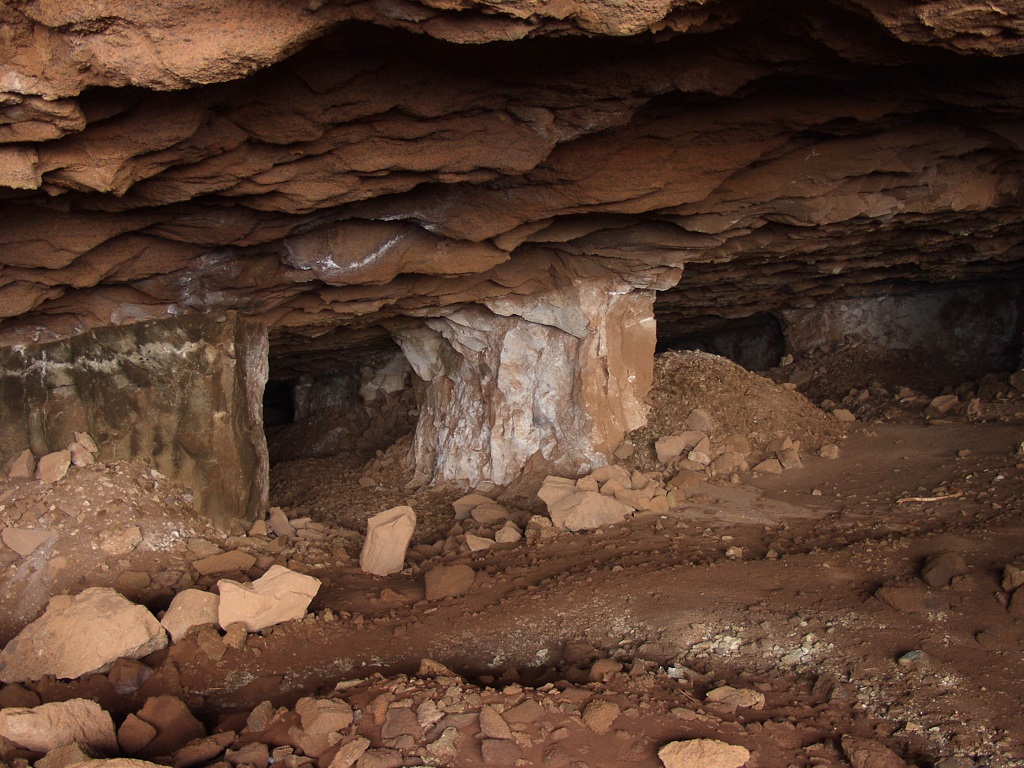
In Ilhéu da Cal, also known as Ilhéu de Baixo, it is possible to observe hyaloclastites, layers of carbonated pararecifal deposits and conglomerates, submarine basaltic flows and basaltic tuffs from the middle Miocene. The top of this islet is covered by Quaternary aeolianitic deposits. Like the other islets, it was once connected to the main island and its individualization resulted from erosive processes that occurred after the last glaciation and the deposition of the aeolianitic formation during the Holocene, less than 10-12 thousand years ago. Several galleries were drilled in the calcareous deposits that formed two continuous layers throughout the islet. This material was used in the lime manufacturing industry, an activity that was extremely important to the local economy. These deposits correspond to carbonated sedimentary marine deposits and fossilized coral reefs, with 15.2 My (middle Miocene), that formed on the top of the volcanic edifice during Porto Santo’s pre-emergence phase.
Relevant notes
The visitation to the islanders requires prior authorization from the Institute of Forests and Nature Conservation (IFCN).
Visiting a site of geological interest is the sole responsibility of the user.
The user must take precautions when visiting the site, taking into account the conditions of the terrain, weather conditions and other hazards, so that they do not create situations that put themselves or others at risk.
The user must respect private property. Access to private areas requires prior authorization from the owners.
The user must respect natural heritage, keeping it intact. The impact of your actions should be minimal.
Protection status
Natura 2000 Network, Network of Marine Protected Areas of Porto Santo, Site of Community Importance PTPOR0001 - Ilhéus do Porto Santo, Scientific Heritage (geological) and Natural Areas of Interdiction, according to the Municipal Master Plan.
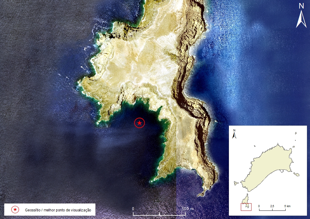
Simplified geological map of Porto Santo Island detail - PST10
Bibliography
BAARLI, B. G., CACHÃO, M., DA SILVA, C. M., JOHNSON, M., MAYORAL, E., SANTOS, A. (2013). A Middle Miocene carbonate embankment on an active volcanic slope: Ilhéu de Baixo, Madeira Archipelago, Eastern Atlantic. Geological Journal, pp. 1-48.
CACHÃO, M., RODRIGUES, D. DA SILVA, C. M. (2001). Património Paleo-recifal de Porto Santo. Congresso Internacional sobre Património Geológico e Mineiro, 4 a 7 de outubro de 2001: Livro de Resumos. Edição Museu do Instituto Geológico e Mineiro; Coordenação José M. Brandão, Octávio Puche-Riarte. Lisboa: Museu do Instituto Geológico e Mineiro, 2001, p. 15, Secção 1: Património Geológico.
FERREIRA, M. R. (2014). Património Geológico da Ilha do Porto Santo e Ilhéus Adjacentes (Madeira): Inventariação, Avaliação e Valorização como Contributo para a Geoconservação. Dissertação de Mestrado em Vulcanologia e Riscos Geológicos. Departamento de Geociências da Universidade dos Açores.
RIBEIRO, M. L. Carta Geológica Simplificada das Ilhas da Madeira e do Porto Santo, na escala 1:80.000 in RIBEIRO, M. L. & RAMALHO, M. (2009). Uma visita geológica ao Arquipélago da Madeira, Principais locais Geo-turísticos. Edição da Direção Regional do Comércio, Indústria e Energia e do Laboratório Nacional de Energia e Geologia, I. P, pp. 55, 82. ISBN: 978-989-96202-0-9.
SILVA, J. (2003). Areia de Praia da Ilha do Porto Santo: geologia, génese, dinâmica e propriedades justificativas do seu interesse medicinal. Madeira Rochas – Divulgações Científicas e Culturais, 344 pp.
SCHMIDT, R. & SCHMINCKE, H.-U. (2002). From seamount to oceanic island, Porto Santo, central East-Atlantic. International Journal of Earth Sciences (Geol Rundsch) nº 91, pp. 594–614.
Photo gallery
How to Cite
FERREIRA, M. R. (2014). Património Geológico da Ilha do Porto Santo e Ilhéus Adjacentes (Madeira): Inventariação, Avaliação e Valorização como Contributo para a Geoconservação. Dissertação de Mestrado em Vulcanologia e Riscos Geológicos. Departamento de Geociências da Universidade dos Açores. In: https://geodiversidade.