")
")
 |
Geosite ID: RB02 Name: Lombo do Mouro Thematic category: Stratigraphy and vulcanology
|
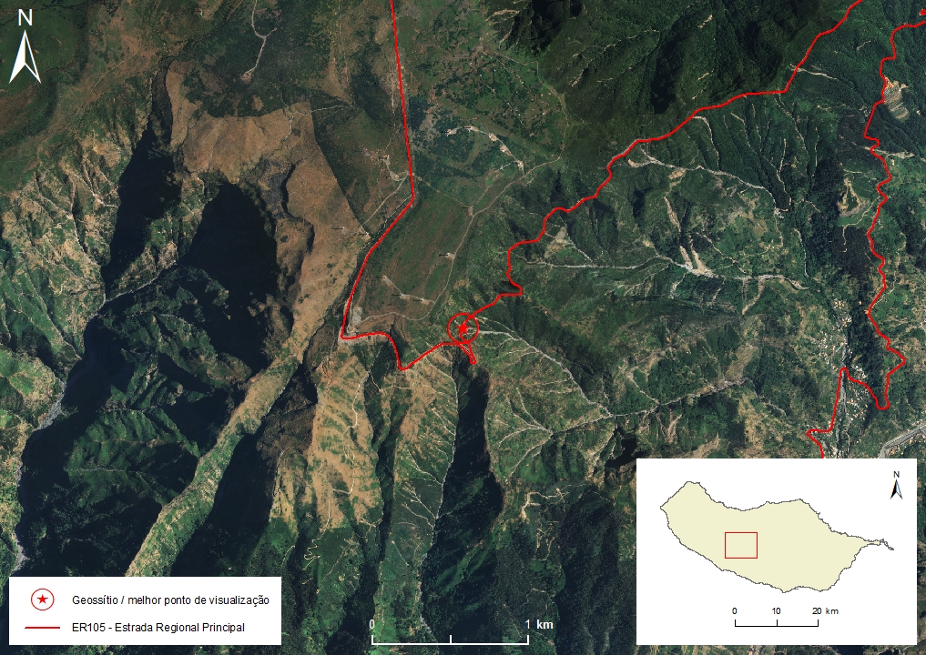 |
Municipality: Ribeira Brava Civil parish: Tabua Location area: ‹ 0,1 ha Coordinates(1):32°44'05.3'' N 17°03'12.3'' W Altitude: 1356 m Accessibility: Easy Distance to nearest paved road: 1 m Conditions of observation: Good (1) Coordinates of the geosite and / or the best viewpoint |
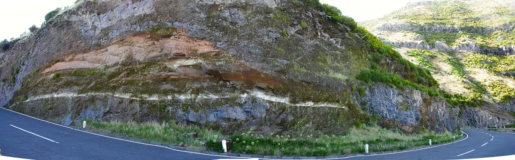
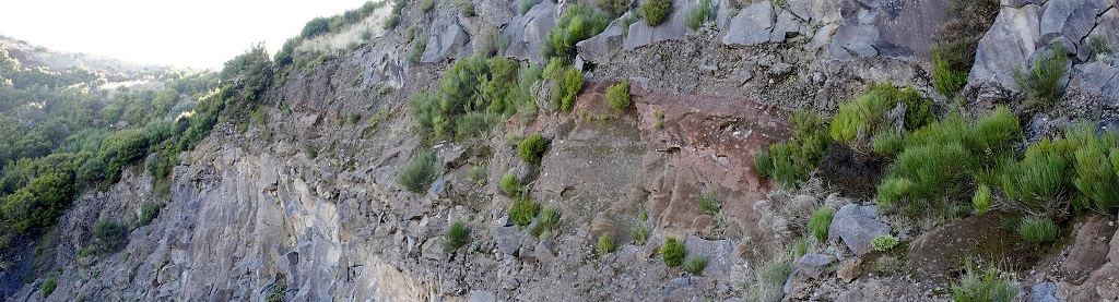
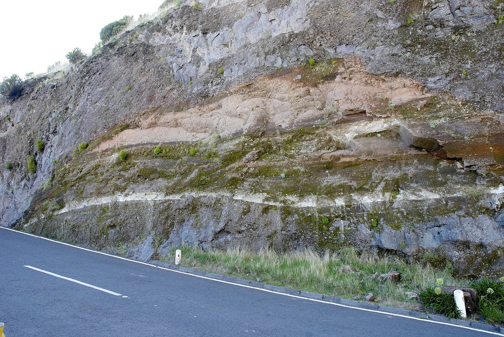
Brief description
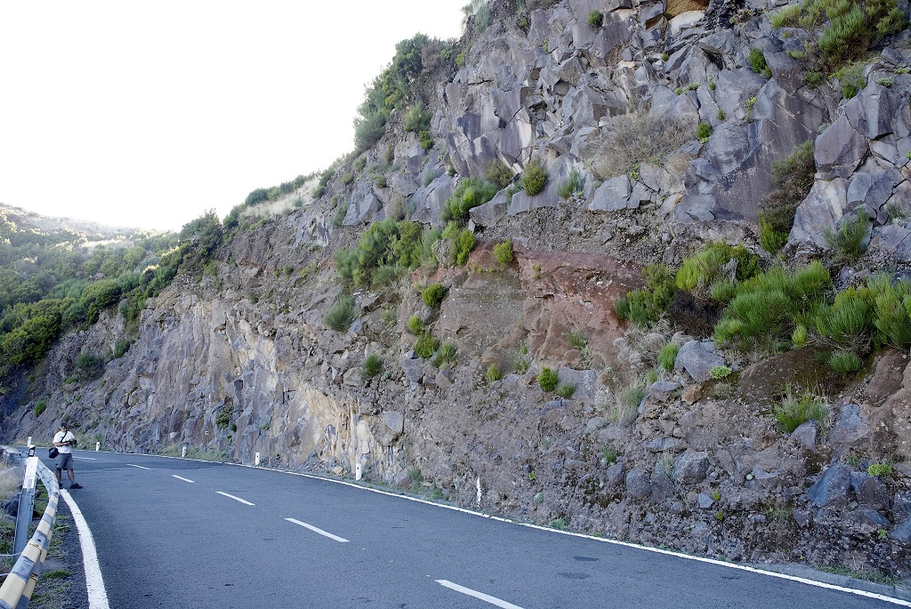
This geosite is considered to be the best place to observe the contact zone that marks the boundary between the Lombos Formation that belongs the Upper Volcanic Complex (Complexo Vulcânico Superior, CVS) and the Curral das Freiras Formation, belonging to the Intermediate Volcanic Complex (CVM). The contact zone is formed by an erosion surface that marks an identified unconformity at the island's scale.
The site is also a reference for characterizing these two stratigraphic formations, due to the representativeness of the outcrops, the good visibility conditions and overall perspective, compared to other sites located, respectively, in the Calheta region and in the Curral das Freiras region.
Relevant notes
Visiting a site of geological interest is the sole responsibility of the user.
The user must take precautions when visiting the site, taking into account the conditions of the terrain, weather conditions and other hazards, so that they do not create situations that put themselves or others at risk.
The user must respect private property. Access to private areas requires prior authorization from the owners.
The user must respect natural heritage, keeping it intact. The impact of your actions should be minimal.
Protection status
Natural space, up and escarpment (section V, articles 58 to 60), according to Municipal Master Plan.
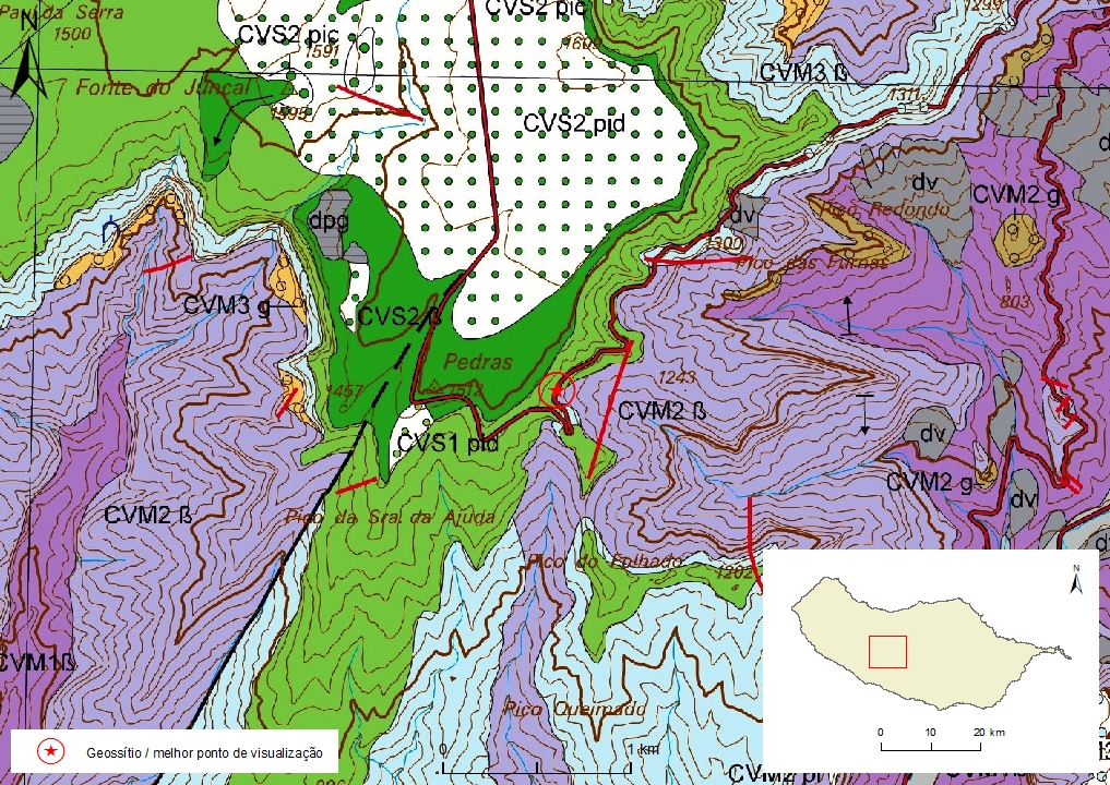
Geological map of Madeira Island detail, sheet a - RB02

Bibliography
BRUM DA SILVEIRA, A.; MADEIRA, J.; RAMALHO, R.; FONSECA, P., PRADA, S. (2010) - Notícia Explicativa da Carta Geológica da ilha da Madeira, na escala 1:50.000, folhas A e B. Edição da Secretaria Regional do Ambiente e Recursos Naturais, Região Autónoma da Madeira e Universidade da Madeira: 47 p. ISBN: 978-972-98405-2-4. (Editado em 2011).
BRUM DA SILVEIRA, A.; MADEIRA, J.; RAMALHO, R.; FONSECA, P.; RODRIGUES, C., PRADA, S. (2010) Carta Geológica da ilha da Madeira na escala 1:50.000 - Folha A e B. Edição da Região Autónoma da Madeira, Secretaria Regional do Ambiente e Recursos Naturais; ISBN: 978-972-98405-1-7 (Editado em 2011).
BRUM DA SILVEIRA, A.; PRADA, S.; RAMALHO, R.; MADEIRA, J.; FONSECA, P.; CANHA, E.; BRILHA, J. (2012). Inventariação do Património Geológico da ilha da Madeira. Secretaria Regional do Ambiente - Relatório Final, 414 p.
GELDMACHER, J.; VAN DEN BOGAARD, P.; HOERNLE, K. & SCHMINCKE, H-U. (2000) Ar age dating of the Madeira Archipelago and hotspot track (eastern North Atlantic) Geochemistry, Geophysics, Geosystems 1, [Paper number 1999GC000018].
Photo gallery
How to Cite
BRUM DA SILVEIRA, A.; PRADA, S.; RAMALHO, R.; MADEIRA, J.; FONSECA, P.; CANHA, E.; BRILHA, J. (2012). Inventariação do Património Geológico da Ilha da Madeira. Secretaria Regional do Ambiente e Recursos Naturais - Relatório Final, 414 p. In: https://geodiversidade.