")
")
 |
Geosite ID: M01PSL03 Name: Dunas da Prainha Thematic category: Sedimentology and Paleontology |
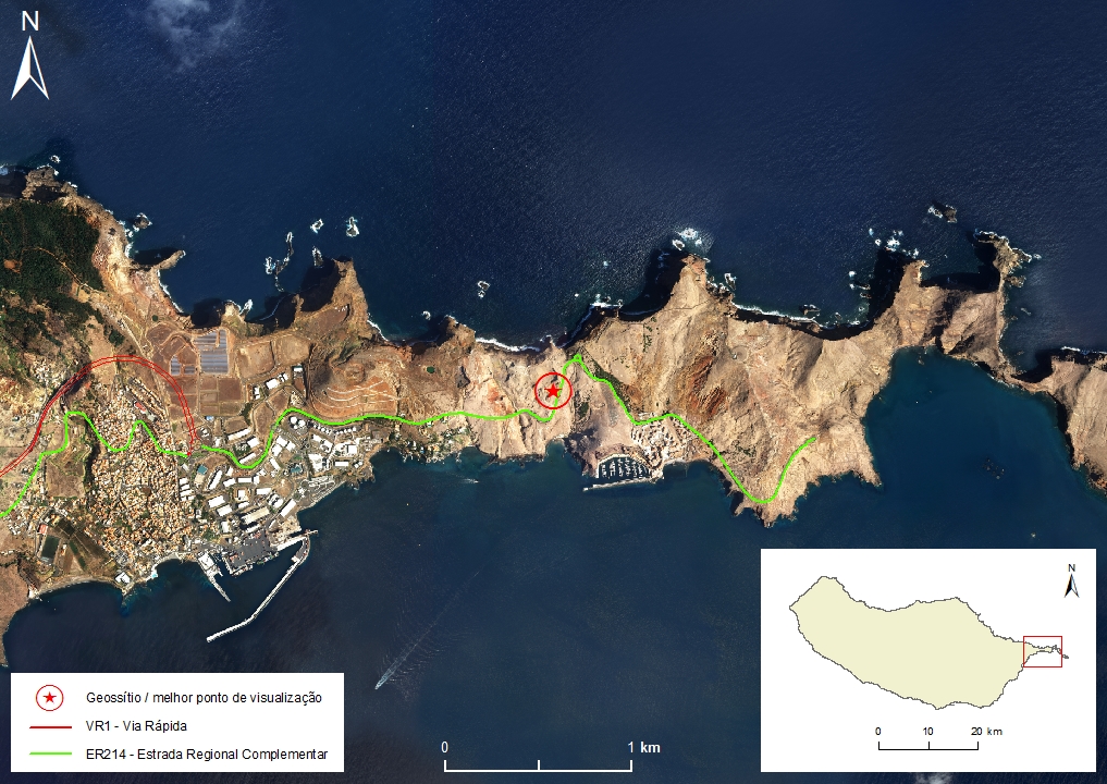 |
Municipality: Machico Civil parish: Caniçal Location area: 0,1 - 10 ha Coordinates(1):32°44'42.6'' N 16°42'56.3'' W Altitude: 60 m Accessibility: Easy Distance to nearest paved road: 1 m Conditions of observation: Good (1) Coordinates of the geosite and / or the best viewpoint |
Brief description
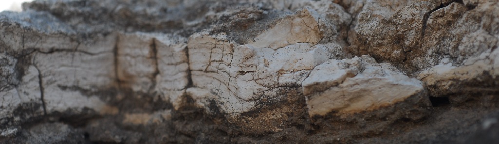
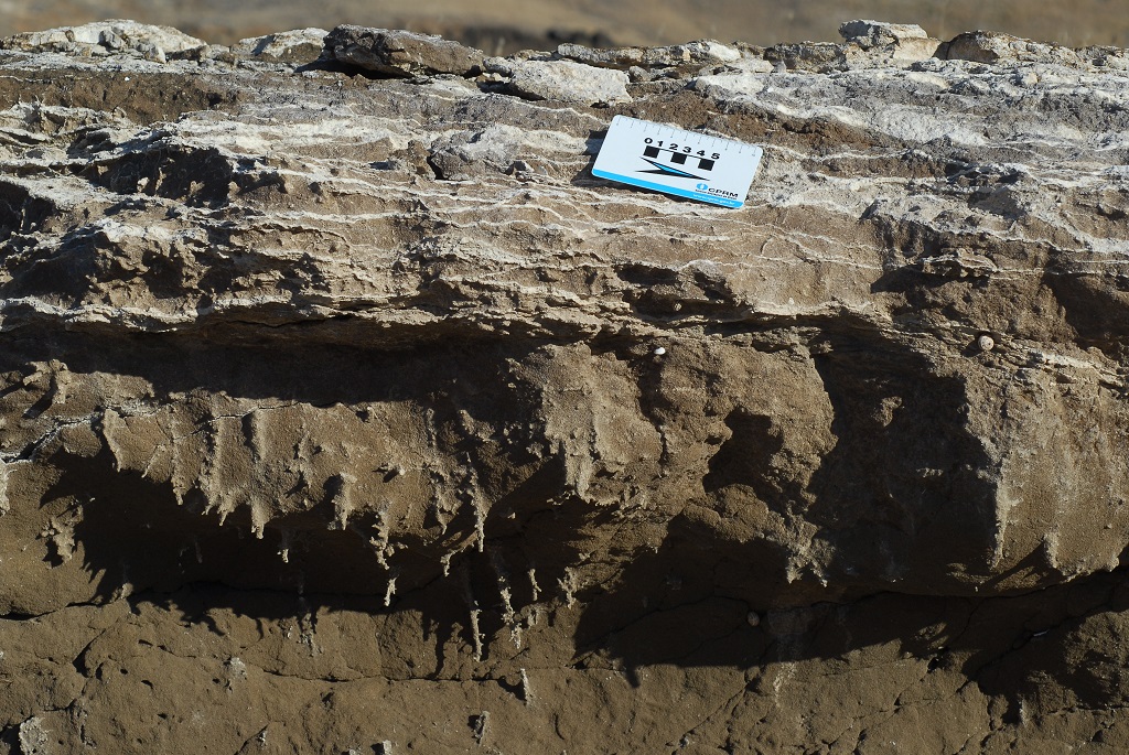
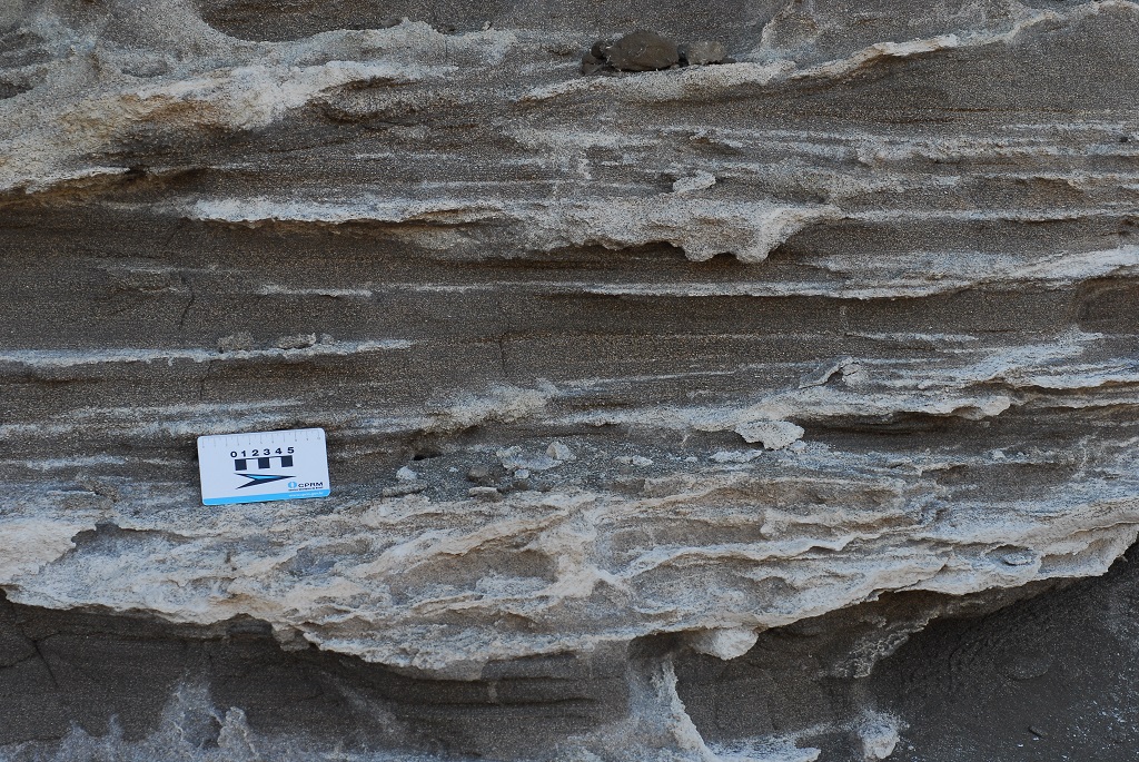
The Dunas da Prainha form a coverage of aeolian sands that ranges from the Middle Pleistocene (200 to 300 thousand years) to the Holocene (8500 to 4500 years B.C.). The sand is composed of bioclasts (shells, calcareous algae, urchin spicules, foraminifera carapace), mineroclasts (rolled olivine and pyroxene grains) and lithoclast (basaltic rock fragments). Despite its marine origins, the deposition and accumulation process is subaerial, as shown by the deposit structure and significant presence of terrestrial gastropod fossils (Pulmonata), whose species were described by Wollaston (1878) and Silva (1957), as well as bird’s bones and eggshells.
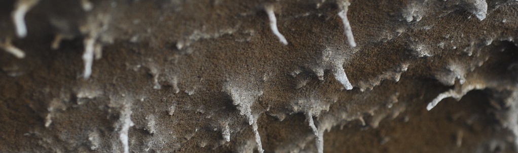
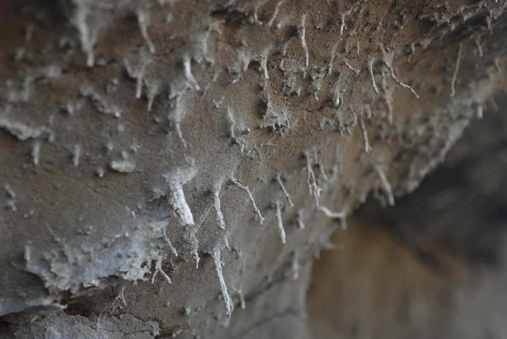
In the aeolian deposits it is possible to observe (very fragile) rootcasts as well as pedogenic carbonate horizons (2 facies, one solid and another one powdery).
Relevant notes
Visiting a site of geological interest is the sole responsibility of the user.
The user must take precautions when visiting the site, taking into account the conditions of the terrain, weather conditions and other hazards, so that they do not create situations that put themselves or others at risk.
The user must respect private property. Access to private areas requires prior authorization from the owners.
The user must respect natural heritage, keeping it intact. The impact of your actions should be minimal.
Protection status
Natural Heritage - Scientific Heritage (Article 17), according to Municipal Master Plan.
ZPE of Ponta de São Lourenço that coincides with the limits of the ZEC of Ponta de São Lourenço, and Natural Park of Madeira (Decreto Regulamentar Regional n.º 3/2014/M, artigo 2.º, alínea c).
Location

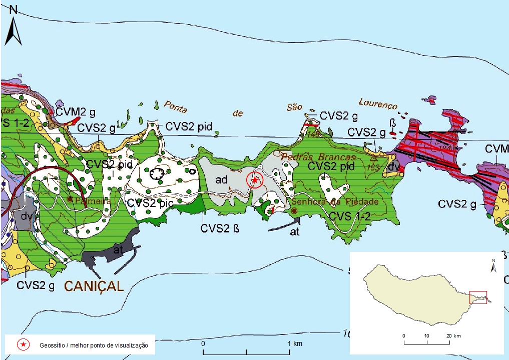
Geological map of Madeira Island detail, Sheet b - M01PSL03

Bibliography
BRUM DA SILVEIRA, A.; MADEIRA, J.; RAMALHO, R.; FONSECA, P., PRADA, S. (2010) - Notícia Explicativa da Carta Geológica da ilha da Madeira, na escala 1:50.000, folhas A e B. Edição da Secretaria Regional do Ambiente e Recursos Naturais, Região Autónoma da Madeira e Universidade da Madeira: 47 p. ISBN: 978-972-98405-2-4. (Editado em 2011).
BRUM DA SILVEIRA, A.; MADEIRA, J.; RAMALHO, R.; FONSECA, P.; RODRIGUES, C., PRADA, S. (2010) Carta Geológica da ilha da Madeira na escala 1:50.000 - Folha A e B. Edição da Região Autónoma da Madeira, Secretaria Regional do Ambiente e Recursos Naturais; ISBN: 978-972-98405-1-7 (Editado em 2011).
BRUM DA SILVEIRA, A.; PRADA, S.; RAMALHO, R.; MADEIRA, J.; FONSECA, P.; CANHA, E.; BRILHA, J. (2012). Inventariação do Património Geológico da ilha da Madeira. Secretaria Regional do Ambiente - Relatório Final, 414 p.
GOODFRIEND, G. A.; CAMERON, R. A. D.; COOK, L. M.; COURTY, M.-A.; FEDOROFF, N.; LIVETT, E. & TALLIS, J. (1996) The Quaternary eolian sequence of Madeira: stratigraphy, chronology, and paleoenvironment interpretation. Palaeogeography, Palaeoclimatology, Palaeoecology 120: 195-234.
SILVA, G. H. (1957) Nota sobre alguns gastrópodes terrestres das ilhas da Madeira e Selvagens. Memórias e Notícias do Museu e Laboratório Mineralógico e Geológico da Universidade de Coimbra 44: 33-43.
ZBYSZEWSKI, G.; VEIGA FERREIRA, O.; CÂNDIDO DE MEDEIROS, A.; AIRES-BARROS, L.; CELESTINO SILVA, L.; MUNHÁ, J.M. E BARRIGA, F. (1975) Carta Geológica de Portugal na escala 1:50.000. Notícia Explicativa das Folha A e B da Ilha da Madeira. Serviços Geológicos de Portugal: 53 p.
Photo gallery
How to Cite
BRUM DA SILVEIRA, A.; PRADA, S.; RAMALHO, R.; MADEIRA, J.; FONSECA, P.; CANHA, E.; BRILHA, J. (2012). Inventariação do Património Geológico da Ilha da Madeira. Secretaria Regional do Ambiente e Recursos Naturais - Relatório Final, 414 p. In: https://geodiversidade.