")
")
 |
Geosite ID: PSt02 Name: Zimbralinho Thematic category: Vulcanology |
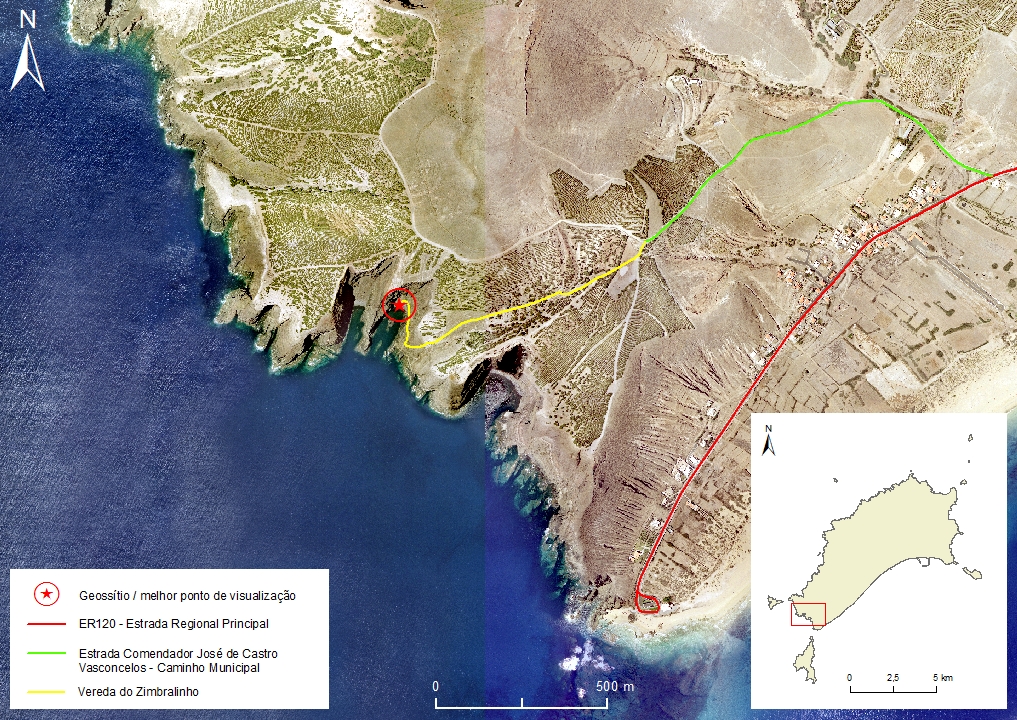 |
Municipality: Porto Santo Civil parish: Porto Santo Location area: 0.1 -10 ha Coordinates(1):33°01'58.28'' N 16°23'15.30'' W Altitude: 2 m Accessibility: Difficult Distance to nearest paved road: 930 m Conditions of observation: Satisfactory (1) Coordinates of the geosite and / or the best viewpoint |
Brief description
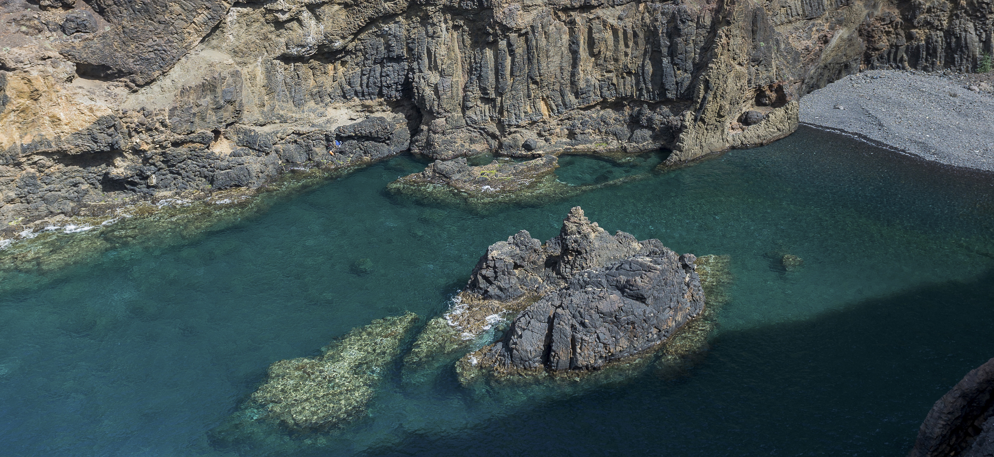
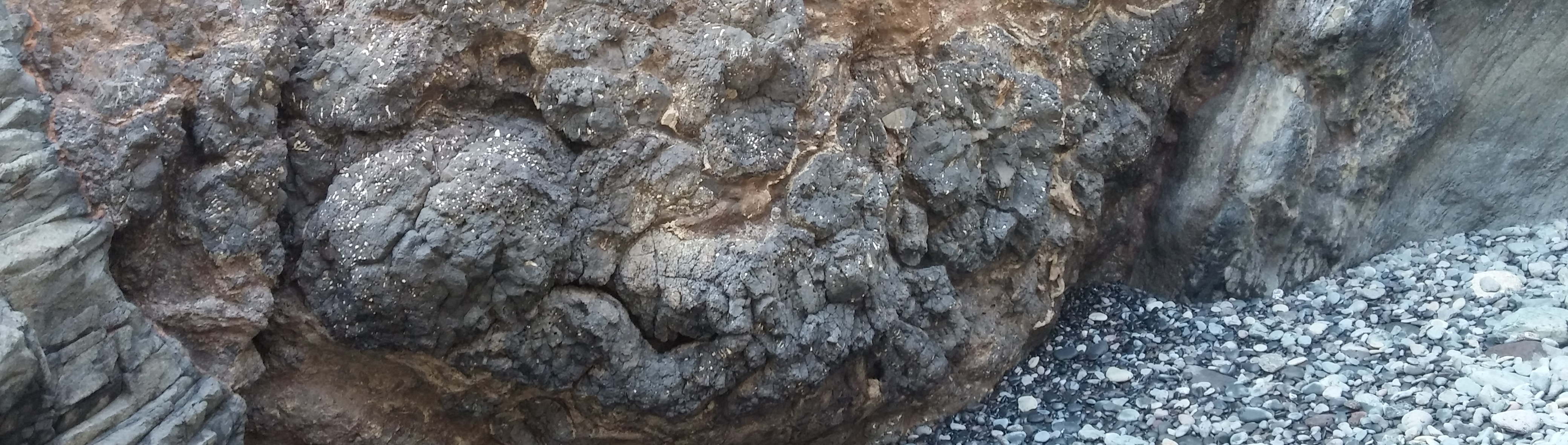
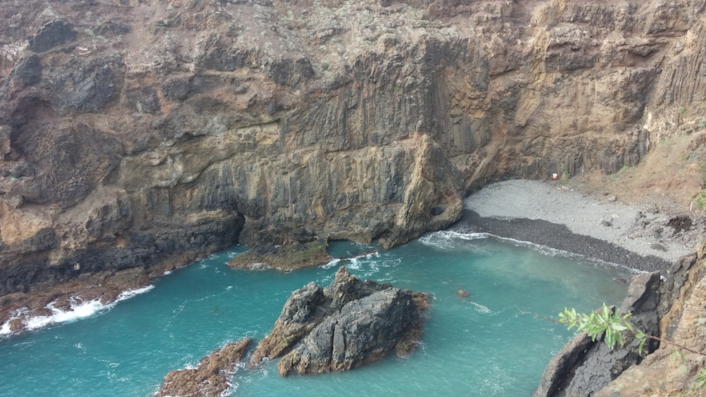
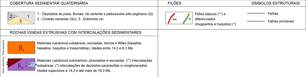
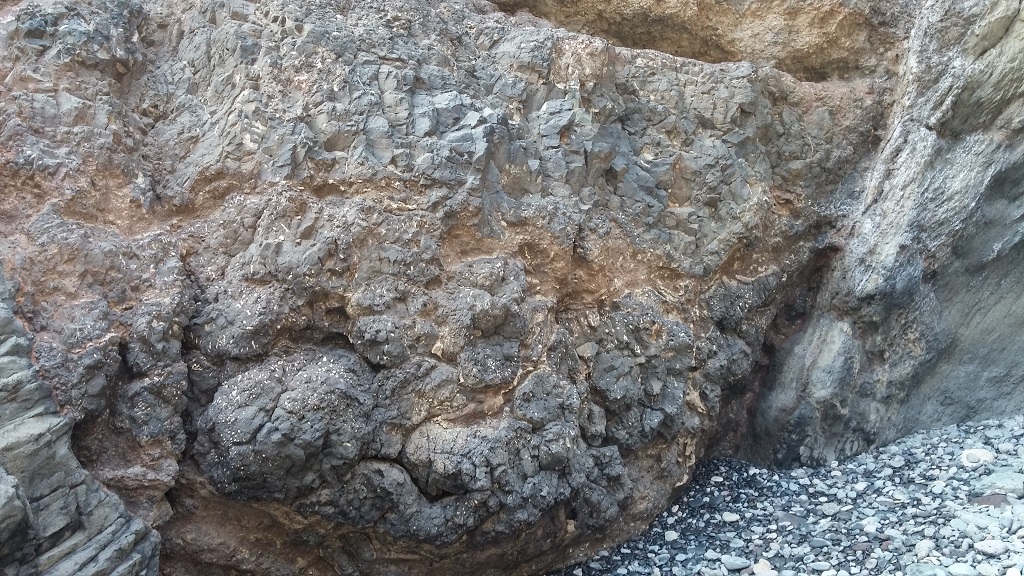
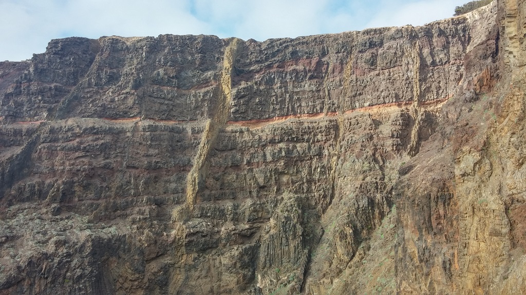
In Zimbralinho bay it is possible to observe basaltic lithologies from the submarine volcanic sequences that were contemporaneous to the island’s pre-emergence phase. In here, excellent examples of pillow lavas, dubbed like this because of their approximately spherical cross-section appearance, are observed. These lavas represent subaquatic eruptions, in this case undersea.
On the way down to the bay, it is also possible to see spheroidal weathering on these materials. It is evident the presence of mugearitic dyke that extends to the Espigão Peak, in one of the cliffs, as well as another dyke with a well-developed prismatic structure.
Relevant notes
Visiting a site of geological interest is the sole responsibility of the user.
The user must take precautions when visiting the site, taking into account the conditions of the terrain, weather conditions and other hazards, so that they do not create situations that put themselves or others at risk.
The user must respect private property. Access to private areas requires prior authorization from the owners.
The user must respect natural heritage, keeping it intact. The impact of your actions should be minimal.
Protection status
Natural Areas of Strongly Conditioned Use, according to the Municipal Master Plan.
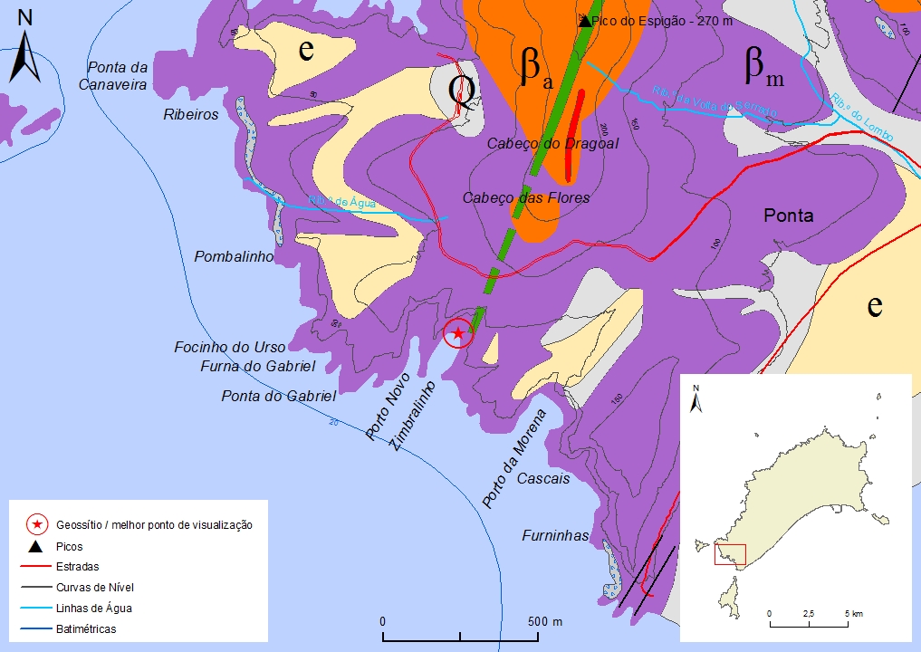
Simplified geological map of Porto Santo Island detail- PSt02
Bibliography
FERREIRA, M. R. (2014). Património Geológico da Ilha do Porto Santo e Ilhéus Adjacentes (Madeira): Inventariação, Avaliação e Valorização como Contributo para a Geoconservação. Dissertação de Mestrado em Vulcanologia e Riscos Geológicos. Departamento de Geociências da Universidade dos Açores.
RIBEIRO, M. L. Carta Geológica Simplificada das Ilhas da Madeira e do Porto Santo, na escala 1:80.000 in RIBEIRO, M. L. & RAMALHO, M. (2009). Uma visita geológica ao Arquipélago da Madeira, Principais locais Geo-turísticos. Edição da Direção Regional do Comércio, Indústria e Energia e do Laboratório Nacional de Energia e Geologia, I. P, pp. 55, 82. ISBN: 978-989-96202-0-9.
RIBEIRO, M. L. & RAMALHO, M. (2009). Uma visita geológica ao Arquipélago da Madeira, Principais locais Geo-turísticos. Direção Regional do Comércio, Indústria e Energia e Laboratório Nacional de Energia e Geologia, I. P., pp. 55, 82.
Photo gallery
How to Cite
FERREIRA, M. R. (2014). Património Geológico da Ilha do Porto Santo e Ilhéus Adjacentes (Madeira): Inventariação, Avaliação e Valorização como Contributo para a Geoconservação. Dissertação de Mestrado em Vulcanologia e Riscos Geológicos. Departamento de Geociências da Universidade dos Açores. In: https://geodiversidade.