")
")
 |
Geosite ID: M01PSL05 Name: Miradouro da Ponta do Rosto Thematic category: Stratigraphy, Tectonics and Geomorphology |
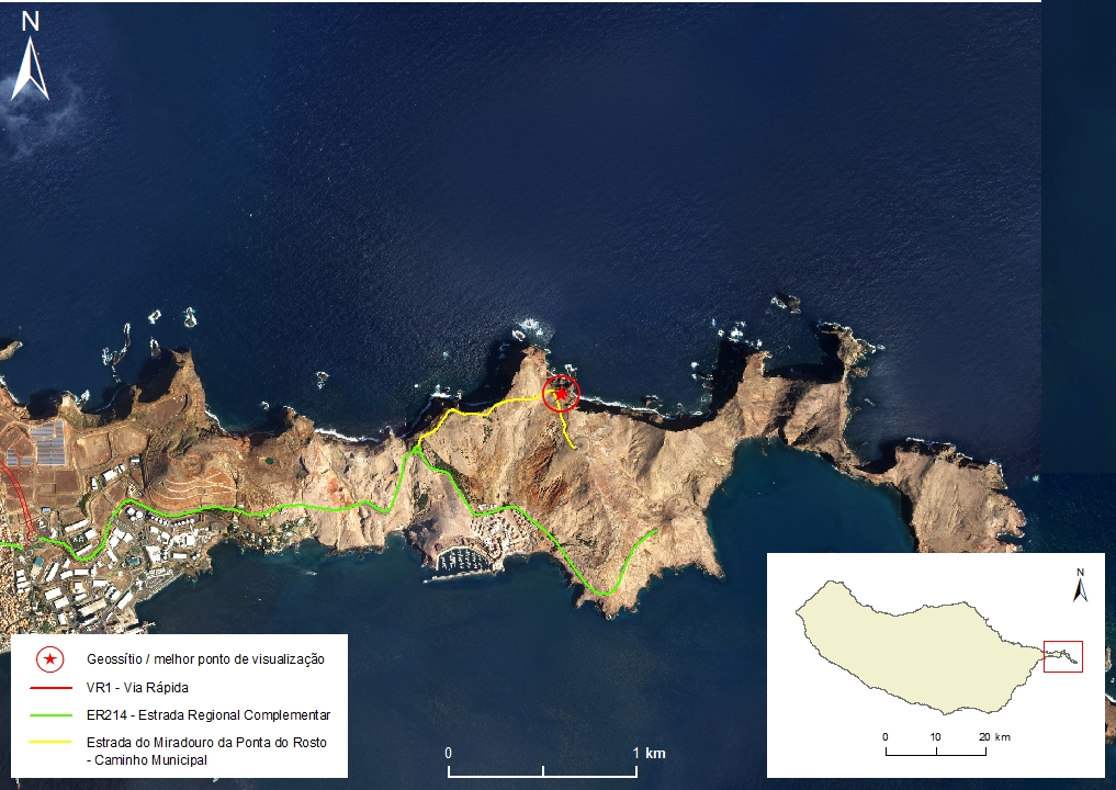 |
Municipality: Machico Civil parish: Caniçal Location area: 0.1-10 ha Coordinates(1):32°44'57.2'' N 16°42'24.3'' W Altitude: 135 m Accessibility: Easy Distance to nearest paved road: 5 m Conditions of observation: Good (1) Coordinates of the geosite and / or the best viewpoint |
Brief description
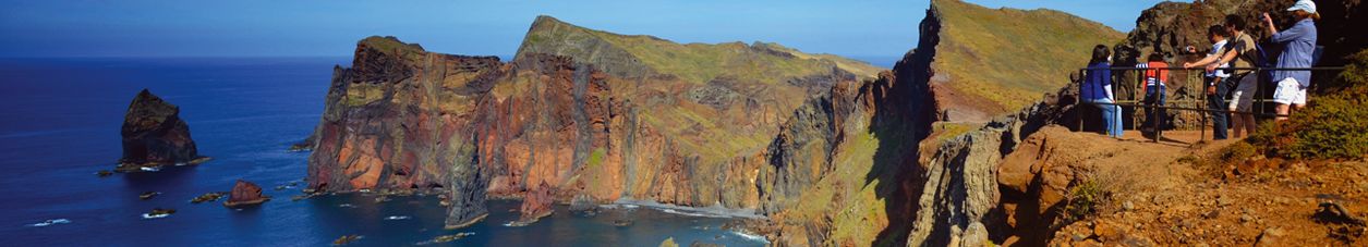
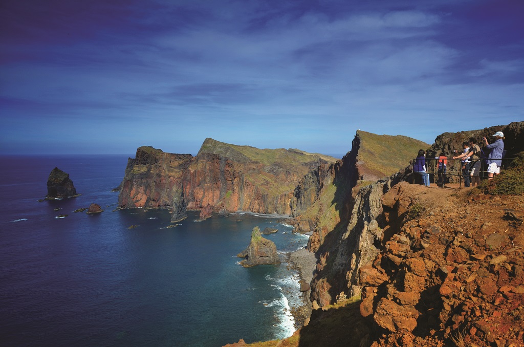
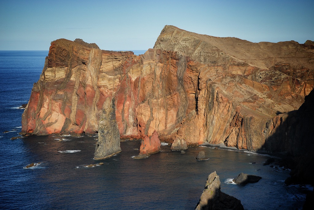
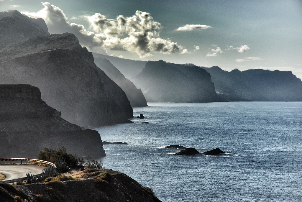
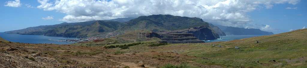
Miradouro da Ponta do Rosto is a privileged site where one can identify the general shape of Madeira Island, a shield volcano. On the coastal cliffs, one can observe the old island's internal structure that formed during the first stage of fissural volcanic construction in subaerial environment, the Intermediate Volcanic Complex (VCM). Numerous vertical dykes related to an old volcanic rift zone in the east-west direction are visible. The dykes can be exposed from the embedded rock or in “cabo real” by differential marine erosion. The Pedra Furada Fault, one of the main tectonic incidents in Ponta de São Lourenço, is also of particular relevance at this site.
From a geomorphological point of view, the relationship between the coastline erosion and the main volcano-tectonic structures is evident.
Relevant notes
Visiting a site of geological interest is the sole responsibility of the user.
The user must take precautions when visiting the site, taking into account the conditions of the terrain, weather conditions and other hazards, so that they do not create situations that put themselves or others at risk.
The user must respect private property. Access to private areas requires prior authorization from the owners.
The user must respect natural heritage, keeping it intact. The impact of your actions should be minimal.
Protection status
Natural spaces of very conditioned use – Scarp zone (Article 55.º), according to the Municipal Master Plan. ZPE of Ponta de São Lourenço that coincides with the limits of the ZEC of Ponta de São Lourenço, and Natural Park of Madeira (Decreto Regulamentar Regional n.º 3/2014/M, artigo 2.º, alínea c).
Location

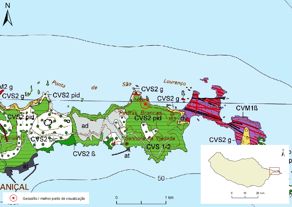
Geological map of Madeira Island detail, Sheet b - M01PSL05

Bibliography
BRUM DA SILVEIRA, A.; MADEIRA, J.; RAMALHO, R.; FONSECA, P., PRADA, S. (2010) - Notícia Explicativa da Carta Geológica da ilha da Madeira, na escala 1:50.000, folhas A e B. Edição da Secretaria Regional do Ambiente e Recursos Naturais, Região Autónoma da Madeira e Universidade da Madeira: 47 p. ISBN: 978-972-98405-2-4. (Editado em 2011).
BRUM DA SILVEIRA, A.; MADEIRA, J.; RAMALHO, R.; FONSECA, P.; RODRIGUES, C., PRADA, S. (2010) Carta Geológica da ilha da Madeira na escala 1:50.000 - Folha A e B. Edição da Região Autónoma da Madeira, Secretaria Regional do Ambiente e Recursos Naturais; ISBN: 978-972-98405-1-7 (Editado em 2011).
BRUM DA SILVEIRA, A.; PRADA, S.; RAMALHO, R.; MADEIRA, J.; FONSECA, P.; CANHA, E.; BRILHA, J. (2012). Inventariação do Património Geológico da ilha da Madeira. Secretaria Regional do Ambiente - Relatório Final, 414 p.
KLÜGEL, A.; SCHWARZ, S.; VAN DEN BOGAARD, P.; HOERNLE, K.A.; WOHLGEMUTH-UEBERWASSER, C.C. & KÖSTER J.J. (2009) Structure and evolution of the volcanic rift zone at Ponta de São Lourenço, eastern Madeira. Bull Volcanol 71: 671-685.
RAMALHO, R. (2004) – Cartografia Geológica da Madeira. Estratigrafia e Tectónica do Sector a Leste de Machico. Universidade de Lisboa. Faculdade de Ciências. 146 p.
RAMALHO, R.; MADEIRA, J.; FONSECA, P.E.; BRUM DA SILVEIRA, A.; PRADA, S.; RODRIGUES, C. F. (2005a) Tectónica da Ponta de São Lourenço, Ilha da Madeira. Cadernos Lab. Xeolóxico de Laxe, Coruña. Vol. 30, pp. 223-234.
RAMALHO, R.; BRUM DA SILVEIRA, A.; MADEIRA, J.; FONSECA, P.E.; PRADA, S.; RODRIGUES, C. F. (2005b) Fracture pattern and structural control of Madeira Island Volcanism (Portugal). Volume de abstracts do International Workshop on Ocean Island Volcanism, Sal, Cabo Verde, 2 – 8 Abril 2005: p.33.
Photo gallery
How to Cite
BRUM DA SILVEIRA, A.; PRADA, S.; RAMALHO, R.; MADEIRA, J.; FONSECA, P.; CANHA, E.; BRILHA, J. (2012). Inventariação do Património Geológico da Ilha da Madeira. Secretaria Regional do Ambiente e Recursos Naturais - Relatório Final, 414 p. In: https://geodiversidade.