")
")
 |
Geosite ID: S02 Name: Miradouro da Beira da Quinta Thematic category: Mass movements and Geomorfology |
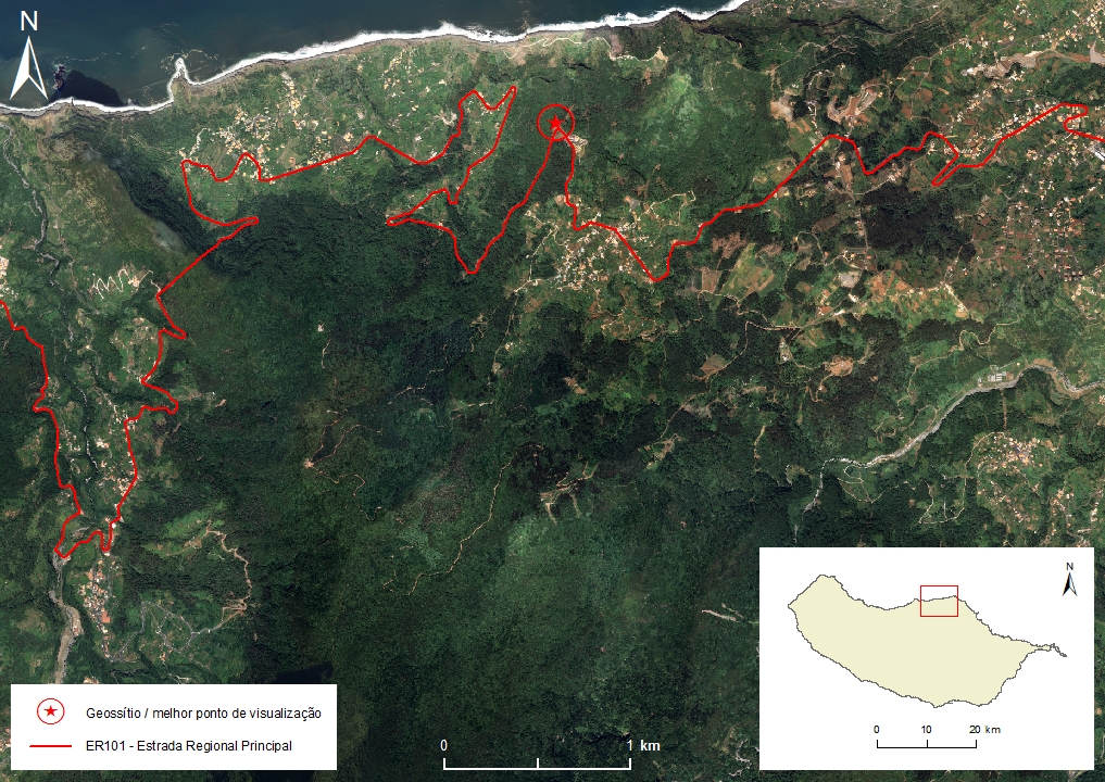 |
Municipality: Santana Civil parish: Arco de S. Jorge Location area: ‹ 0,1 ha Coordinates(1):32°49'35.9'' N 16°56'20.4'' W Altitude: 469 m Accessibility: Easy Distance to nearest paved road: 5 m Conditions of observation: Good (1) Coordinates of the geosite and / or the best viewpoint |
Brief description
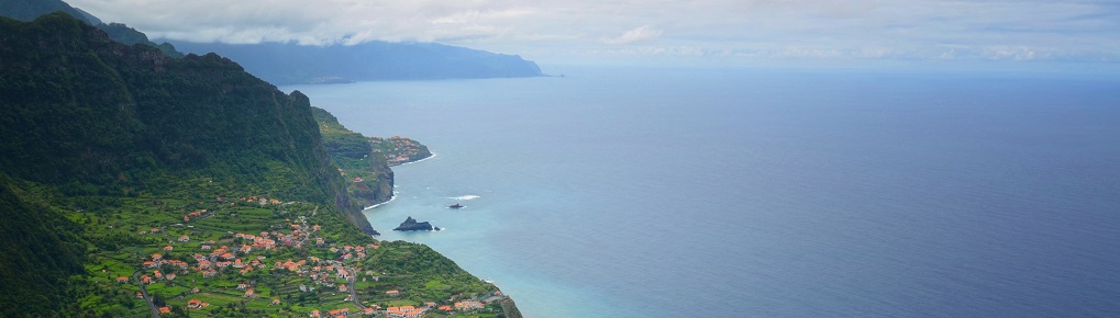
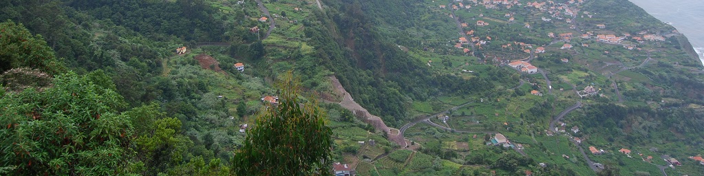
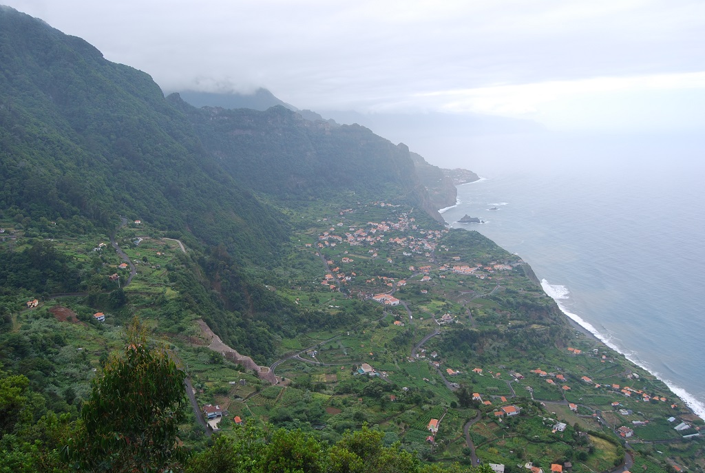
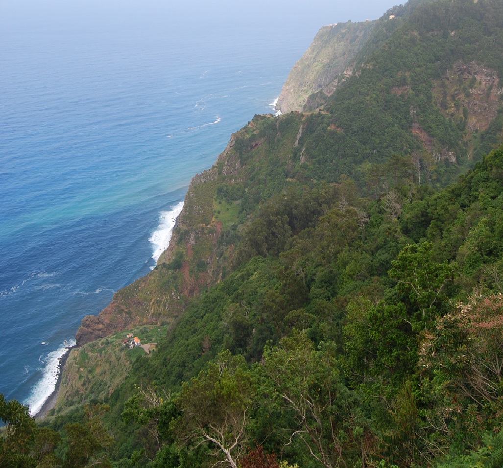
From the Miradouro das Cabanas, in addition to the high sea cliffs (up to about 500 m), we can observe the triangular depression of Arco de S. Jorge [St. George’s Arch], which was formed by sliding-type mass movements, and more recent solifluction events. The steep slope that corresponds to the slipping head reaches, locally, 800 m in altitude. Within the depression, several levels can be observed that correlate with the top of the dislocated materials from the various events that contributed to the current depression.
Relevant notes
Visiting a site of geological interest is the sole responsibility of the user.
The user must take precautions when visiting the site, taking into account the conditions of the terrain, weather conditions and other hazards, so that they do not create situations that put themselves or others at risk.
The user must respect private property. Access to private areas requires prior authorization from the owners.
The user must respect natural heritage, keeping it intact. The impact of your actions should be minimal.
Protection status
ZPE of the Laurissilva of Madeira, which coincides with the limits of the ZEC of the Laurissilva of Madeira, and Natural Park of Madeira (Decreto Regulamentar Regional n.º 3/2014/M, artigo 2.º, alínea a).
Plano Diretor Municipal, atualmente (2015) em revisão.
Location

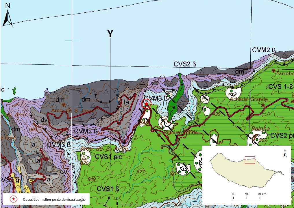
Geological map of Madeira Island detail, Sheet a and b - S02

Bibliography
BRUM DA SILVEIRA, A.; MADEIRA, J.; RAMALHO, R.; FONSECA, P., PRADA, S. (2010) - Notícia Explicativa da Carta Geológica da ilha da Madeira, na escala 1:50.000, folhas A e B. Edição da Secretaria Regional do Ambiente e Recursos Naturais, Região Autónoma da Madeira e Universidade da Madeira: 47 p. ISBN: 978-972-98405-2-4. (Editado em 2011).
BRUM DA SILVEIRA, A.; MADEIRA, J.; RAMALHO, R.; FONSECA, P.; RODRIGUES, C., PRADA, S. (2010) Carta Geológica da ilha da Madeira na escala 1:50.000 - Folha A e B. Edição da Região Autónoma da Madeira, Secretaria Regional do Ambiente e Recursos Naturais; ISBN: 978-972-98405-1-7 (Editado em 2011).
BRUM DA SILVEIRA, A.; PRADA, S.; RAMALHO, R.; MADEIRA, J.; FONSECA, P.; CANHA, E.; BRILHA, J. (2012). Inventariação do Património Geológico da ilha da Madeira. Secretaria Regional do Ambiente - Relatório Final, 414 p.
RODRIGUES, D. (2005) Análise de risco de movimentos de vertente e ordenamento do território na Madeira. Aplicação ao caso do Machico. Tese de Doutoramento, Univ. da Madeira: 381 pp.
ZBYSZEWSKI, G.; VEIGA FERREIRA, O.; CÂNDIDO DE MEDEIROS, A.; AIRES-BARROS, L.; CELESTINO SILVA, L.; MUNHÁ, J.M. E BARRIGA, F. (1975) Carta Geológica de Portugal na escala 1:50.000. Notícia Explicativa das Folha A e B da Ilha da Madeira. Serviços Geológicos de Portugal: 53 p.
Photo gallery
How to Cite
BRUM DA SILVEIRA, A.; PRADA, S.; RAMALHO, R.; MADEIRA, J.; FONSECA, P.; CANHA, E.; BRILHA, J. (2012). Inventariação do Património Geológico da Ilha da Madeira. Secretaria Regional do Ambiente e Recursos Naturais - Relatório Final, 414 p. In: https://geodiversidade.