")
")
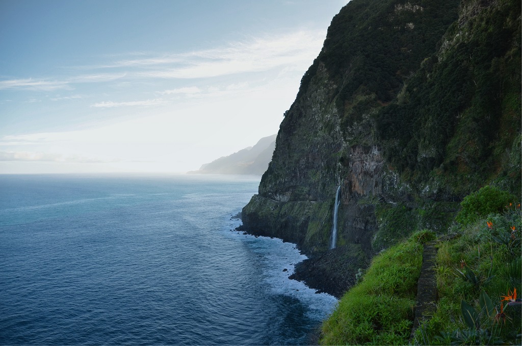 |
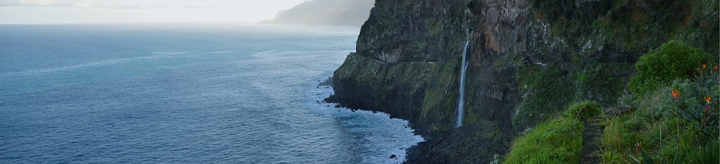
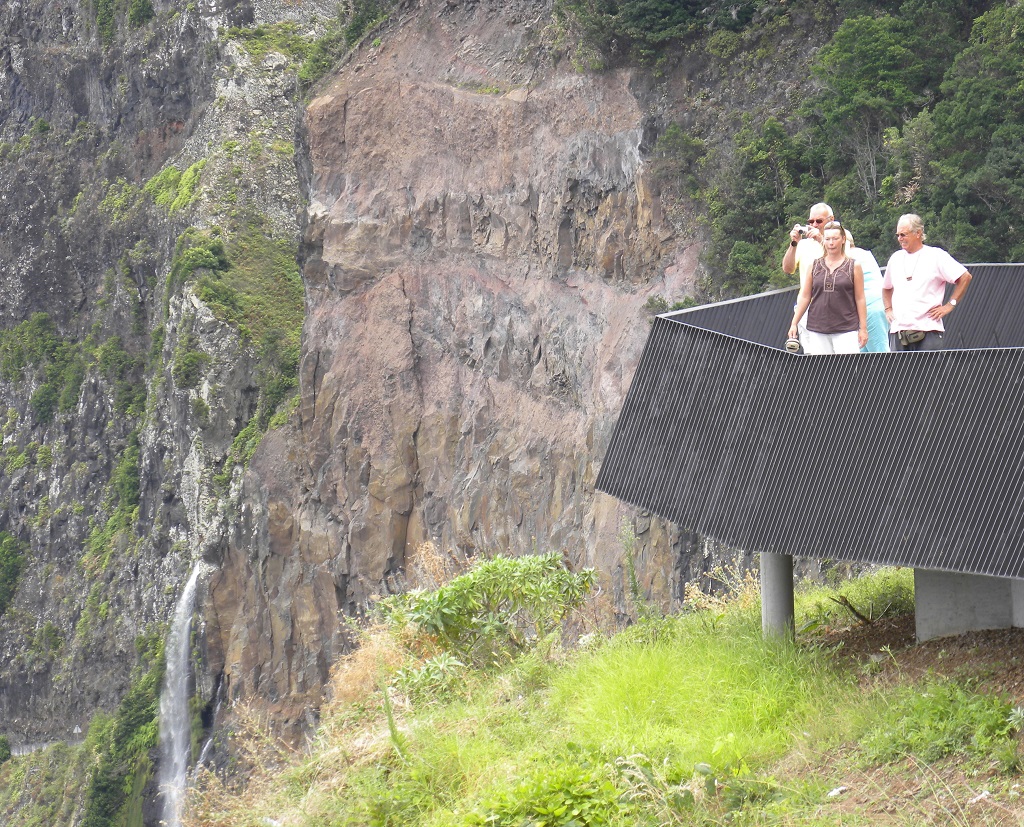
Geosite ID: PM04 Name: Miradouro da Véu da Noiva Thematic category: Water resources, geomorphology, mass movements |
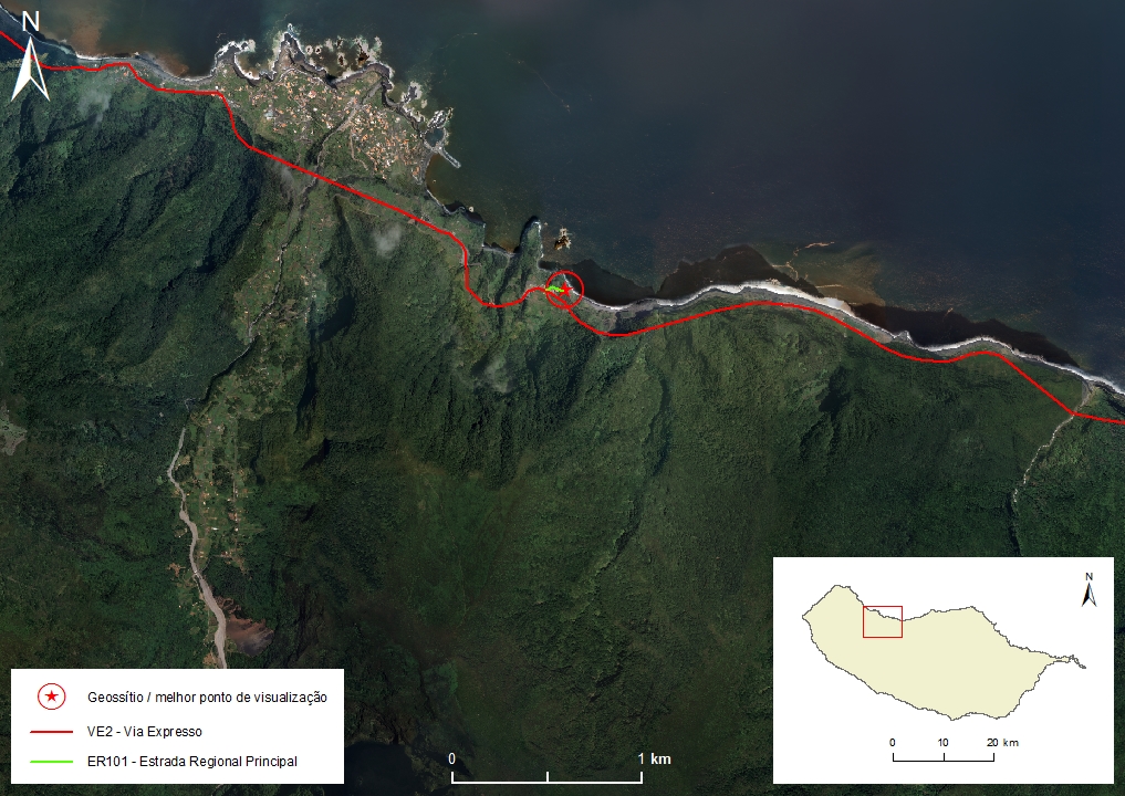 |
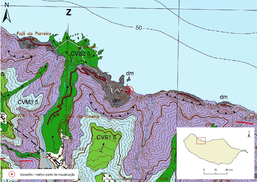
Municipality: Porto Moniz Civil parish: Seixal Location area: 0,1 -10 ha Coordinates(1):32°48'58.1'' N 17°05'42.7'' W Altitude: 115 m Accessibility: Easy Distance to nearest paved road: 10 m Conditions of observation: Good (1) Coordinates of the geosite and / or the best viewpoint |
Brief description
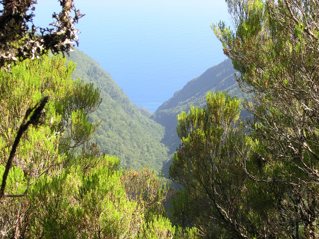
Véu da Noiva is the suspended mouth of the Ribeira de João Delgado and results from the rapid retreat of the shoreline, in relation to the vertical erosion from fluvial incision processes.
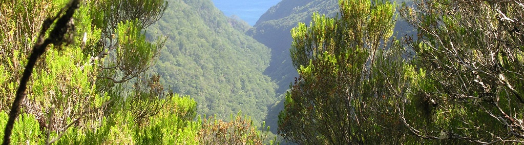
In the absence of precipitation, permanent waterways such as the Ribeira de João Delgado are fed by groundwater that flow from numerous springs, particularly productive on the north slope of the island. This groundwater abundance is mainly due to the climate, the presence of vegetation and the geological constitution of Madeira Island.
Only a small fraction of the flow of this hydrographic basin is captured and transported by a levada (levada do norte) from the north to the south coast of the island. The remainder, which gives rise to Véu da Noiva, flows through the suspended mouth, falling into the sea.
Relevant notes
The user must take precautions when visiting the site, taking into account the conditions of the terrain, weather conditions and other hazards, so that they do not create situations that put themselves or others at risk.
The user must respect private property. Access to private areas requires prior authorization from the owners.
The user must respect natural heritage, keeping it intact. The impact of your actions should be minimal.
Protection status
Natural spaces of very conditioned use – Scarp zone (Article 49º), according to the Municipal Master Plan.
ZPE of the Laurissilva of Madeira, which coincides with the limits of the ZEC of the Laurissilva of Madeira, and Natural Park of Madeira (Decreto Regulamentar Regional n.º 3/2014/M, artigo 2.º, alínea a).
Plano Diretor Municipal, atualmente (2015) em revisão.
Location

Geological map of Madeira Island detail, sheet a - PM04

Bibliography
BRUM DA SILVEIRA, A.; MADEIRA, J.; RAMALHO, R.; FONSECA, P., PRADA, S. (2010) - Notícia Explicativa da Carta Geológica da ilha da Madeira, na escala 1:50.000, folhas A e B. Edição da Secretaria Regional do Ambiente e Recursos Naturais, Região Autónoma da Madeira e Universidade da Madeira: 47 p. ISBN: 978-972-98405-2-4. (Editado em 2011).
BRUM DA SILVEIRA, A.; MADEIRA, J.; RAMALHO, R.; FONSECA, P.; RODRIGUES, C., PRADA, S. (2010) Carta Geológica da ilha da Madeira na escala 1:50.000 - Folha A e B. Edição da Região Autónoma da Madeira, Secretaria Regional do Ambiente e Recursos Naturais; ISBN: 978-972-98405-1-7 (Editado em 2011).
BRUM DA SILVEIRA, A.; PRADA, S.; RAMALHO, R.; MADEIRA, J.; FONSECA, P.; CANHA, E.; BRILHA, J. (2012). Inventariação do Património Geológico da ilha da Madeira. Secretaria Regional do Ambiente - Relatório Final, 414 p.
NASCIMENTO, S. (1990) Estudo Hidrogeológico do Paul da Serra (Ilha da Madeira). Dissertação para obtenção do Grau de Mestre em Geologia Económica e Aplicada pela FCUL. Universidade de Lisboa: 147 pp.
PRADA, S.N. (2000) Geologia e Recursos Hídricos Subterrâneos da Ilha da Madeira. Dissertação para obtenção do Grau de Doutor em Geologia, Universidade da Madeira: 351 pp.
PRADA, S. & SILVA, M.O. (2001) Fog Precipitation on the Island of Madeira (Portugal). Environmental Geology 41 (3-4), 384-389.
PRADA, S., SILVA, M.O., CRUZ, J.V. (2005) Groundwater behaviour in Madeira, volcanic island (Portugal). Hydrogeology Journal 13: 800-812. IF: 1,417
PRADA, S., MENEZES DE SEQUEIRA, M., FIGUEIRA C., SILVA, M. O., (2009) Fog precipitation and rainfall interception in the natural forests of Madeira island (Portugal), Agricultural and Forest Meteorology 149: 1179-1187.
Photo gallery
How to Cite
BRUM DA SILVEIRA, A.; PRADA, S.; RAMALHO, R.; MADEIRA, J.; FONSECA, P.; CANHA, E.; BRILHA, J. (2012). Inventariação do Património Geológico da Ilha da Madeira. Secretaria Regional do Ambiente e Recursos Naturais - Relatório Final, 414 p. In: https://geodiversidade.