")
")
 |
Geosite ID: PS01 Name: Sítio das Pedras Thematic category: Geomorphology and Sedimentology |
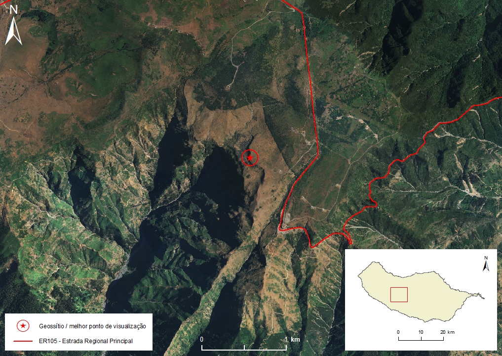 |
Municipality: Ponta do Sol Civil parish: Ponta do Sol Location area: 10 -1000 ha Coordinates(1):32°44'30.8'' N 17°03'56.0'' W Altitude: 1493 m Accessibility: Moderate Distance to nearest paved road: 840 m Conditions of observation: Good (1) Coordinates of the geosite and / or the best viewpoint |
Brief description
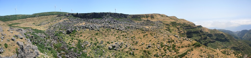
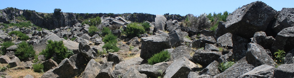
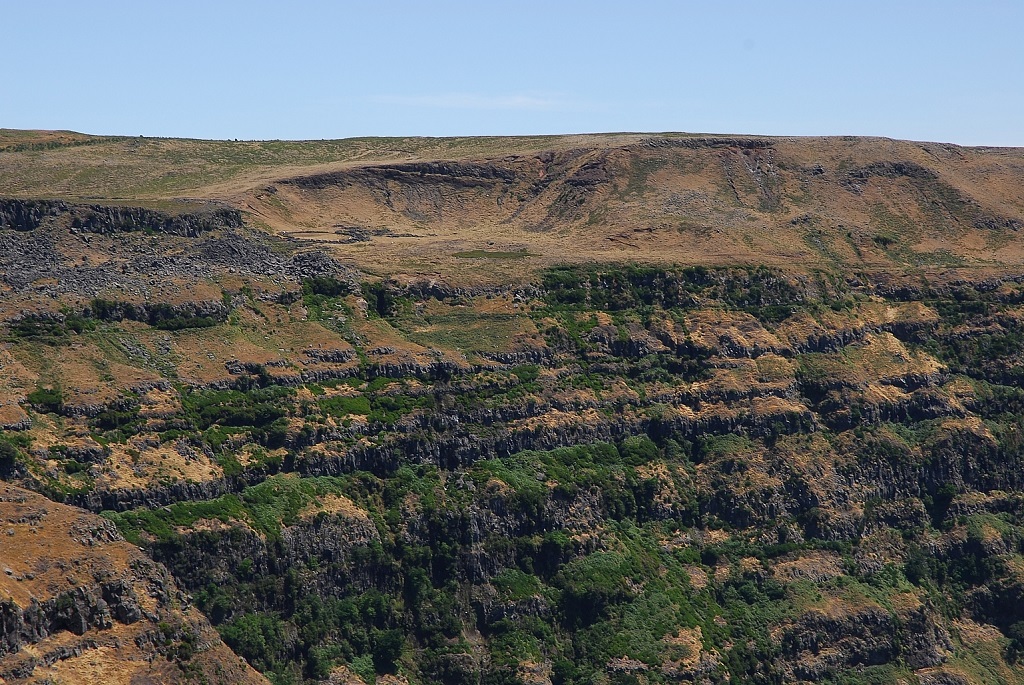
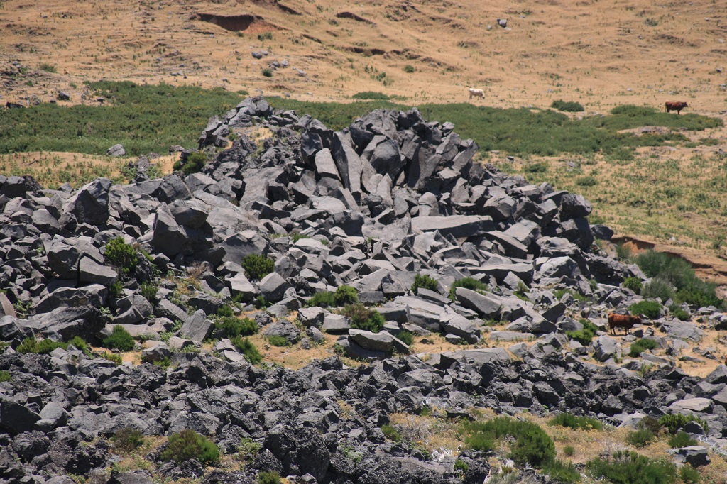
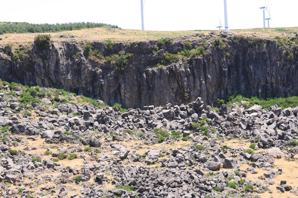
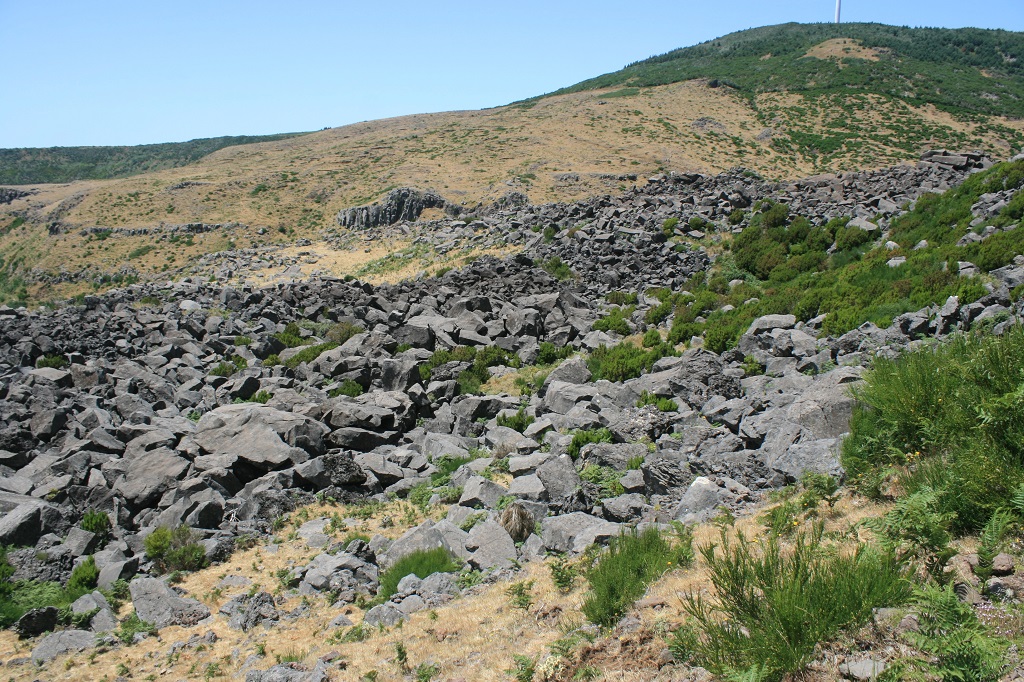
In the Paul da Serra area, more specifically in the Sítio das Pedras, it is possible to observe landforms and deposits that result from the action of a plateau glacier. The observable landforms are: shallow U-shaped valleys; small glacial cirque type amphitheatres; closed depressions; “roches moutonées” (sheepback) and striated rocks.
Relevant notes
Visiting a site of geological interest is the sole responsibility of the user.
The user must take precautions when visiting the site, taking into account the conditions of the terrain, weather conditions and other hazards, so that they do not create situations that put themselves or others at risk.
The user must respect private property. Access to private areas requires prior authorization from the owners.
The user must respect natural heritage, keeping it intact. The impact of your actions should be minimal.
Protection status
Natural spaces - protected areas (Article 57º), according to the Municipal Master Plan, and Madeira Natural Park.
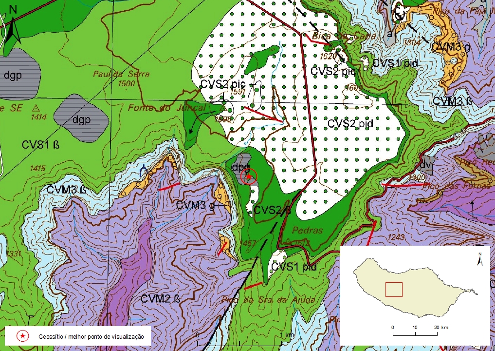
Geological map of Madeira Island detail, sheet a - PS01

Bibliography
BENNET, M. R. & GLASSER, N. F. (1999) Glacial Geology: Ice sheets and landforms. John Wiley & Sons, Chichester: 364 p.
BRUM DA SILVEIRA, A.; MADEIRA, J.; PRADA, S.; CANHA, R.; FONSECA, P. & RAMALHO, R. (2006) Glacial landforms in Madeira Island (Portugal). Volume de Resumos do 3º Congresso de Geomorfologia, Outubro de 2006, Funchal: 41.
BRUM DA SILVEIRA, A.; MADEIRA, J.; RAMALHO, R.; FONSECA, P., PRADA, S. (2010) - Notícia Explicativa da Carta Geológica da ilha da Madeira, na escala 1:50.000, folhas A e B. Edição da Secretaria Regional do Ambiente e Recursos Naturais, Região Autónoma da Madeira e Universidade da Madeira: 47 p. ISBN: 978-972-98405-2-4. (Editado em 2011).
BRUM DA SILVEIRA, A.; MADEIRA, J.; RAMALHO, R.; FONSECA, P.; RODRIGUES, C., PRADA, S. (2010) Carta Geológica da ilha da Madeira na escala 1:50.000 - Folha A e B. Edição da Região Autónoma da Madeira, Secretaria Regional do Ambiente e Recursos Naturais; ISBN: 978-972-98405-1-7 (Editado em 2011).
BRUM DA SILVEIRA, A.; PRADA, S.; RAMALHO, R.; MADEIRA, J.; FONSECA, P.; CANHA, E.; BRILHA, J. (2012). Inventariação do Património Geológico da ilha da Madeira. Secretaria Regional do Ambiente - Relatório Final, 414 p.
BRUM FERREIRA, A. (1981) Manifestações periglaciárias de altitude na ilha da Madeira. Finisterra 16(32): 213-229.
GELDMACHER, J.; VAN DEN BOGAARD, P.; HOERNLE, K. & SCHMINCKE H-U. (2000) Ar age dating of the Madeira Archipelago and hotspot track (eastern North Atlantic) Geochemistry, Geophysics, Geosystems, VOL. 1, [Paper number 1999GC000018]
Photo gallery
How to Cite
BRUM DA SILVEIRA, A.; PRADA, S.; RAMALHO, R.; MADEIRA, J.; FONSECA, P.; CANHA, E.; BRILHA, J. (2012). Inventariação do Património Geológico da Ilha da Madeira. Secretaria Regional do Ambiente e Recursos Naturais - Relatório Final, 414 p. In: https://geodiversidade.