")
")
 |
Geosite ID: S03 Name: Caldeirão do Inferno Thematic category: Geomorfology, Water resources and Tectonics |
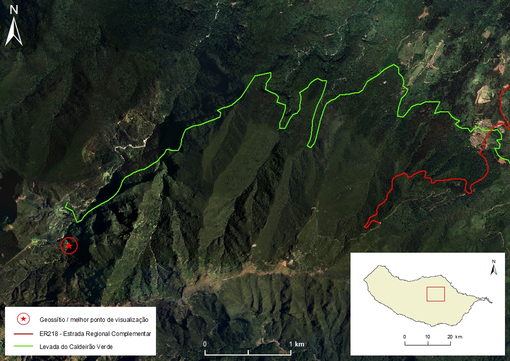 |
Municipality: Santana Civil parish: Ilha Location area: 0,1 -10 ha Coordinates(1):32°45'59.1'' N 16°56'51.9'' W Altitude: 1080 m Accessibility: Easy Distance to nearest paved road: 8000 m Conditions of observation: Good (1) Coordinates of the geosite and / or the best viewpoint |
Brief description
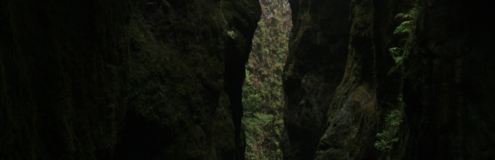
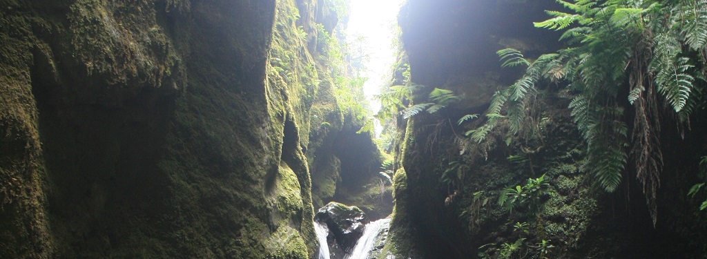
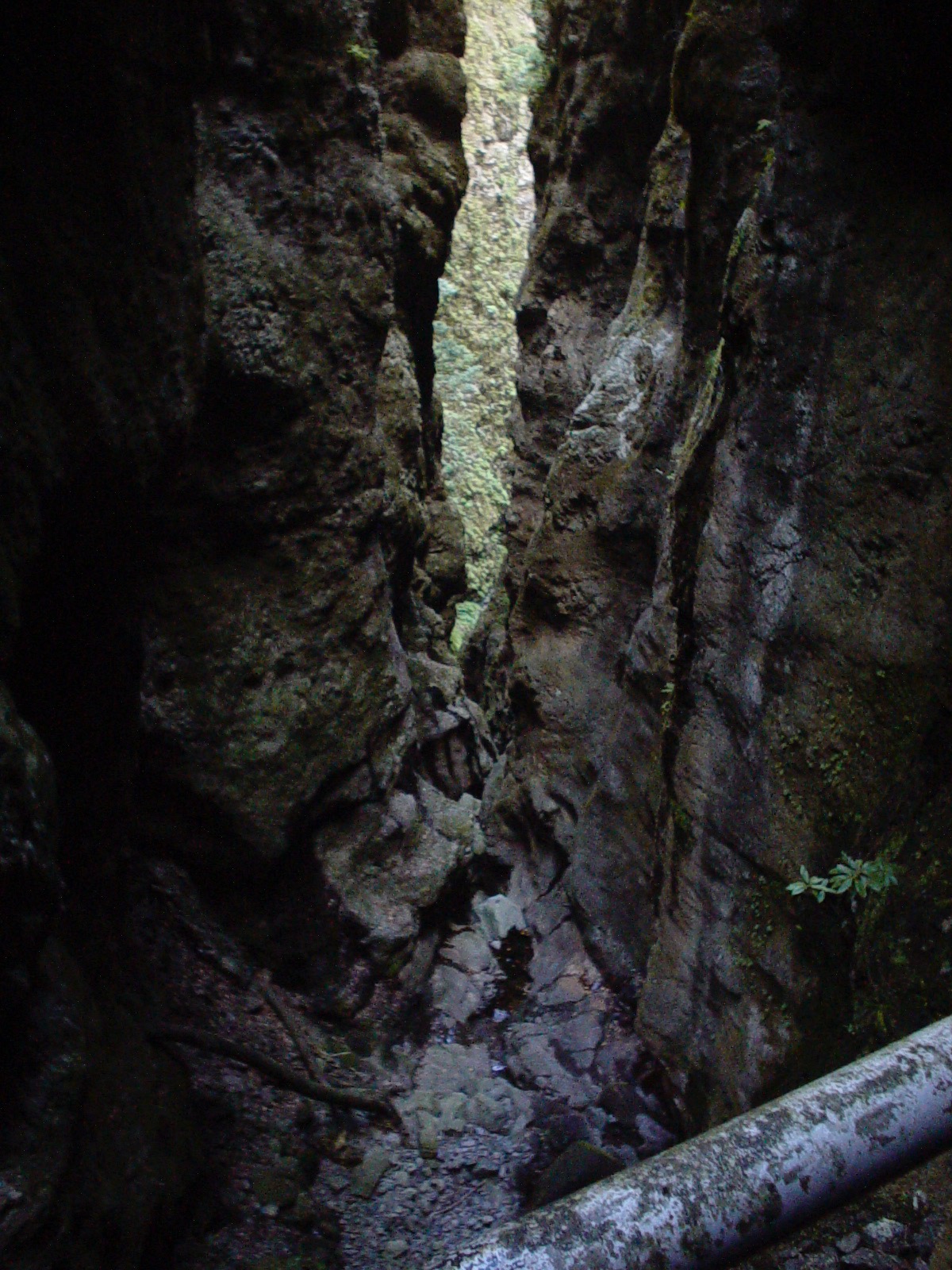
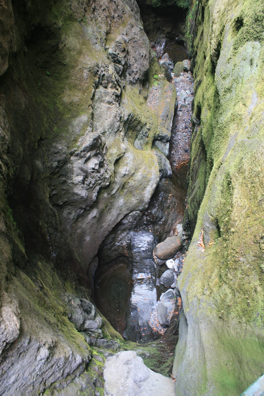
In Madeira Island, due to its high relief rainfall regime, and rock nature and structures, there as a strong fluvial erosion that results in deeply embedded and deep valleys.
Caldeirão do Inferno is the best example of a very narrow river gorge, of almost vertical slopes, which resulted from an extreme fluvial erosion process. In this case, the strong fluvial incision occurred along a dyke system whose edges with the embedding rock and intense internal fracturing constituted an area of structural weakness that was exploited by the water’s erosive action.
The permanent streams are fed from groundwater flows, from suspended aquifers that drain through numerous springs, notably copious on the island’s north slope. This abundance of water was in the origin of the construction of Madeira’s network of levadas.
The water captured at Caldeirão do Inferno is transported by the Serra do Faial levada to the charging chamber at Fajã da Nogueira’s hydroelectric power plant. After going through a turbine, it contributes to the Tornos adductor system that supplies the city of Funchal.
Relevant notes
Visiting a site of geological interest is the sole responsibility of the user.
The user must take precautions when visiting the site, taking into account the conditions of the terrain, weather conditions and other hazards, so that they do not create situations that put themselves or others at risk.
The user must respect private property. Access to private areas requires prior authorization from the owners.
The user must respect natural heritage, keeping it intact. The impact of your actions should be minimal.
Protection status
Natural spaces - Area of greatest natural value (Article 58), according to the Municipal Master Plan, atualmente (2015) em revisão.
ZPE of the Eastern Mountainous Massif of the Island of Madeira, which coincides with the limits of the Special Zone of Conservation of the Central Mountain Massif of the Island of Madeira only with regard to the area of the eastern spot of the said massif, and Natural Park of Madeira (Decreto Regulamentar Regional n.º 3/2014/M, artigo 2.º, alínea b).
Geological map of Madeira Island detail, Sheet b - S03


Bibliography
BRUM DA SILVEIRA, A.; MADEIRA, J.; RAMALHO, R.; FONSECA, P., PRADA, S. (2010) - Notícia Explicativa da Carta Geológica da ilha da Madeira, na escala 1:50.000, folhas A e B. Edição da Secretaria Regional do Ambiente e Recursos Naturais, Região Autónoma da Madeira e Universidade da Madeira: 47 p. ISBN: 978-972-98405-2-4. (Editado em 2011).
BRUM DA SILVEIRA, A.; MADEIRA, J.; RAMALHO, R.; FONSECA, P.; RODRIGUES, C., PRADA, S. (2010) Carta Geológica da ilha da Madeira na escala 1:50.000 - Folha A e B. Edição da Região Autónoma da Madeira, Secretaria Regional do Ambiente e Recursos Naturais; ISBN: 978-972-98405-1-7 (Editado em 2011).
BRUM DA SILVEIRA, A.; PRADA, S.; RAMALHO, R.; MADEIRA, J.; FONSECA, P.; CANHA, E.; BRILHA, J. (2012). Inventariação do Património Geológico da ilha da Madeira. Secretaria Regional do Ambiente - Relatório Final, 414 p.
PRADA, S.N. (2000) Geologia e Recursos Hídricos Subterrâneos da Ilha da Madeira. Dissertação para obtenção do Grau de Doutor em Geologia, Universidade da Madeira: 351 pp.
PRADA, S., SILVA, M.O., CRUZ, J.V. (2005) Groundwater behaviour in Madeira, volcanic island (Portugal). Hydrogeology Journal 13: 800-812.
Photo gallery
How to Cite
BRUM DA SILVEIRA, A.; PRADA, S.; RAMALHO, R.; MADEIRA, J.; FONSECA, P.; CANHA, E.; BRILHA, J. (2012). Inventariação do Património Geológico da Ilha da Madeira. Secretaria Regional do Ambiente e Recursos Naturais - Relatório Final, 414 p. In: https://geodiversidade.