")
")
 |
Geosite ID: PM01 Name: Pico da Fajã da Lenha Thematic category: Sedimentology |
 |
Municipality: Porto Moniz Civil parish: Seixal Location area: < 0,1 ha Coordinates(1):32°46'19.8'' N 17°07'15.9'' W Altitude: 1335 m Accessibility: Easy Distance to nearest paved road: 50 m Conditions of observation: Good (1) Coordinates of the geosite and / or the best viewpoint |
Brief description
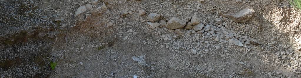
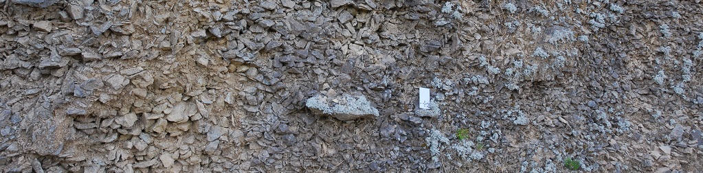
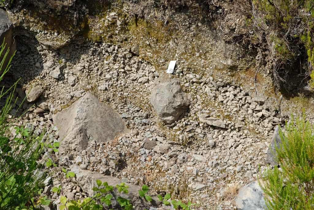
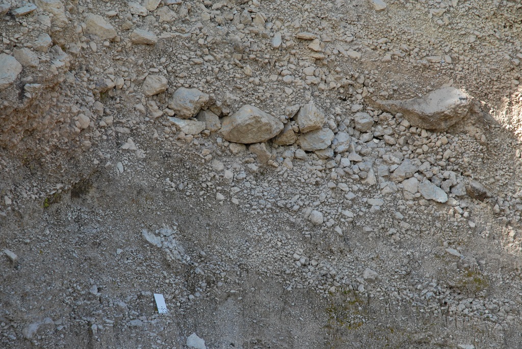
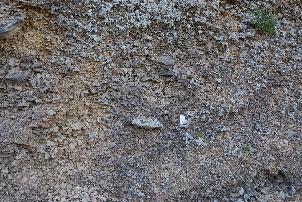
The periglacial deposits of the Pico da Fajã da Lenha are compared by levels of angular clasts formed by cryoclast. They are the result of a cold high – altitude climate during the recent geological history (Pleistocene).
This outcrop is exposed on the side of the road that connects Paul da Serra to Ribeira da Janela.
Relevant notes
Visiting a site of geological interest is the sole responsibility of the user.
The user must take precautions when visiting the site, taking into account the conditions of the terrain, weather conditions and other hazards, so that they do not create situations that put themselves or others at risk.
The user must respect private property. Access to private areas requires prior authorization from the owners.
The user must respect natural heritage, keeping it intact. The impact of your actions should be minimal.
Protection status
ZPE of the Laurissilva of Madeira, which coincides with the limits of the ZEC of the Laurissilva of Madeira, and Natural Park of Madeira (Decreto Regulamentar Regional n.º 3/2014/M, artigo 2.º, alínea a).
Plano Diretor Municipal, atualmente (2015) em revisão.
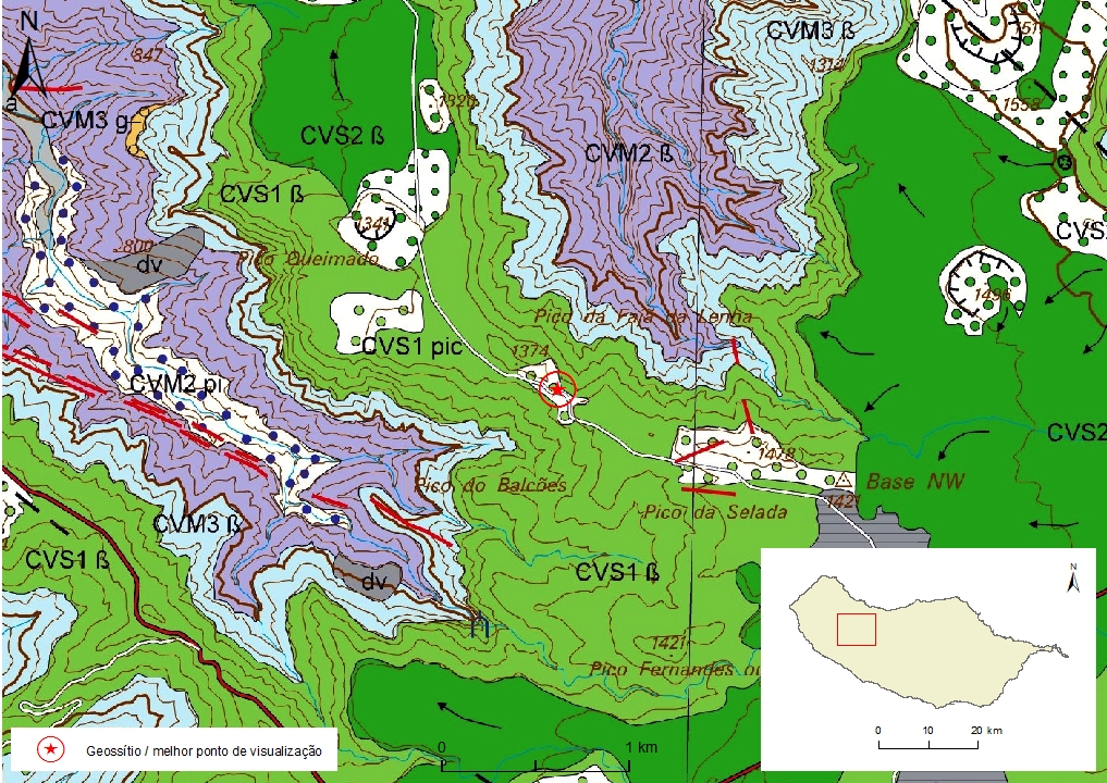
Geological map of Madeira Island detail, Sheet a - PM01

Bibliography
BRUM DA SILVEIRA, A.; MADEIRA, J.; PRADA, S.; CANHA, R.; FONSECA, P. & RAMALHO, R. (2006). Glacial landforms in Madeira Island (Portugal). Volume de Resumos do 3º Congresso de Geomorfologia,Outubro de 2006, Funchal: 41.
BRUM DA SILVEIRA, A.; MADEIRA, J.; RAMALHO, R.; FONSECA, P., PRADA, S. (2010) - Notícia Explicativa da Carta Geológica da ilha da Madeira, na escala 1:50.000, folhas A e B. Edição da Secretaria Regional do Ambiente e Recursos Naturais, Região Autónoma da Madeira e Universidade da Madeira: 47 p. ISBN: 978-972-98405-2-4. (Editado em 2011).
BRUM DA SILVEIRA, A.; MADEIRA, J.; RAMALHO, R.; FONSECA, P.; RODRIGUES, C., PRADA, S. (2010) Carta Geológica da ilha da Madeira na escala 1:50.000 - Folha A e B. Edição da Região Autónoma da Madeira, Secretaria Regional do Ambiente e Recursos Naturais; ISBN: 978-972-98405-1-7 (Editado em 2011).
BRUM DA SILVEIRA, A.; PRADA, S.; RAMALHO, R.; MADEIRA, J.; FONSECA, P.; CANHA, E.; BRILHA, J. (2012). Inventariação do Património Geológico da ilha da Madeira. Secretaria Regional do Ambiente - Relatório Final, 414 p.
BRUM FERREIRA, A. (1981). Manifestações periglaciárias de altitude na ilha da Madeira. Finisterra 16 (32): 213-229.
Photo gallery
How to Cite
BRUM DA SILVEIRA, A.; PRADA, S.; RAMALHO, R.; MADEIRA, J.; FONSECA, P.; CANHA, E.; BRILHA, J. (2012). Inventariação do Património Geológico da Ilha da Madeira. Secretaria Regional do Ambiente e Recursos Naturais - Relatório Final, 414 p. In: https://geodiversidade.