")
")
 |
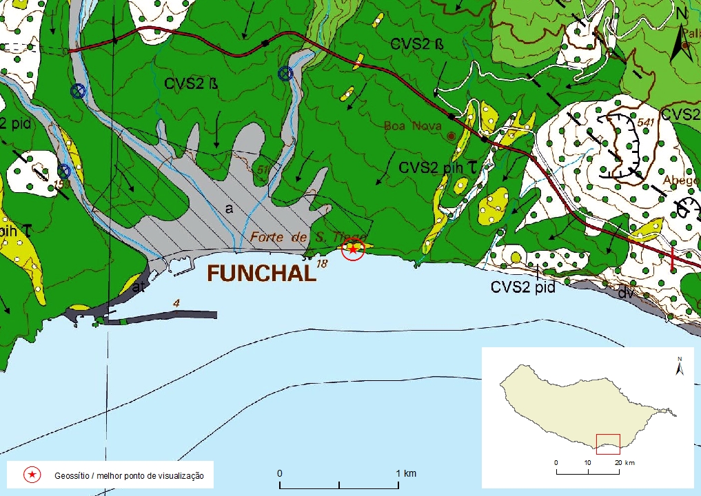
Geosite ID: F01 Name: Toco Thematic category: Volcanology and Lithology |
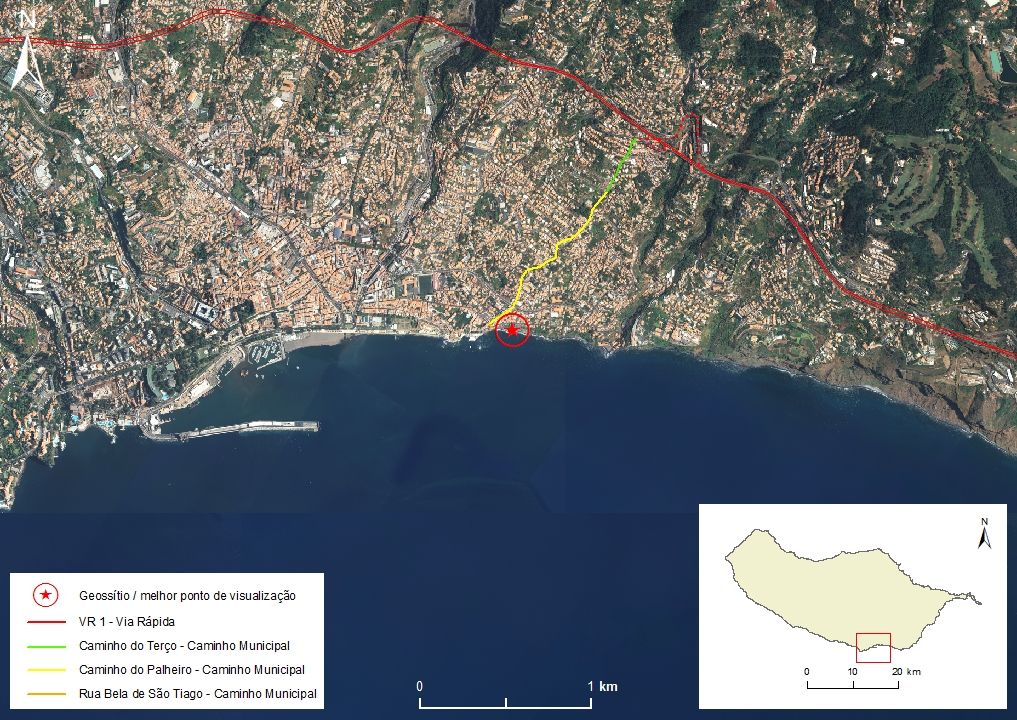 |
Municipality: Funchal Civil parish: Santa Maria Maior Location area: 10 -1000 ha Coordinates(1):32°38'49.3'' N 16°53'38.9'' W Altitude: 30 m Accessibility: difficult Distance to nearest paved road: 50 m Conditions of observation: satisfactory (1) Coordinates of the geosite and / or the best viewpoint |
Brief description
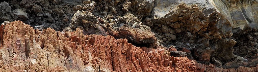
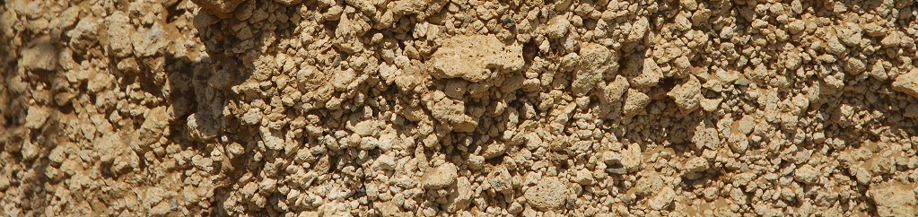
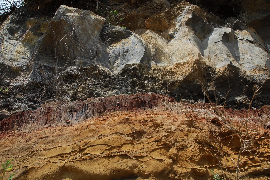
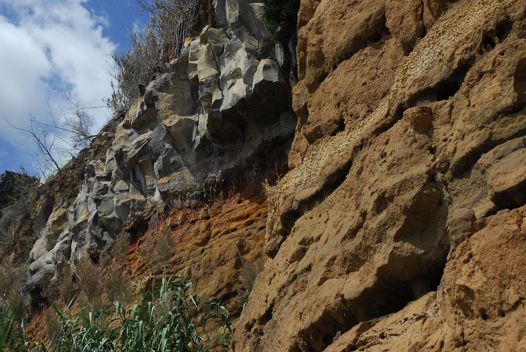
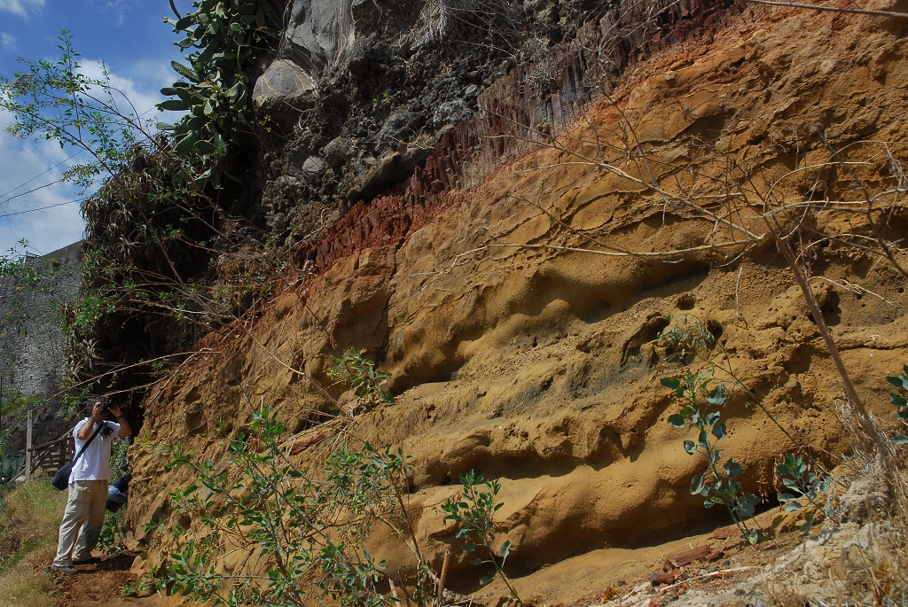
The Toco coastal cliff shows the best hydrovolcanic deposits outcrop from hydroplinic eruptions, that belong to the Funchal Formation, Upper Volcanic Complex (CVS). It is a sequence composed by distal hydrovolcanic and trachytic pumice strate intercalated whith paleosols. At the top of this sequence, a subaerial basaltic flow outcrops presenting a well developed prismatic disjunction that gently tilts into the sea.
Relevant notes
Visiting a site of geological interest is the sole responsibility of the user.
The user must take precautions when visiting the site, taking into account the conditions of the terrain, weather conditions and other hazards, so that they do not create situations that put themselves or others at risk.
The user must respect private property. Access to private areas requires prior authorization from the owners.
The user must respect natural heritage, keeping it intact. The impact of your actions should be minimal.
Protection status
Natural spaces - Scarp zone (Article 87º), according to the Municipal Master Plan.
Geological map of Madeira Island detail, Sheet b - F01

Bibliography
BRUM DA SILVEIRA, A.; MADEIRA, J.; RAMALHO, R.; FONSECA, P., PRADA, S. (2010) - Notícia Explicativa da Carta Geológica da ilha da Madeira, na escala 1:50.000, folhas A e B. Edição da Secretaria Regional do Ambiente e Recursos Naturais, Região Autónoma da Madeira e Universidade da Madeira: 47 p. ISBN: 978-972-98405-2-4. (Editado em 2011).
BRUM DA SILVEIRA, A.; MADEIRA, J.; RAMALHO, R.; FONSECA, P.; RODRIGUES, C., PRADA, S. (2010) Carta Geológica da ilha da Madeira na escala 1:50.000 - Folha A e B. Edição da Região Autónoma da Madeira, Secretaria Regional do Ambiente e Recursos Naturais; ISBN: 978-972-98405-1-7 (Editado em 2011).
BRUM DA SILVEIRA, A.; PRADA, S.; RAMALHO, R.; MADEIRA, J.; FONSECA, P.; CANHA, E.; BRILHA, J. (2012). Inventariação do Património Geológico da ilha da Madeira. Secretaria Regional do Ambiente - Relatório Final, 414 p.
Photo gallery
How to Cite
BRUM DA SILVEIRA, A.; PRADA, S.; RAMALHO, R.; MADEIRA, J.; FONSECA, P.; CANHA, E.; BRILHA, J. (2012). Inventariação do Património Geológico da Ilha da Madeira. Secretaria Regional do Ambiente e Recursos Naturais - Relatório Final, 414 p. In: https://geodiversidade.