")
")
 |
Geosite ID: M05 Name: Ribeira Tem-te Não Caias Thematic category: Volcanology and Stratigraphy |
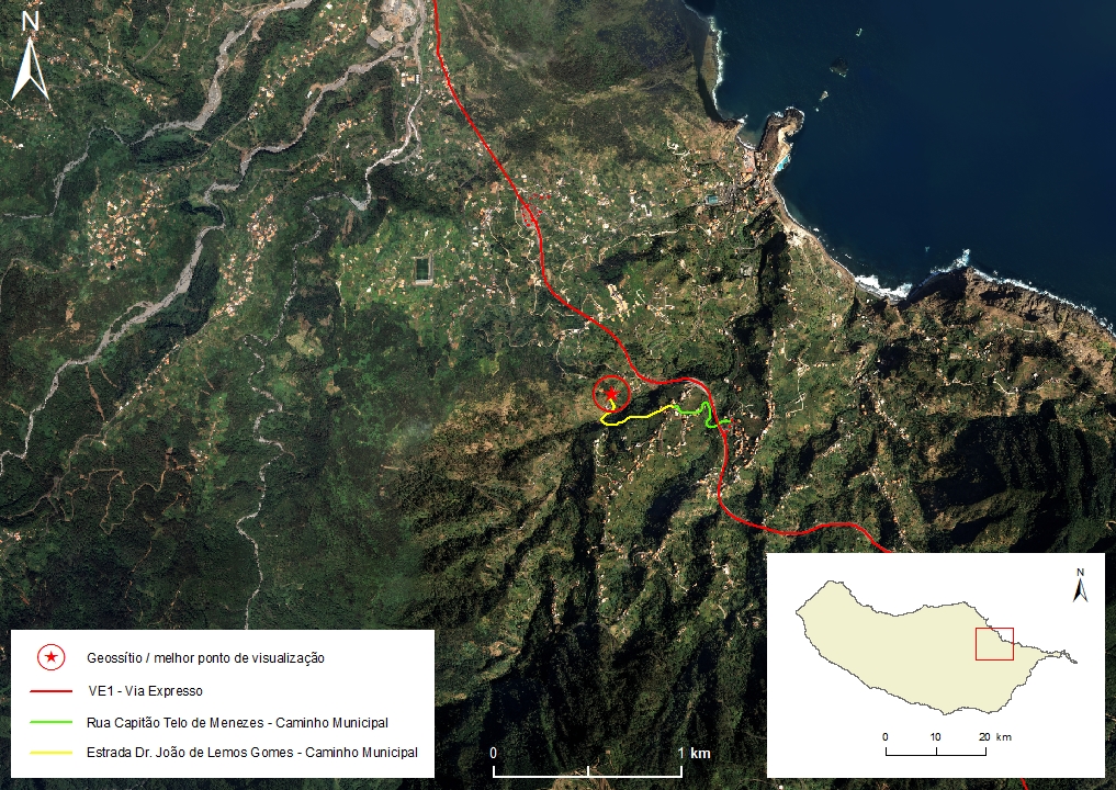 |
Municipality: Machico Civil parish: Porto da Cruz Location area: 10 -1000 ha Coordinates(1):32°45'46.4'' N 16°50'10.4'' W Altitude: 181 m Accessibility: Easy Distance to nearest paved road: 1 m Conditions of observation: good (1) Coordinates of the geosite and / or the best viewpoint |
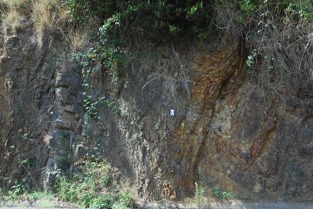
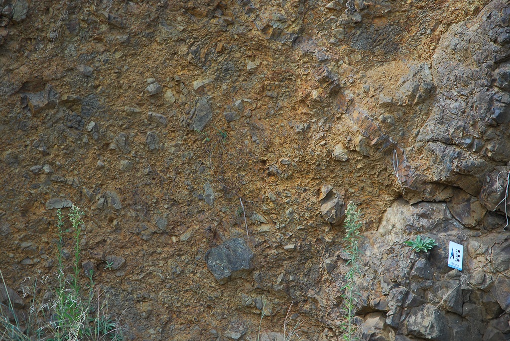
Brief description
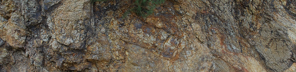
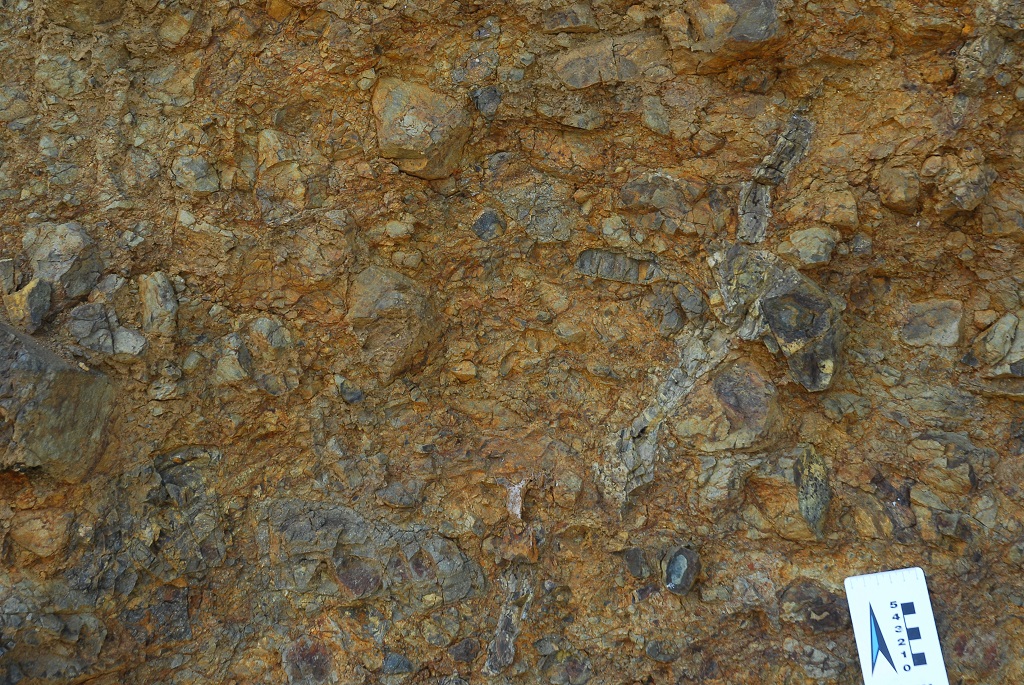
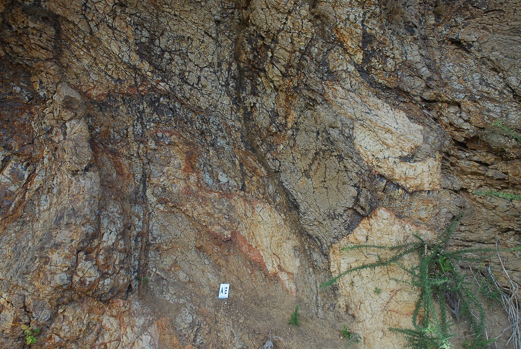
On this geosite it is possible to observe the oldest rocks exposed on Madeira Island, part of the Lower Volcanic Complex (CVI).
This set of outcrops, due to its integrity and representativeness, should be used as a reference when characterizing the Porto da Cruz Formation, defining its simple stratotype.
The lithological characteristics of these rocks allows this volcanic-stratigraphic formation to be correlated with a submarine volcanic stage, in which the Madeira shield volcano was about to emerge and to form an island.
Relevant notes
Visiting a site of geological interest is the sole responsibility of the user.
The user must take precautions when visiting the site, taking into account the conditions of the terrain, weather conditions and other hazards, so that they do not create situations that put themselves or others at risk.
The user must respect private property. Access to private areas requires prior authorization from the owners.
The user must respect natural heritage, keeping it intact. The impact of your actions should be minimal.
Protection status
Agroforestry spaces - Agricultural spaces (Article 50), according to Municipal Master Plan.
Geological map of Madeira Island detail, Sheet b - M05


Bibliography
BRUM DA SILVEIRA, A.; MADEIRA, J.; RAMALHO, R.; FONSECA, P., PRADA, S. (2010) - Notícia Explicativa da Carta Geológica da ilha da Madeira, na escala 1:50.000, folhas A e B. Edição da Secretaria Regional do Ambiente e Recursos Naturais, Região Autónoma da Madeira e Universidade da Madeira: 47 p. ISBN: 978-972-98405-2-4. (Editado em 2011).
BRUM DA SILVEIRA, A.; MADEIRA, J.; RAMALHO, R.; FONSECA, P.; RODRIGUES, C., PRADA, S. (2010) Carta Geológica da ilha da Madeira na escala 1:50.000 - Folha A e B. Edição da Região Autónoma da Madeira, Secretaria Regional do Ambiente e Recursos Naturais; ISBN: 978-972-98405-1-7 (Editado em 2011).
BRUM DA SILVEIRA, A.; PRADA, S.; RAMALHO, R.; MADEIRA, J.; FONSECA, P.; CANHA, E.; BRILHA, J. (2012). Inventariação do Património Geológico da ilha da Madeira. Secretaria Regional do Ambiente - Relatório Final, 414 p.
Photo gallery
How to Cite
BRUM DA SILVEIRA, A.; PRADA, S.; RAMALHO, R.; MADEIRA, J.; FONSECA, P.; CANHA, E.; BRILHA, J. (2012). Inventariação do Património Geológico da Ilha da Madeira. Secretaria Regional do Ambiente e Recursos Naturais - Relatório Final, 414 p. In: https://geodiversidade.