")
")
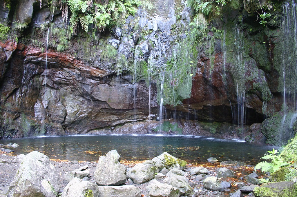 |
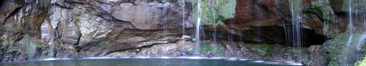
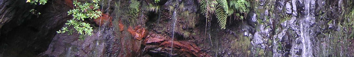
Geosite ID: C01 Name: 25 Fontes Thematic category: Water resources |
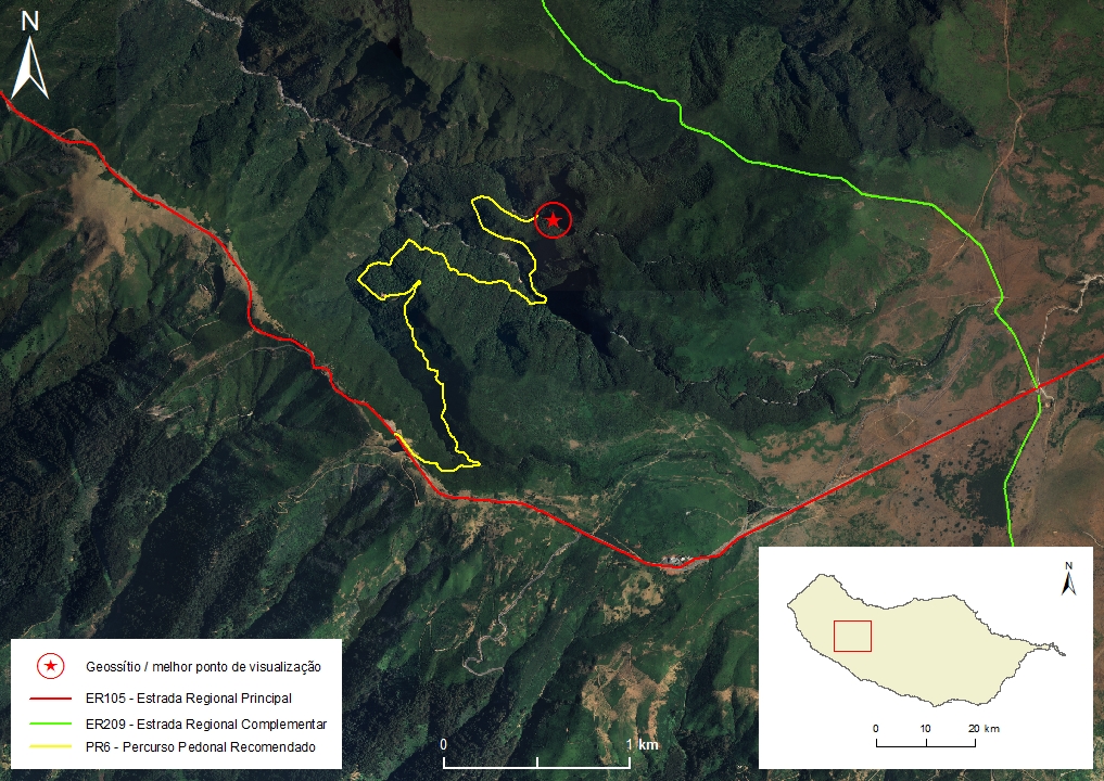 |
Municipality: Calheta Civil parish: Calheta Location area: 0,1 -10 ha Coordinates(1):32°45'56.2'' N 17°07'31.1'' W Altitude: 990 m Accessibility: Moderate Distance to nearest paved road: 4900 m Conditions of observation: Good (1) Coordinates of the geosite and / or the best viewpoint |
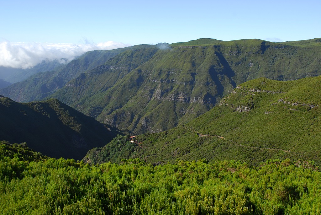
Brief description
The geosite is a superb example of a suspended aquifer, a very important type of aquifer on Madeira Island.
This site shows, in exemplary fashion, the abundance and the permanence of the springs that determined the construction of a vast aqueduct network, the Madeira Island levadas.
Relevant notes
Visiting a site of geological interest is the sole responsibility of the user.
The user must take precautions when visiting the site, taking into account the conditions of the terrain, weather conditions and other hazards, so that they do not create situations that put themselves or others at risk.
The user must respect private property. Access to private areas requires prior authorization from the owners.
The user must respect natural heritage, keeping it intact. The impact of your actions should be minimal.
Protection status
Natural spaces - protected areas (Article 56º), according to the Municipal Master Plan, and Madeira Natural Park.
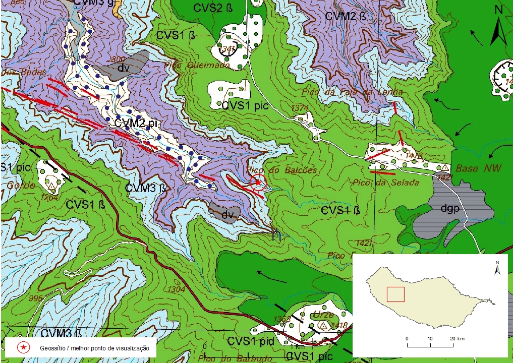
Geological map of Madeira Island detail, sheet a - C01

Bibliography
BRUM DA SILVEIRA, A.; MADEIRA, J.; RAMALHO, R.; FONSECA, P., PRADA, S. (2010) - Notícia Explicativa da Carta Geológica da ilha da Madeira, na escala 1:50.000, folhas A e B. Edição da Secretaria Regional do Ambiente e Recursos Naturais, Região Autónoma da Madeira e Universidade da Madeira: 47 p. ISBN: 978-972-98405-2-4. (Editado em 2011).
BRUM DA SILVEIRA, A.; MADEIRA, J.; RAMALHO, R.; FONSECA, P.; RODRIGUES, C., PRADA, S. (2010) Carta Geológica da ilha da Madeira na escala 1:50.000 - Folha A e B. Edição da Região Autónoma da Madeira, Secretaria Regional do Ambiente e Recursos Naturais; ISBN: 978-972-98405-1-7 (Editado em 2011).
BRUM DA SILVEIRA, A.; PRADA, S.; RAMALHO, R.; MADEIRA, J.; FONSECA, P.; CANHA, E.; BRILHA, J. (2012). Inventariação do Património Geológico da ilha da Madeira. Secretaria Regional do Ambiente - Relatório Final, 414 p.
NASCIMENTO, S. (1990) Estudo Hidrogeológico do Paul da Serra (Ilha da Madeira). Dissertação para obtenção do Grau de Mestre em Geologia Económica e Aplicada pela FCUL. Universidade de Lisboa: 147 pp.
PRADA, S.N. (2000) Geologia e Recursos Hídricos Subterrâneos da Ilha da Madeira. Dissertação para obtenção do Grau de Doutor em Geologia, Universidade da Madeira: 351 pp.
PRADA, S., SILVA, M.O., CRUZ, J.V. (2005) Groundwater behaviour in Madeira, volcanic island (Portugal). Hydrogeology Journal 13: 800-812.
Photo gallery
How to Cite
BRUM DA SILVEIRA, A.; PRADA, S.; RAMALHO, R.; MADEIRA, J.; FONSECA, P.; CANHA, E.; BRILHA, J. (2012). Inventariação do Património Geológico da Ilha da Madeira. Secretaria Regional do Ambiente e Recursos Naturais - Relatório Final, 414 p. In: https://geodiversidade.