")
")
 |
Geosite ID: CL02 Name: Miradouro do Cabo Girão Thematic category: Volcanology and Stratigraphy |
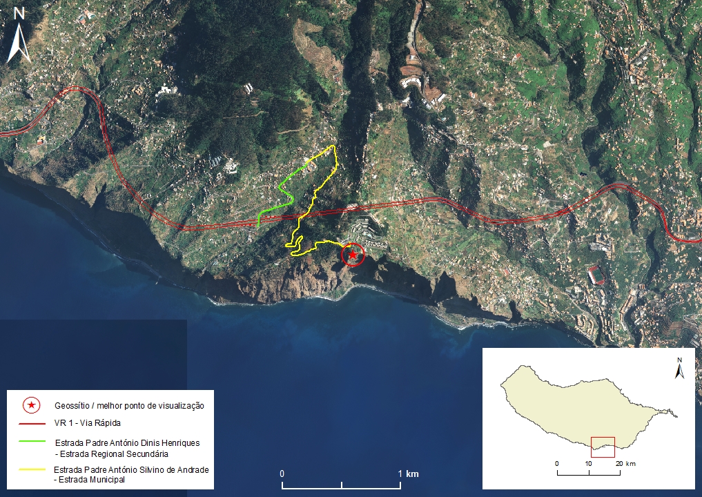 |
Municipality: Câmara de Lobos Civil parish: Quinta Grande Location area: 10 -1000 ha Coordinates(1): 32°39'23.4'' N 17°00'15.9'' W Altitude: 580 m Accessibility: Easy Distance to nearest paved road: 50 m Conditions of observation: good (1) Coordinates of the geosite and / or the best viewpoint |
Brief description
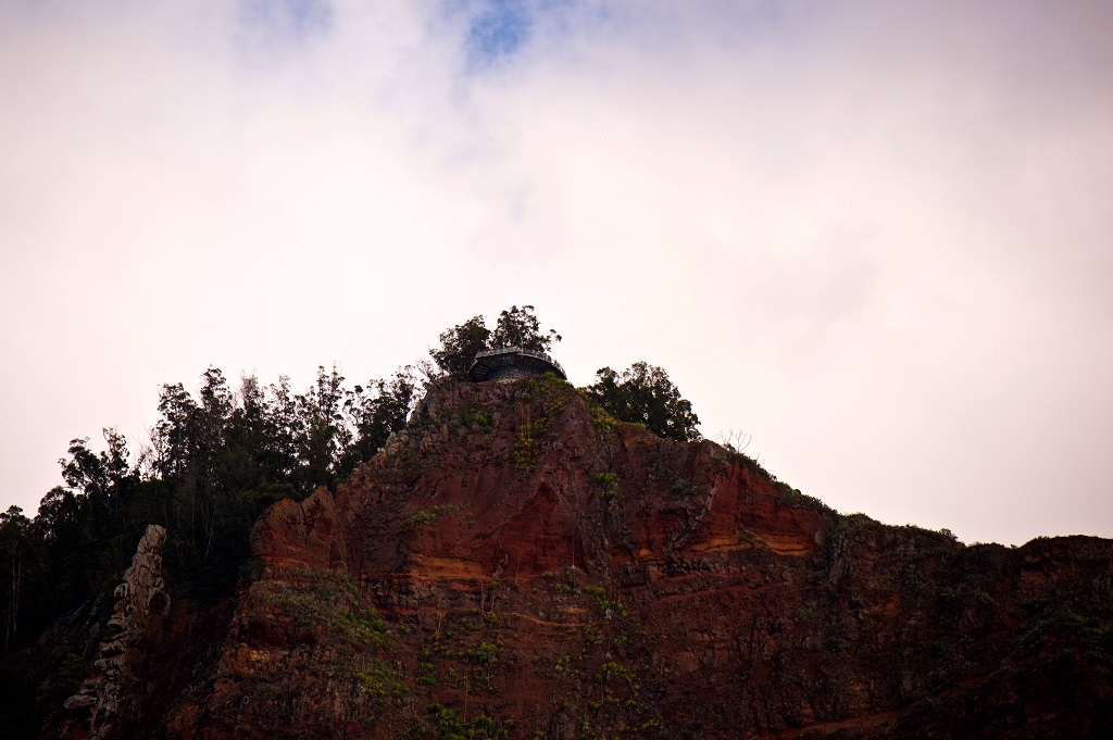
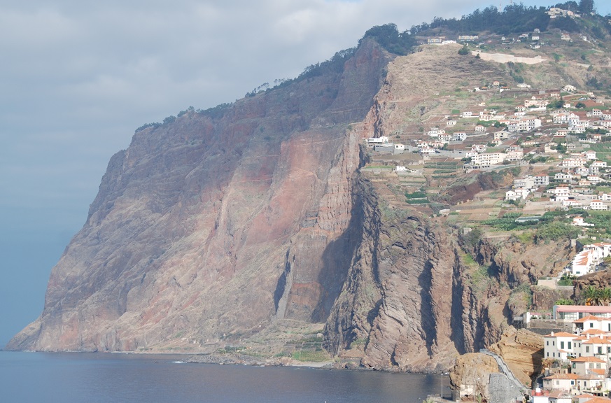
The coastal landscape in Cabo Girão is characterized by a 580 m high sea cliff, carved in a structure of pyroclastic fallout deposits and basaltic flows, from the Penha d’Águia Formation, Intermediate Volcanic Complex (CVM). This structure is cut by a dense network of dykes. At the top, flow, from the Curral das Freiras Formation, Intermediate Volcanic Complex, outcrop.
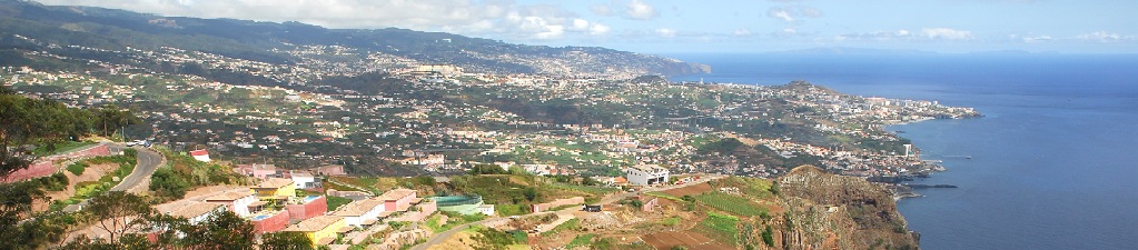
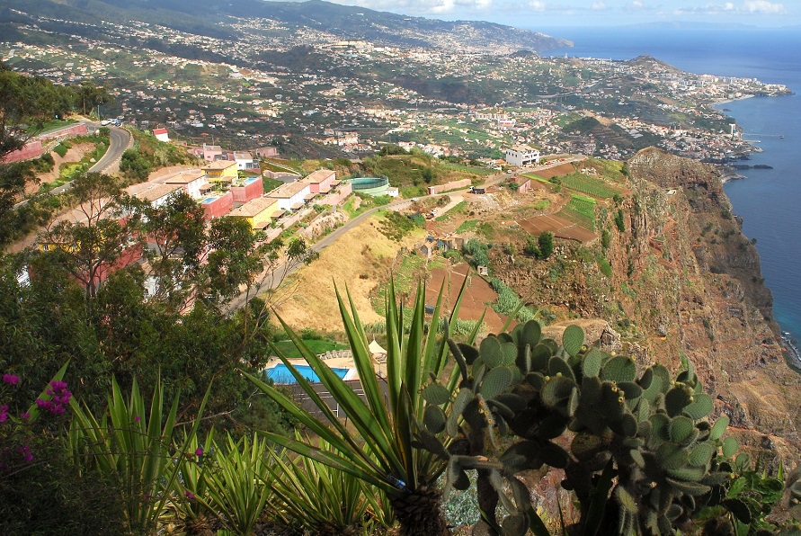
From the belvedere, located at the top of the cliff, several volcanic cones can be observed in the Funchal region as well as a natural amphitheatre morphology, facing south, that was originated by lava flows from the upper reaches of the island (Pico do Areeiro and Pico do Cedro).
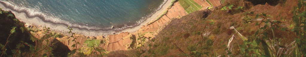
At the base of the cliff there is sedimentary platform (Fajã dos Asnos), used for agriculture, that results from landslide mass movements, one of them being historical (1930) and by occasional falling blocks; these materials gave rise to a rocky beach made of gravel, boulders, and rolled pebbles.
Relevant notes
Visiting a site of geological interest is the sole responsibility of the user.
The user must take precautions when visiting the site, taking into account the conditions of the terrain, weather conditions and other hazards, so that they do not create situations that put themselves or others at risk.
The user must respect private property. Access to private areas requires prior authorization from the owners.
The user must respect natural heritage, keeping it intact. The impact of your actions should be minimal.
Protection status
Natural spaces of very conditioned use (Article 50º), according to the Municipal Master Plan.
Marine Nature Park of the Cabo Girão (D.L.R. n.º 4/2017).
Natural Monument and Protected Landscape of the Cabo Girão (D.L.R. n.º 8/2017).
Location

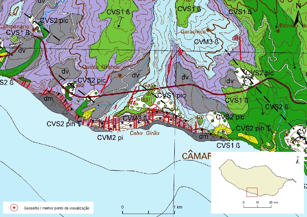
Geological map of Madeira Island detail, Sheet a - CL02

Bibliography
BRUM DA SILVEIRA, A.; MADEIRA, J.; RAMALHO, R.; FONSECA, P., PRADA, S. (2010) - Notícia Explicativa da Carta Geológica da ilha da Madeira, na escala 1:50.000, folhas A e B. Edição da Secretaria Regional do Ambiente e Recursos Naturais, Região Autónoma da Madeira e Universidade da Madeira: 47 p. ISBN: 978-972-98405-2-4. (Editado em 2011).
BRUM DA SILVEIRA, A.; MADEIRA, J.; RAMALHO, R.; FONSECA, P.; RODRIGUES, C., PRADA, S. (2010) Carta Geológica da ilha da Madeira na escala 1:50.000 - Folha A e B. Edição da Região Autónoma da Madeira, Secretaria Regional do Ambiente e Recursos Naturais; ISBN: 978-972-98405-1-7 (Editado em 2011).
BRUM DA SILVEIRA, A.; PRADA, S.; RAMALHO, R.; MADEIRA, J.; FONSECA, P.; CANHA, E.; BRILHA, J. (2012). Inventariação do Património Geológico da ilha da Madeira. Secretaria Regional do Ambiente - Relatório Final, 414 p.
Photo gallery
How to Cite
BRUM DA SILVEIRA, A.; PRADA, S.; RAMALHO, R.; MADEIRA, J.; FONSECA, P.; CANHA, E.; BRILHA, J. (2012). Inventariação do Património Geológico da Ilha da Madeira. Secretaria Regional do Ambiente e Recursos Naturais - Relatório Final, 414 p. In: https://geodiversidade.