")
")
 |
Geosite ID: PM02 Name: Miradouro da Vilado Porto Moniz Thematic category: Vulcanology e Geomorphology |
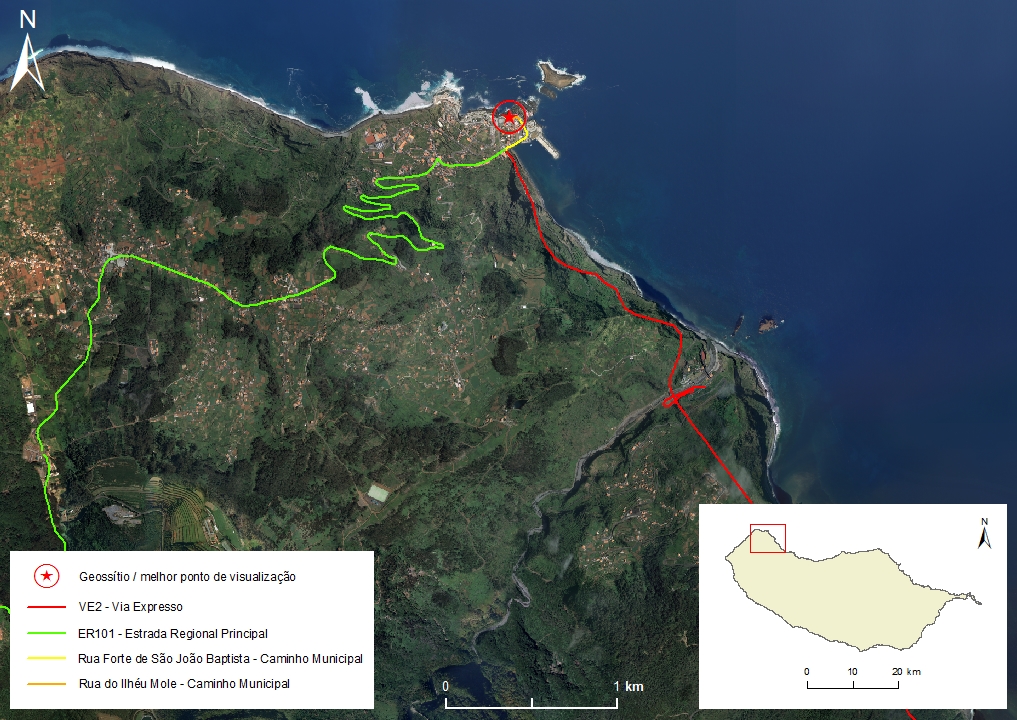 |
Municipality: Porto Moniz Civil parish: Porto Moniz Location area: 10 -1000 ha Coordinates(1): 32°51'45.1"N 17°10'23.9"W Altitude: 275 m Accessibility: Easy Distance to nearest paved road: 1 m Conditions of observation: Good (1) Coordinates of the geosite and / or the best viewpoint |
Brief description
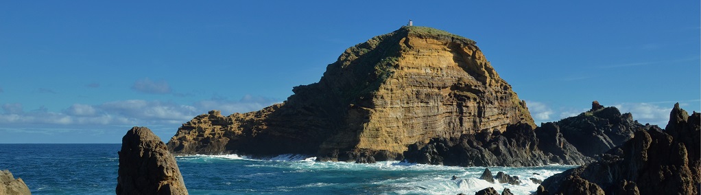
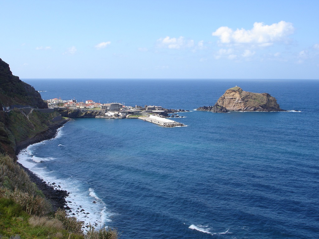
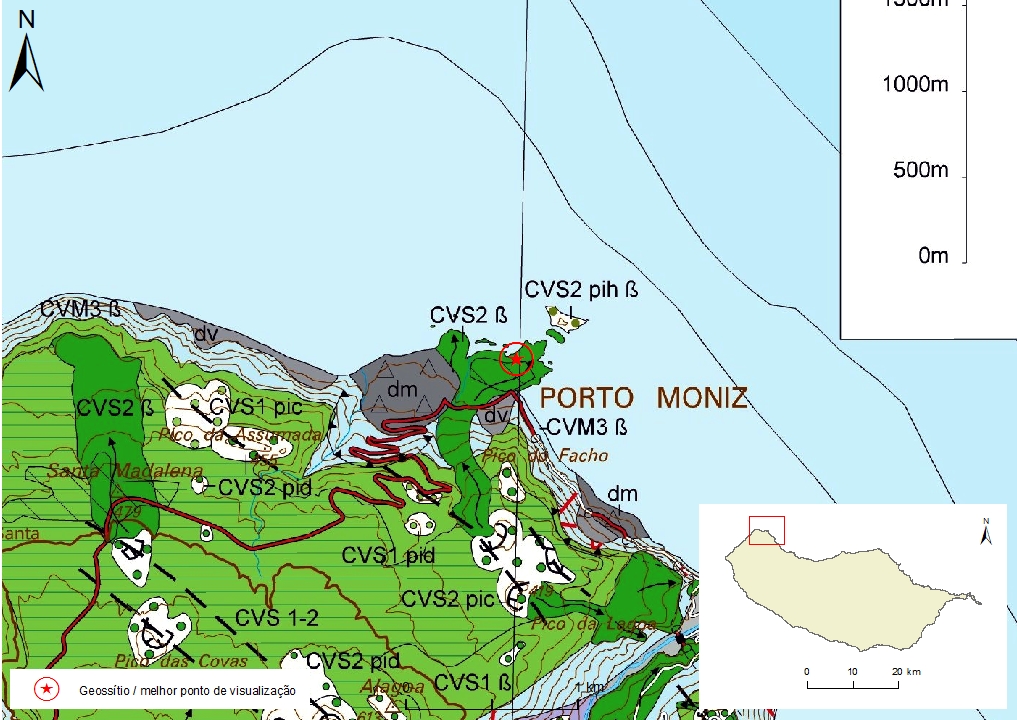
This geosite displays several aspects of high geomorphological and volcanological interest, namely a basaltic lava delta, which forms the Porto Moniz coastal platform (fajã), that resulted from a Hawaiian/Strombolian eruption, that is part of the Funchal Formation (Pleistocene and Holocene ≈ 1.8 - 0.007 Ma).
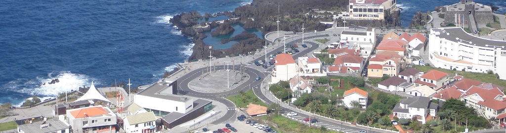
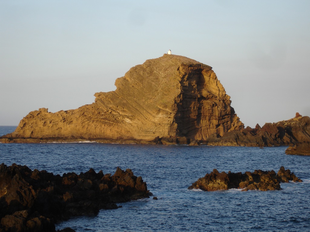
To the south-west of Porto Moniz, coming doun the old coastal cliff (paleo-cliff), one can observe the lava flows that gave rise to this delta. It is also possible to observe the Mole islet, a surtseyan cone partially destroyed by marine erosion, which resulted from a submarine eruption that followed the flows that formed the lava delta. Northwest of the fajã of Porto Moniz there is a crater of another surtseyan cone that is practically at sea level, that which is visible during the low tide as shoals.
Notas relevantes
Visiting a site of geological interest is the sole responsibility of the user.
The user must take precautions when visiting the site, taking into account the conditions of the terrain, weather conditions and other hazards, so that they do not create situations that put themselves or others at risk.
The user must respect private property. Access to private areas requires prior authorization from the owners.
The user must respect natural heritage, keeping it intact. The impact of your actions should be minimal.
Protection status
Urban Spaces - Equipment Spaces (Article 37), according to the Municipal Master Plan.
Geological map of Madeira Island detail, sheet a - PM02

Bibliography
BRUM DA SILVEIRA, A.; MADEIRA, J.; RAMALHO, R.; FONSECA, P., PRADA, S. (2010) - Notícia Explicativa da Carta Geológica da ilha da Madeira, na escala 1:50.000, folhas A e B. Edição da Secretaria Regional do Ambiente e Recursos Naturais, Região Autónoma da Madeira e Universidade da Madeira: 47 p. ISBN: 978-972-98405-2-4. (Editado em 2011).
BRUM DA SILVEIRA, A.; MADEIRA, J.; RAMALHO, R.; FONSECA, P.; RODRIGUES, C., PRADA, S. (2010) Carta Geológica da ilha da Madeira na escala 1:50.000 - Folha A e B. Edição da Região Autónoma da Madeira, Secretaria Regional do Ambiente e Recursos Naturais; ISBN: 978-972-98405-1-7 (Editado em 2011).
BRUM DA SILVEIRA, A.; PRADA, S.; RAMALHO, R.; MADEIRA, J.; FONSECA, P.; CANHA, E.; BRILHA, J. (2012). Inventariação do Património Geológico da ilha da Madeira. Secretaria Regional do Ambiente - Relatório Final, 414 p.
ZBYSZEWSKI, G.; VEIGA FERREIRA, O.; CÂNDIDO DE MEDEIROS, A.; AIRES-BARROS, L.; CELESTINO SILVA, L.; MUNHÁ, J.M. E BARRIGA, F. (1975) Carta Geológica de Portugal na escala 1:50.000. Notícia Explicativa das Folha A e B da Ilha da Madeira. Serviços Geológicos de Portugal: 53 p.
Photo gallery
How to Cite
BRUM DA SILVEIRA, A.; PRADA, S.; RAMALHO, R.; MADEIRA, J.; FONSECA, P.; CANHA, E.; BRILHA, J. (2012). Inventariação do Património Geológico da Ilha da Madeira. Secretaria Regional do Ambiente e Recursos Naturais - Relatório Final, 414 p. In: https://geodiversidade.