")
")
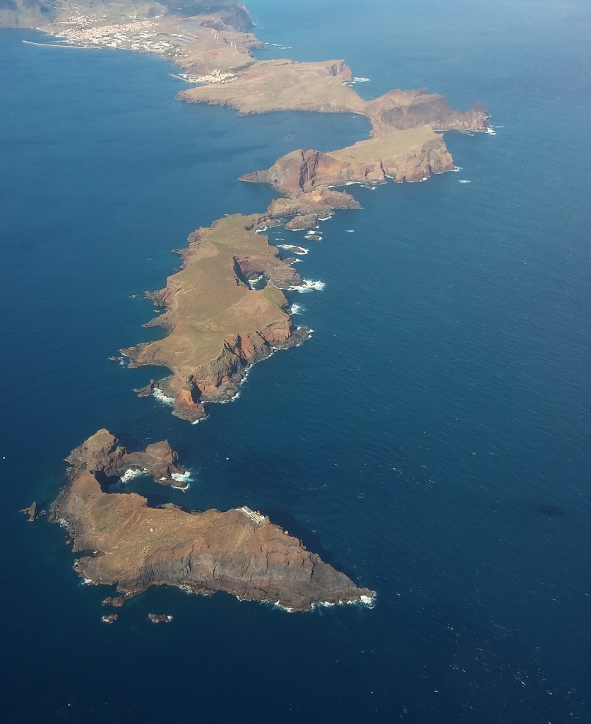 |
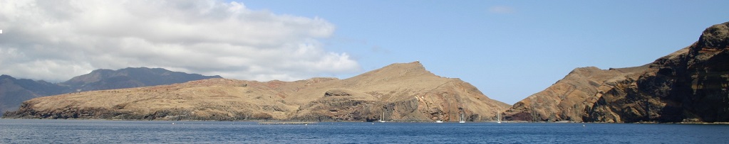
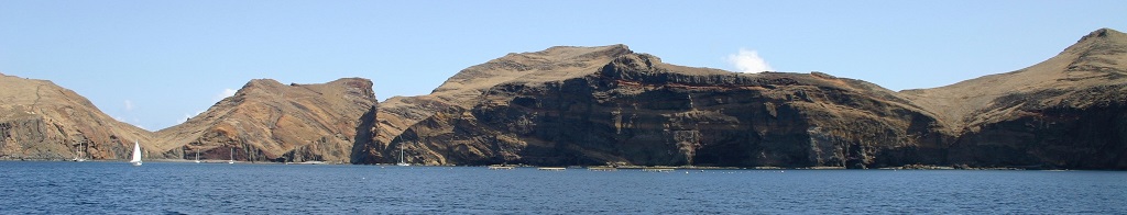
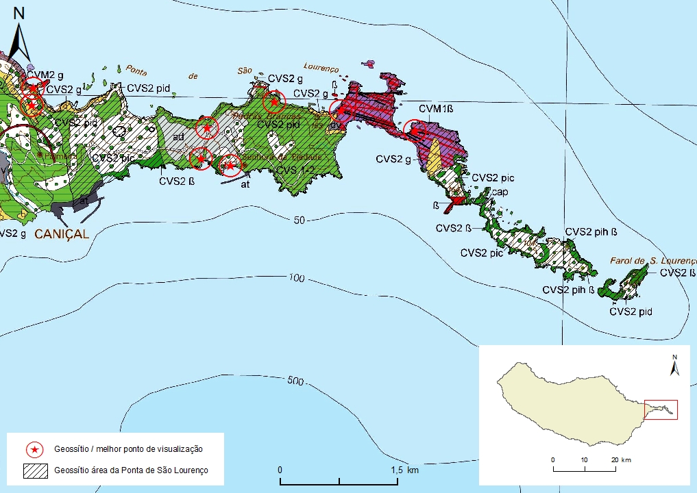
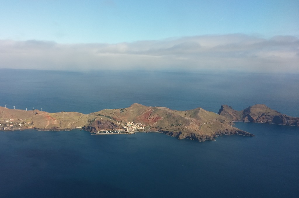
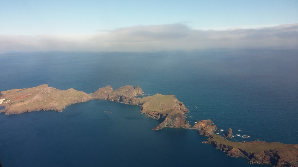
Geosite ID: M01 Name: Ponta de São Lourenço Thematic category: Volcanology and Tectonics |
 |
Municipality: Machico Civil parish: Caniçal Location area: 0,1 -1000 ha Coordinates(1): 32º44.7' N 16º42.7' W Average altitude: 72 m Accessibility: fácil Distance to nearest paved road: 583 m Conditions of observation: Good (1) Coordinates of the geosite and / or the best viewpoint |
Brief description
The Ponta de São Lourenço is an area of major geological relevance. Despite being physiographicaly homogenous, this area encompasses a set of 8 geosites that represent a high multitude of aspects, mainly of stratigraphical, tectonic, volcanic, geomorphological, lithological and sedimentological nature.
Relevant notes
Visiting a site of geological interest is the sole responsibility of the user.
The user must take precautions when visiting the site, taking into account the conditions of the terrain, weather conditions and other hazards, so that they do not create situations that put themselves or others at risk.
The user must respect private property. Access to private areas requires prior authorization from the owners.
The user must respect natural heritage, keeping it intact. The impact of your actions should be minimal.
Protection status
ZPE of Ponta de São Lourenço that coincides with the limits of the ZEC of Ponta de São Lourenço, and Natural Park of Madeira (Decreto Regulamentar Regional n.º 3/2014/M, artigo 2.º, alínea c).
Monumento Natural integrado na Rede de Monumentos Naturais (D.L.R. n.º 7/2021/M).
Geological map of Madeira Island detail, Sheet b - M01

Bibliography
BRUM DA SILVEIRA, A.; MADEIRA, J.; RAMALHO, R.; FONSECA, P., PRADA, S. (2010) - Notícia Explicativa da Carta Geológica da ilha da Madeira, na escala 1:50.000, folhas A e B. Edição da Secretaria Regional do Ambiente e Recursos Naturais, Região Autónoma da Madeira e Universidade da Madeira: 47 p. ISBN: 978-972-98405-2-4. (Editado em 2011).
BRUM DA SILVEIRA, A.; MADEIRA, J.; RAMALHO, R.; FONSECA, P.; RODRIGUES, C., PRADA, S. (2010) Carta Geológica da ilha da Madeira na escala 1:50.000 - Folha A e B. Edição da Região Autónoma da Madeira, Secretaria Regional do Ambiente e Recursos Naturais; ISBN: 978-972-98405-1-7 (Editado em 2011).
BRUM DA SILVEIRA, A.; PRADA, S.; RAMALHO, R.; MADEIRA, J.; FONSECA, P.; CANHA, E.; BRILHA, J. (2012). Inventariação do Património Geológico da ilha da Madeira. Secretaria Regional do Ambiente - Relatório Final, 414 p.
Photo gallery
How to Cite
BRUM DA SILVEIRA, A.; PRADA, S.; RAMALHO, R.; MADEIRA, J.; FONSECA, P.; CANHA, E.; BRILHA, J. (2012). Inventariação do Património Geológico da Ilha da Madeira. Secretaria Regional do Ambiente e Recursos Naturais - Relatório Final, 414 p. In: https://geodiversidade.