")
")
 |
Geosite ID: CL01 Name: Miradouro da Eira do Serrado Thematic category: Geomorfology and Mass movements |
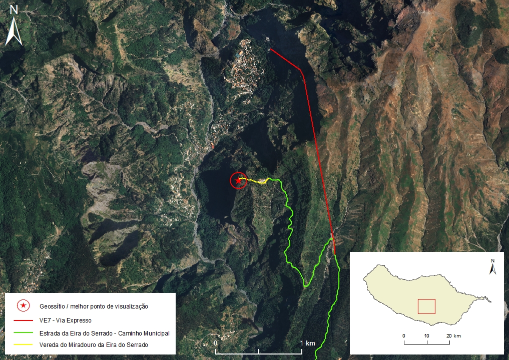 |
Municipality: Câmara de Lobos Civil parish: Curral das Freiras Location area: 10 -1000 ha Coordinates(1):32°42'37.1'' N 16°57'56.7'' W Altitude: 1050 m Accessibility: Easy Distance to nearest paved road: 300 m Conditions of observation: good (1) Coordinates of the geosite and / or the best viewpoint |
Brief description
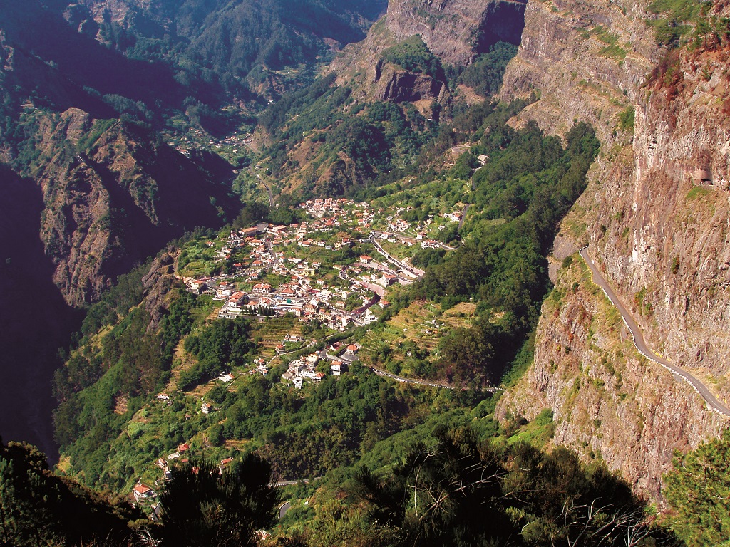
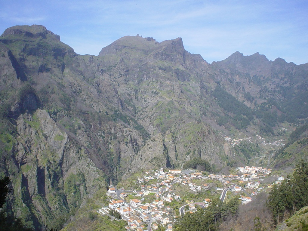
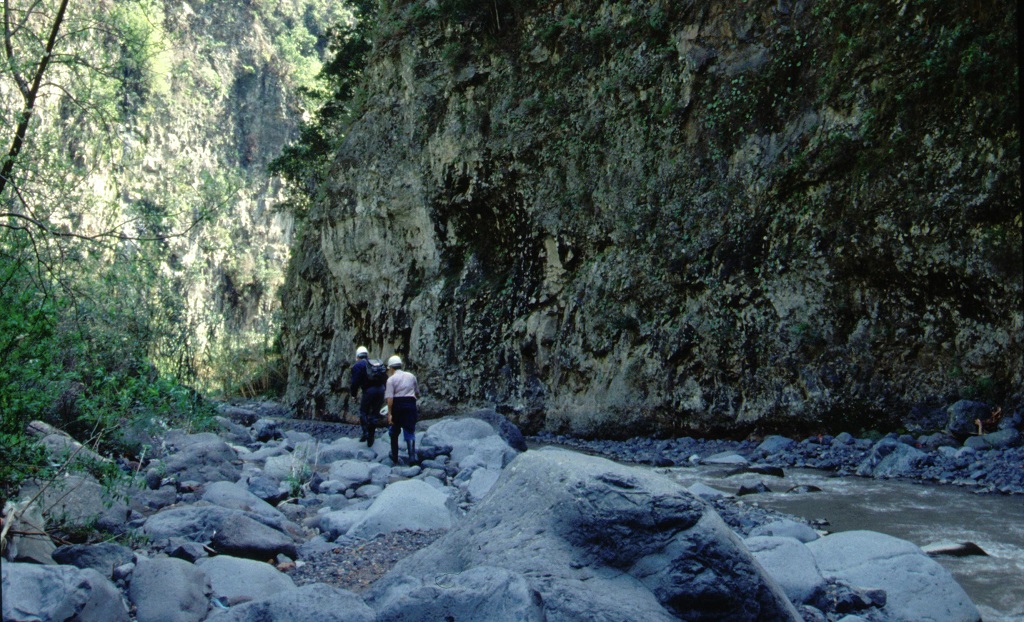
The Eira do Serrado geosite is located on the left bank of the Socorridos river basin. From the belvedere, it is possible to identify the open and wide form of the headwater of the Socorridos stream (reception area) and, downstream, the very embedded and narrow valley (drainage channel sector).
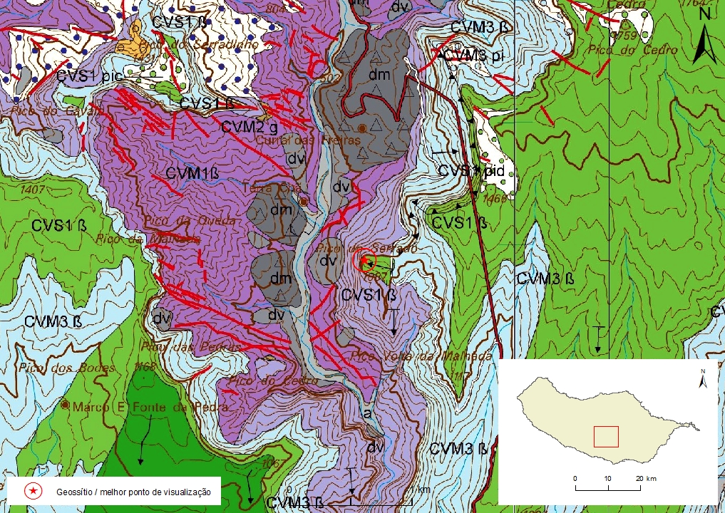
The Curral das Freiras region’s steep and high slopes reveal a complex volcanic geology and structure, with great lithological and stratigraphic diversity, exposing mainly the Formations of the Intermediate Volcanic Complex (CVM) as well as the non-conformity surfaces that separate them.
Inside the valley stands a lower flattened top landform on top of which the Curral das Freiras village was built. This plateau consists of very heterometric breccia deposits that resulted from an important slide-type mass movement event.
Relevant notes
Visiting a site of geological interest is the sole responsibility of the user.
The user must take precautions when visiting the site, taking into account the conditions of the terrain, weather conditions and other hazards, so that they do not create situations that put themselves or others at risk.
The user must respect private property. Access to private areas requires prior authorization from the owners.
The user must respect natural heritage, keeping it intact. The impact of your actions should be minimal.
Protection status
Forest spaces - Exotic forest (Article 43º), according to Municipal Master Plan, and Natural Park of Madeira.
Geological map of Madeira Island detail, Sheet a - CL02

Bibliography
BRUM DA SILVEIRA, A.; MADEIRA, J.; RAMALHO, R.; FONSECA, P., PRADA, S. (2010) - Notícia Explicativa da Carta Geológica da ilha da Madeira, na escala 1:50.000, folhas A e B. Edição da Secretaria Regional do Ambiente e Recursos Naturais, Região Autónoma da Madeira e Universidade da Madeira: 47 p. ISBN: 978-972-98405-2-4. (Editado em 2011).
BRUM DA SILVEIRA, A.; MADEIRA, J.; RAMALHO, R.; FONSECA, P.; RODRIGUES, C., PRADA, S. (2010) Carta Geológica da ilha da Madeira na escala 1:50.000 - Folha A e B. Edição da Região Autónoma da Madeira, Secretaria Regional do Ambiente e Recursos Naturais; ISBN: 978-972-98405-1-7 (Editado em 2011).
BRUM DA SILVEIRA, A.; PRADA, S.; RAMALHO, R.; MADEIRA, J.; FONSECA, P.; CANHA, E.; BRILHA, J. (2012). Inventariação do Património Geológico da ilha da Madeira. Secretaria Regional do Ambiente - Relatório Final, 414 p.
RODRIGUES, D. M. M. (2005) Análise de risco de movimentos de vertente e ordenamento do território na Madeira. Aplicação ao caso de Machico.
Photo gallery
How to Cite
BRUM DA SILVEIRA, A.; PRADA, S.; RAMALHO, R.; MADEIRA, J.; FONSECA, P.; CANHA, E.; BRILHA, J. (2012). Inventariação do Património Geológico da Ilha da Madeira. Secretaria Regional do Ambiente e Recursos Naturais - Relatório Final, 414 p. In: https://geodiversidade.