")
")
 |
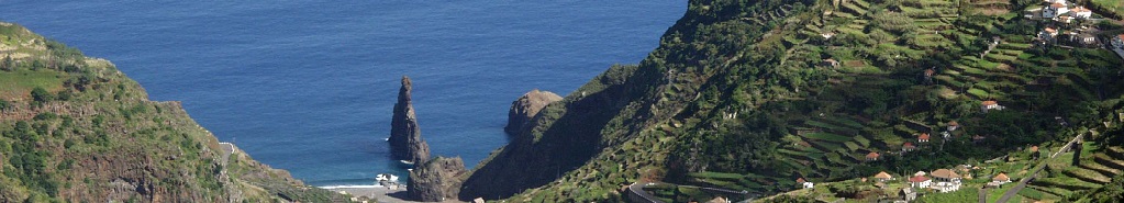
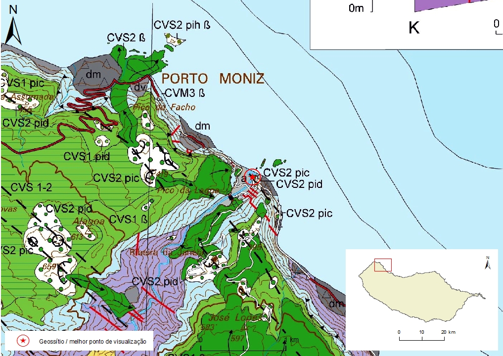
Geosite ID: PM03 Name: Foz da Ribeira da Janela Thematic category: Vulcanology |
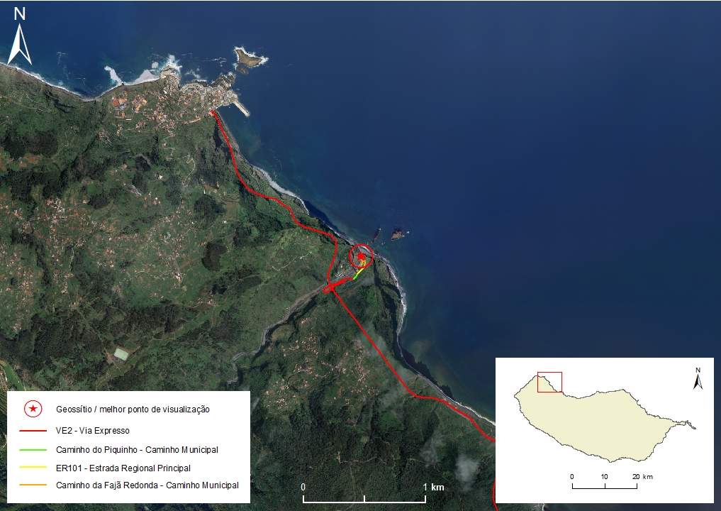 |
Municipality: Porto Moniz Civil parish: Ribeira da Janela Location area: 0,1 - 10 ha Coordinates(1):32°51'18.5'' N 17°09'13.0'' W Altitude: 22 m Accessibility: Easy Distance to nearest paved road: 5 m Conditions of observation: boas (1) Coordinates of the geosite and / or the best viewpoint |
Brief description
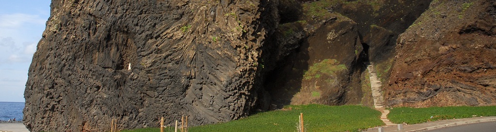
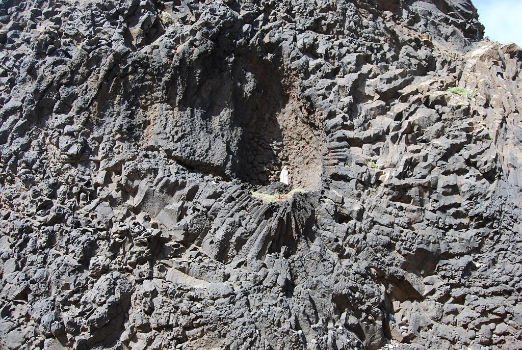
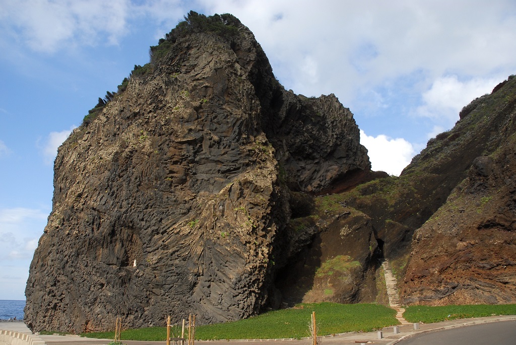
At the geosite one has a good view of the typical internal structure of subaquatic lava, of roll or pillow type (pillow lava). In the Foz da Ribeira da Janela it is possible to observe the flow and that ran inside the valley that produced these roller forms. It is contemporary of the Upper Volcanic Complex (CVS), Funchal Formation.
In this outcrop, radial fracturing in a large roll can be easily observed.
Relevant notes
Visiting a site of geological interest is the sole responsibility of the user.
The user must take precautions when visiting the site, taking into account the conditions of the terrain, weather conditions and other hazards, so that they do not create situations that put themselves or others at risk.
The user must respect private property. Access to private areas requires prior authorization from the owners.
The user must respect natural heritage, keeping it intact. The impact of your actions should be minimal.
Protection status
Natural spaces of very conditioned use – Scarp zone (Article 49º), according to the Municipal Master Plan.
Geological map of Madeira Island detail, sheet a - PM03

Bibliography
BRUM DA SILVEIRA, A.; MADEIRA, J.; RAMALHO, R.; FONSECA, P., PRADA, S. (2010) - Notícia Explicativa da Carta Geológica da ilha da Madeira, na escala 1:50.000, folhas A e B. Edição da Secretaria Regional do Ambiente e Recursos Naturais, Região Autónoma da Madeira e Universidade da Madeira: 47 p. ISBN: 978-972-98405-2-4. (Editado em 2011).
BRUM DA SILVEIRA, A.; MADEIRA, J.; RAMALHO, R.; FONSECA, P.; RODRIGUES, C., PRADA, S. (2010) Carta Geológica da ilha da Madeira na escala 1:50.000 - Folha A e B. Edição da Região Autónoma da Madeira, Secretaria Regional do Ambiente e Recursos Naturais; ISBN: 978-972-98405-1-7 (Editado em 2011).
BRUM DA SILVEIRA, A.; PRADA, S.; RAMALHO, R.; MADEIRA, J.; FONSECA, P.; CANHA, E.; BRILHA, J. (2012). Inventariação do Património Geológico da ilha da Madeira. Secretaria Regional do Ambiente - Relatório Final, 414 p.
Photo gallery
How to Cite
BRUM DA SILVEIRA, A.; PRADA, S.; RAMALHO, R.; MADEIRA, J.; FONSECA, P.; CANHA, E.; BRILHA, J. (2012). Inventariação do Património Geológico da Ilha da Madeira. Secretaria Regional do Ambiente e Recursos Naturais - Relatório Final, 414 p. In: https://geodiversidade.