")
")
 |
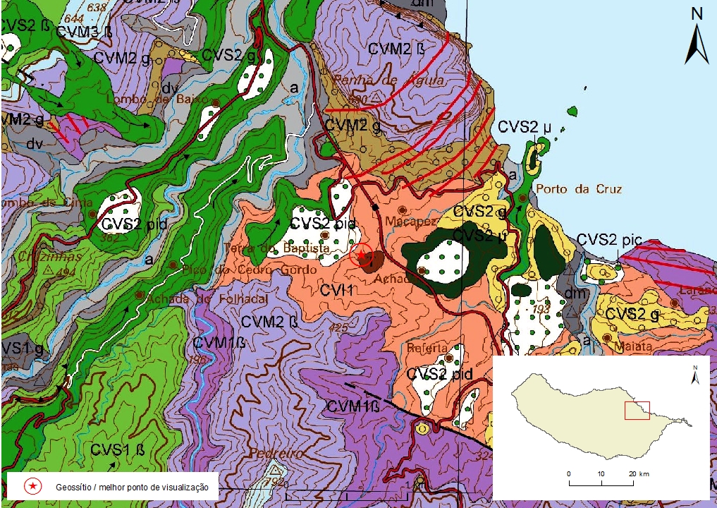
Geosite ID: M06 Name: Terra do Baptista Thematic category: Stratigraphy and Lithology |
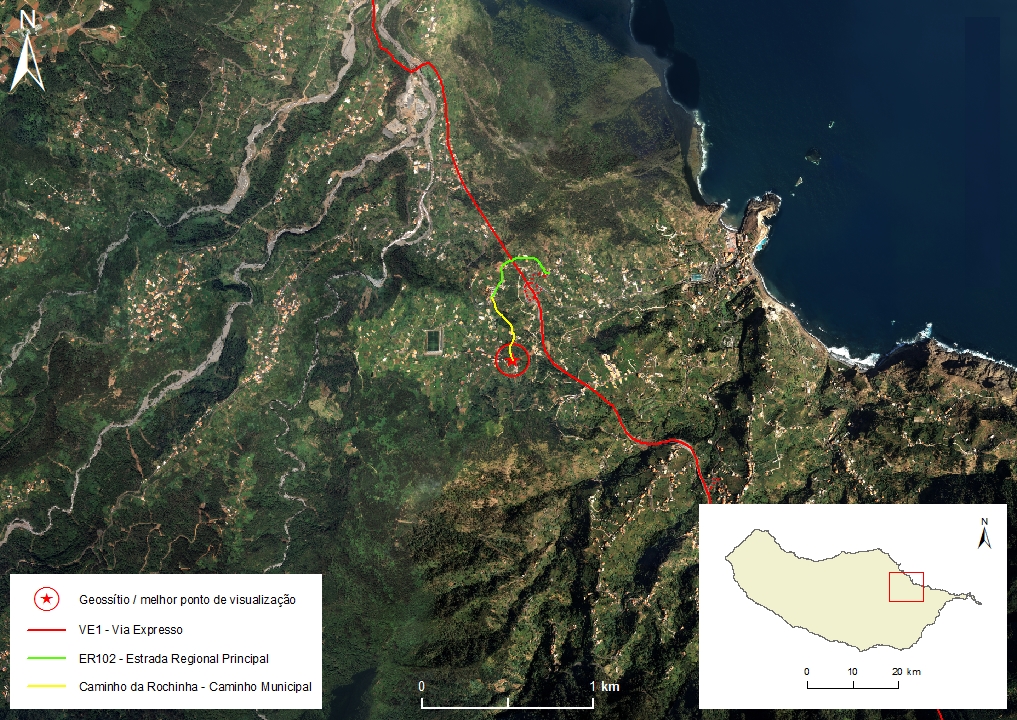 |
Municipality: Machico Civil parish: Porto da Cruz Location area: 0.1-10 ha Location area(1):32°46'03.3'' N 16°50'32.7'' W Altitude: 225 m Accessibility: moderada Distance to nearest paved road: 200 m Conditions of observation: Satisfactory (1) Coordinates of the geosite and / or the best viewpoint |
Brief description
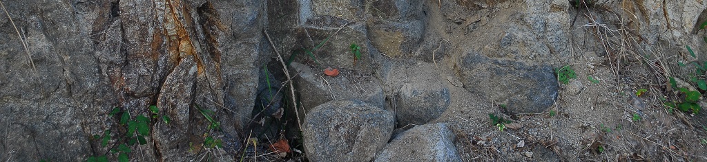
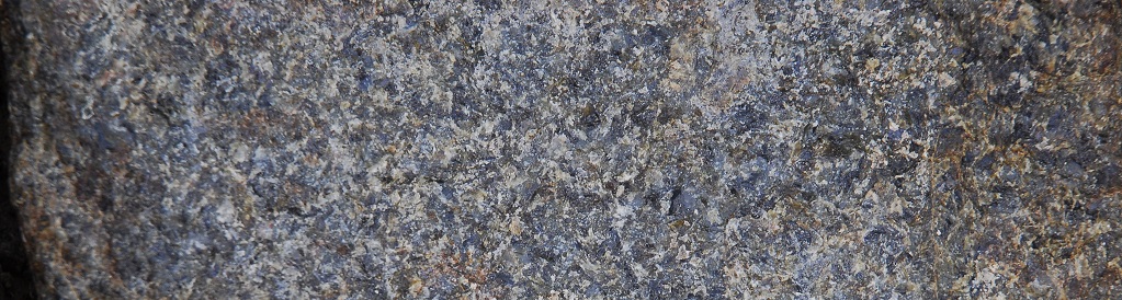
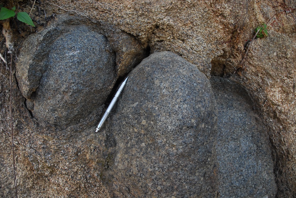
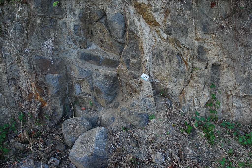
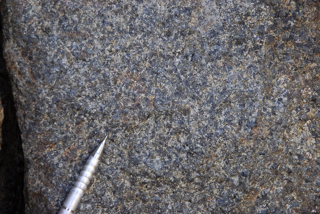
Porto da Cruz’s granular mafic rocks, that outcrop inside the embedded Voltas and Massapez valleys, are a rare example of plutonic igneous rocks on Madeira Island. They are essentially gabbroic rocks (gabbros, monzogabbros and essexites) that contain as their main characteristic minerals such as feldspathóids, kaersutite and aegirine, suggesting a late residual alkaline emanation phase.
The existence of these lithologies confirms the fractional crystallization of small magmatic pockets in the internal and relatively shallow sectors of Madeira’s volcanic submarine edifice.
These rocks intrude the Porto da Cruz Formation, lower volcanic complex, and it is unknown if they are contemporaneous with it or if they are related with the eruptive phases of the Intermidiate Volvanic Complex.
Relevant notes
Visiting a site of geological interest is the sole responsibility of the user.
The user must take precautions when visiting the site, taking into account the conditions of the terrain, weather conditions and other hazards, so that they do not create situations that put themselves or others at risk.
The user must respect private property. Access to private areas requires prior authorization from the owners.
The user must respect natural heritage, keeping it intact. The impact of your actions should be minimal.
Protection status
Agroforestry spaces - Agricultural spaces (Article 50), according to Municipal Master Plan.
Geological map of Madeira Island detail, Sheet b - M06

Bibliography
BRUM DA SILVEIRA, A.; MADEIRA, J.; RAMALHO, R.; FONSECA, P., PRADA, S. (2010) - Notícia Explicativa da Carta Geológica da ilha da Madeira, na escala 1:50.000, folhas A e B. Edição da Secretaria Regional do Ambiente e Recursos Naturais, Região Autónoma da Madeira e Universidade da Madeira: 47 p. ISBN: 978-972-98405-2-4. (Editado em 2011).
BRUM DA SILVEIRA, A.; MADEIRA, J.; RAMALHO, R.; FONSECA, P.; RODRIGUES, C., PRADA, S. (2010) Carta Geológica da ilha da Madeira na escala 1:50.000 - Folha A e B. Edição da Região Autónoma da Madeira, Secretaria Regional do Ambiente e Recursos Naturais; ISBN: 978-972-98405-1-7 (Editado em 2011).
BRUM DA SILVEIRA, A.; PRADA, S.; RAMALHO, R.; MADEIRA, J.; FONSECA, P.; CANHA, E.; BRILHA, J. (2012). Inventariação do Património Geológico da ilha da Madeira. Secretaria Regional do Ambiente - Relatório Final, 414 p.
RIBEIRO, L. e RAMALHO, M. (2009). Uma visita geológica ao Arquipélago da Madeira. Principais locais Geo-turísticos. LNEG, 91 p.
SILVA, L. C.; MUNHÁ, J. e BARRIGA, F. (1975) Contribuição para o conhecimento das rochas granulares da Madeira. Boletim da Sociedade Geológica de Portugal, nº19, pp. 203-237.
Photo gallery
How to Cite
BRUM DA SILVEIRA, A.; PRADA, S.; RAMALHO, R.; MADEIRA, J.; FONSECA, P.; CANHA, E.; BRILHA, J. (2012). Inventariação do Património Geológico da Ilha da Madeira. Secretaria Regional do Ambiente e Recursos Naturais - Relatório Final, 414 p. In: https://geodiversidade.