")
")
 |
Geosite ID: M01PSL04 Name: Prainha Thematic category: Geomorphology, Sedimentology and Paleontology |
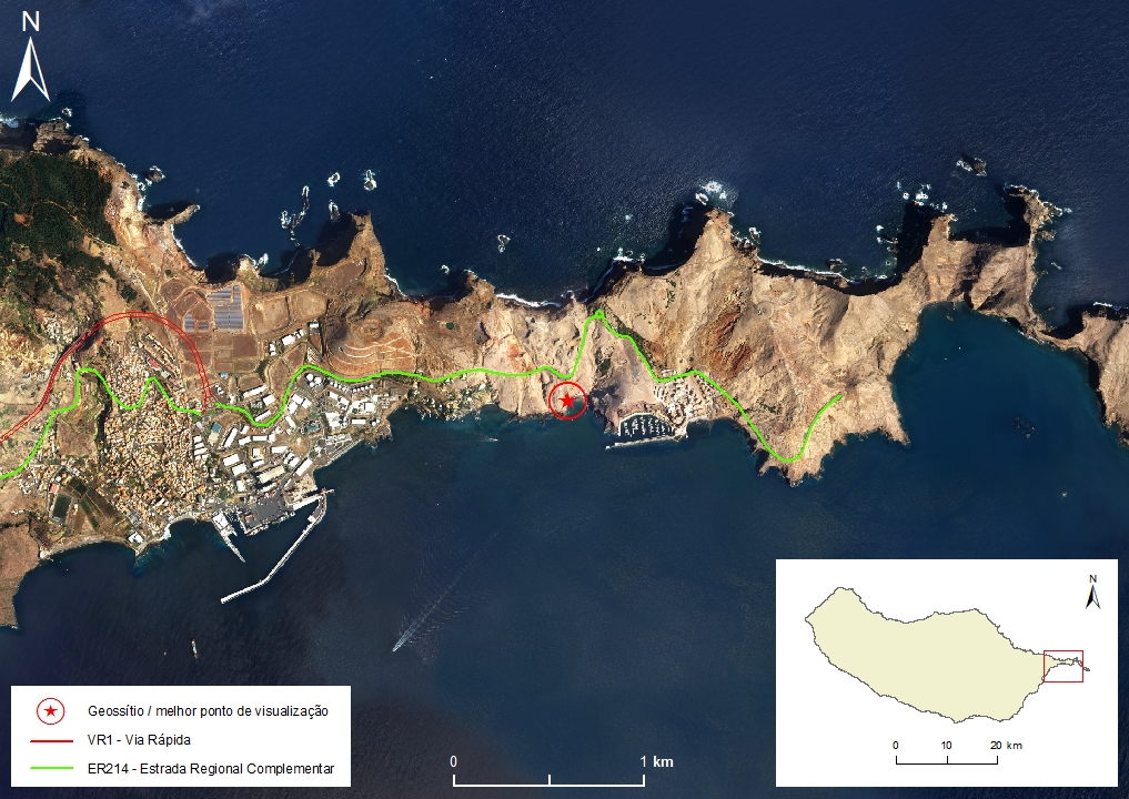 |
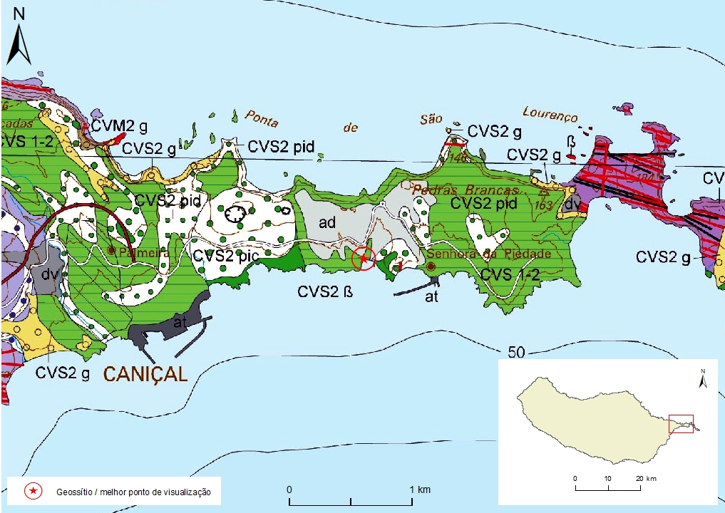
Municipality: Machico Civil parish: Caniçal Location area: 10 -1000 ha Coordinates(1):32°44'34.7'' N 16°42'59.1'' W Altitude: 24 m Accessibility: Moderate Distance to nearest paved road: 100 m Conditions of observation: Good (1) Coordinates of the geosite and / or the best viewpoint |
Brief description
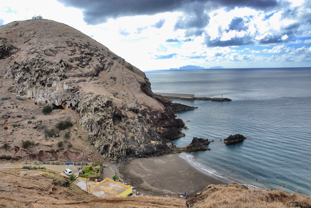
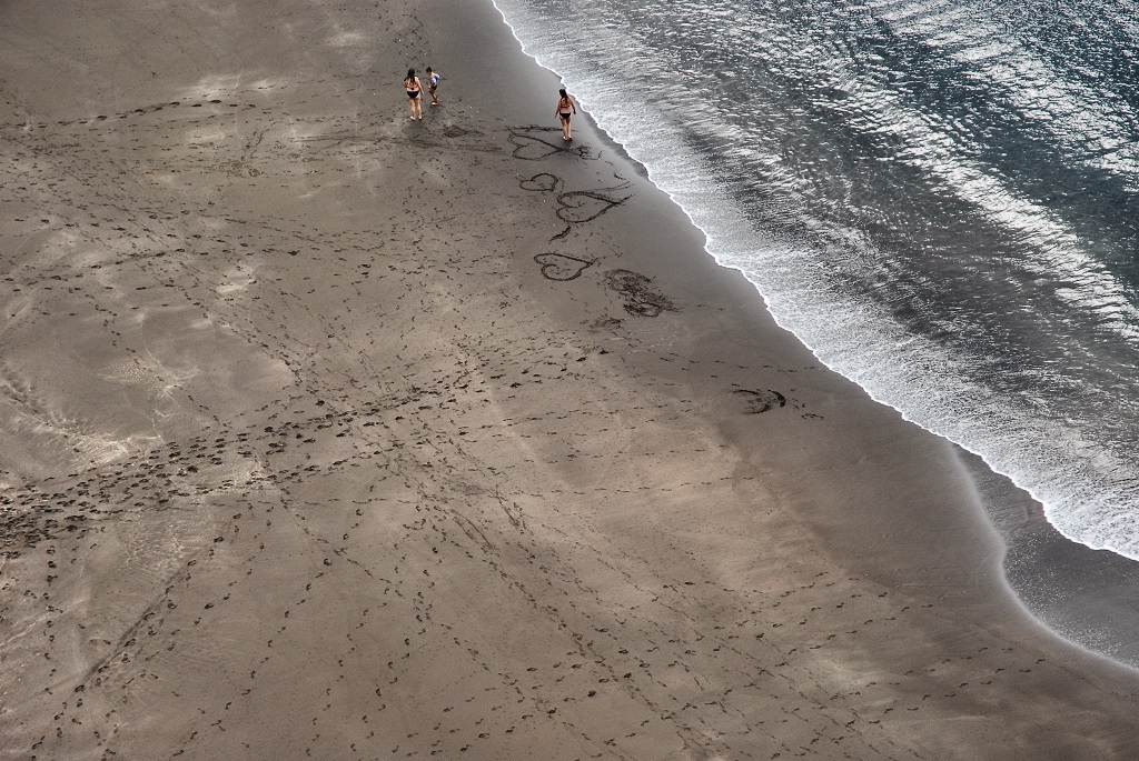
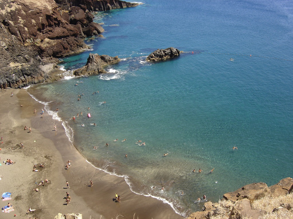
Praínha is one of the few permanent natural sand beaches on Madeira Island, an island characterized by steep cliffs and beaches made almost exclusively of pebbles. Its rarity is due to the lack of hydrodynamic, sedimentary and geomorphological conditions that allow the accumulation and permanence of sand on the beach. These sediments originate from the Holocene-aged aeolian deposits (old dunes) that are upstream, and which, constitute the main source of the beach sand.
Relevant notes
Visiting a site of geological interest is the sole responsibility of the user.
The user must take precautions when visiting the site, taking into account the conditions of the terrain, weather conditions and other hazards, so that they do not create situations that put themselves or others at risk.
The user must respect private property. Access to private areas requires prior authorization from the owners.
The user must respect natural heritage, keeping it intact. The impact of your actions should be minimal.
Protection status
Natural Spaces - Natural spaces for recreational use - Beach (Article 57), according to Municipal Master Plan.
ZPE of Ponta de São Lourenço that coincides with the limits of the ZEC of Ponta de São Lourenço, and Natural Park of Madeira (Decreto Regulamentar Regional n.º 3/2014/M, artigo 2.º, alínea c).
Location

Geological map of Madeira Island detail, Sheet b - M01PSL04

Bibliography
BRUM DA SILVEIRA, A.; CANHA, E.; MADEIRA, J.; RAMALHO, R.; FONSECA, P.; PRADA, S.; RODRIGUES, C. (2006) - Património Geológico da Ilha da Madeira. O Cone de Piroclastos da Sr.ª da Piedade (Ponta de S. Lourenço, Ilha da Madeira, IV Jornadas Internacionais de vulcanologia da Ilha do Pico, Açores.
BRUM DA SILVEIRA, A.; MADEIRA, J.; RAMALHO, R.; FONSECA, P., PRADA, S. (2010) - Notícia Explicativa da Carta Geológica da ilha da Madeira, na escala 1:50.000, folhas A e B. Edição da Secretaria Regional do Ambiente e Recursos Naturais, Região Autónoma da Madeira e Universidade da Madeira: 47 p. ISBN: 978-972-98405-2-4. (Editado em 2011).
BRUM DA SILVEIRA, A.; MADEIRA, J.; RAMALHO, R.; FONSECA, P.; RODRIGUES, C., PRADA, S. (2010) Carta Geológica da ilha da Madeira na escala 1:50.000 - Folha A e B. Edição da Região Autónoma da Madeira, Secretaria Regional do Ambiente e Recursos Naturais; ISBN: 978-972-98405-1-7 (Editado em 2011).
BRUM DA SILVEIRA, A.; PRADA, S.; RAMALHO, R.; MADEIRA, J.; FONSECA, P.; CANHA, E.; BRILHA, J. (2012). Inventariação do Património Geológico da ilha da Madeira. Secretaria Regional do Ambiente - Relatório Final, 414 p.
CANHA, E. (2007) – Património Natural da ilha da Madeira. Estudo de um local de interesse geológico: Cone de Piroclastos da N.ª Sra. da Piedade. Dissertação de Mestrado. Universidade da Madeira. 173 p.
GOODFRIEND, G.A.; CAMERON, R.A.D.; COOK, L.M.; COURTY, M.-A.; FEDEROFF, N.; LIVET, E. & TALLIS, J. (1996) The Quaternary eolian sequence of Madeira: stratigraphy, chronology, and paleoenvironment interpretation. Palaeogeography, Palaeoclimatology, Palaeoecology 120: 195-234.
RAMALHO, R. (2004) – Cartografia Geológica da Madeira. Estratigrafia e Tectónica do Sector a Leste de Machico. Universidade de Lisboa. Faculdade de Ciências. 146 p
RAMALHO, R.; BRUM DA SILVEIRA, A.; MADEIRA, J.; FONSECA, P.E.; PRADA, S.; RODRIGUES, C. F. (2005b) Fracture pattern and structural control of Madeira Island Volcanism (Portugal). Volume de abstracts do International Workshop on Ocean Island Volcanism, Sal, Cabo Verde, 2 – 8 Abril 2005: p.33.
RAMALHO, R.; MADEIRA, J.; FONSECA, P.E.; BRUM DA SILVEIRA, A.; PRADA, S.; RODRIGUES, C. F. (2005a) Tectónica da Ponta de São Lourenço, Ilha da Madeira. Cadernos Lab. Xeolóxico de Laxe, Coruña. Vol. 30, pp. 223-234
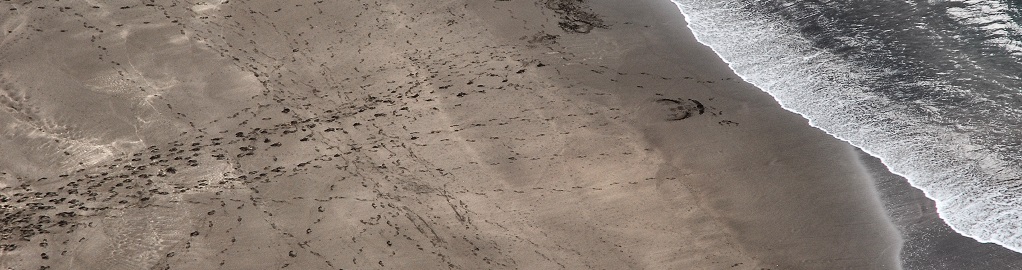
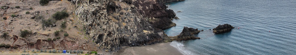
Photo gallery
How to Cite
BRUM DA SILVEIRA, A.; PRADA, S.; RAMALHO, R.; MADEIRA, J.; FONSECA, P.; CANHA, E.; BRILHA, J. (2012). Inventariação do Património Geológico da Ilha da Madeira. Secretaria Regional do Ambiente e Recursos Naturais - Relatório Final, 414 p. In: https://geodiversidade.