")
")
 |
Geosite ID: RB01 Name: Fajã dos Vinháticos Thematic category: Stratigraphy and Geomorphology |
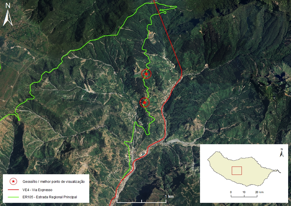 |
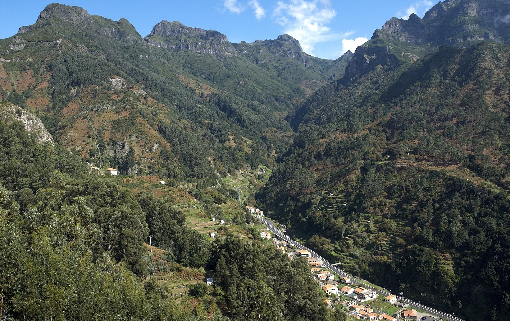
Municipality: Ribeira Brava Civil parish: Serra d’Água Location area: 0,1 - 10 ha Coordinates(1): P1: 32°44'11.6'' N 17°01'31.7'' W / P2: 32°44'30.8'' N 17°01'30.5'' W Altitude: P1: 601 m; P2: 695 m Accessibility: Easy Distance to nearest paved road: 1 m Conditions of observation: Satisfactory (1) Coordinates of the geosite and / or the best viewpoint |
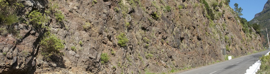
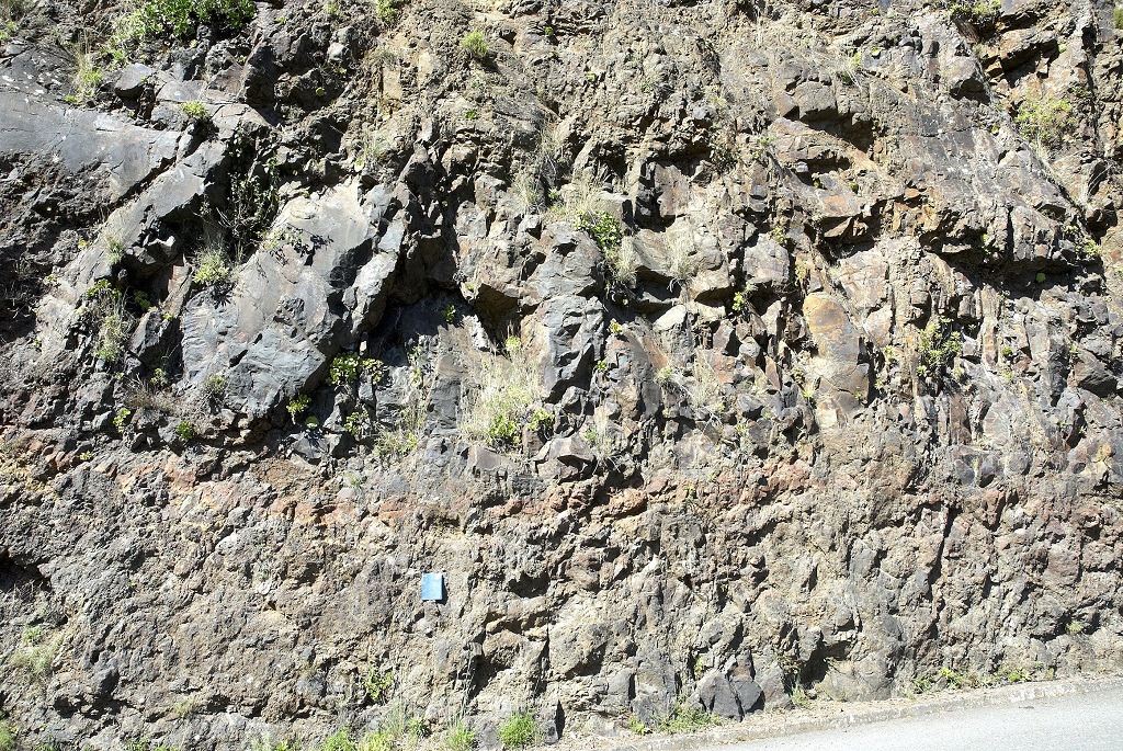
Brief description
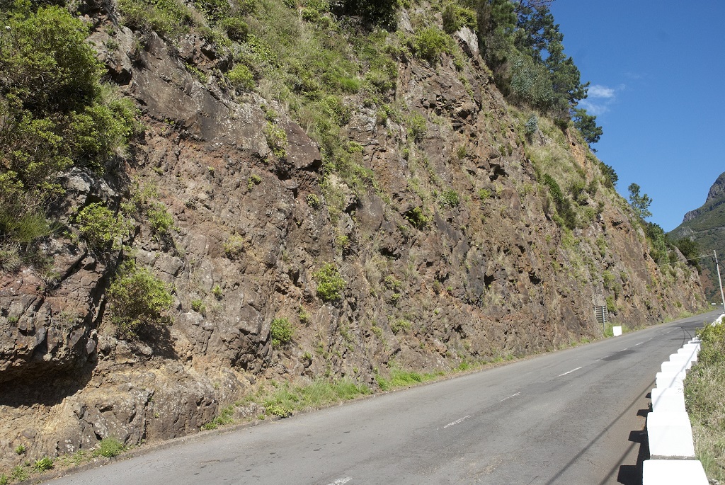
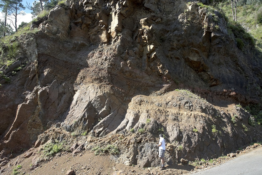
The Vinháticos geosite is considered the best place to observe the lithologies (volcanic and sedimentary sequences) that from the Encumeada Formation, from the Intermediate Volcanic Complex (CVM).
Due to its entirety and representativeness, this set of outcrops should be used as a reference when characterizing this stratigraphic unit, as it forms its simple stratotype.
Relevant notes
The route on the road is about 600 m. As a result, the observer may be at risk from road traffic.
Visiting a site of geological interest is the sole responsibility of the user.
The user must take precautions when visiting the site, taking into account the conditions of the terrain, weather conditions and other hazards, so that they do not create situations that put themselves or others at risk.
The user must respect private property. Access to private areas requires prior authorization from the owners.
The user must respect natural heritage, keeping it intact. The impact of your actions should be minimal.
Protection status
Forest spaces (Section II - Articles 53º and 54º) - Natural spaces, spontaneous plant formations (section V - Articles 58º to 60º), according to Municipal Master Plan.
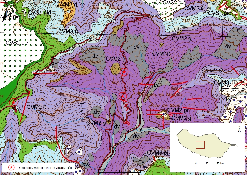
Geological map of Madeira Island detail, sheet a - RB01

Bibliography
BRUM DA SILVEIRA, A.; MADEIRA, J.; RAMALHO, R.; FONSECA, P., PRADA, S. (2010) - Notícia Explicativa da Carta Geológica da ilha da Madeira, na escala 1:50.000, folhas A e B. Edição da Secretaria Regional do Ambiente e Recursos Naturais, Região Autónoma da Madeira e Universidade da Madeira: 47 p. ISBN: 978-972-98405-2-4. (Editado em 2011).
BRUM DA SILVEIRA, A.; MADEIRA, J.; RAMALHO, R.; FONSECA, P.; RODRIGUES, C., PRADA, S. (2010) Carta Geológica da ilha da Madeira na escala 1:50.000 - Folha A e B. Edição da Região Autónoma da Madeira, Secretaria Regional do Ambiente e Recursos Naturais; ISBN: 978-972-98405-1-7 (Editado em 2011).
BRUM DA SILVEIRA, A.; PRADA, S.; RAMALHO, R.; MADEIRA, J.; FONSECA, P.; CANHA, E.; BRILHA, J. (2012). Inventariação do Património Geológico da ilha da Madeira. Secretaria Regional do Ambiente - Relatório Final, 414 p.
GELDMACHER, J.; VAN DEN BOGAARD, P.; HOERNLE, K. & SCHMINCKE, H-U. (2000) Ar age dating of the Madeira Archipelago and hotspot track (eastern North Atlantic) Geochemistry, Geophysics, Geosystems 1, [Paper number 1999GC000018].
Photo gallery
How to Cite
BRUM DA SILVEIRA, A.; PRADA, S.; RAMALHO, R.; MADEIRA, J.; FONSECA, P.; CANHA, E.; BRILHA, J. (2012). Inventariação do Património Geológico da Ilha da Madeira. Secretaria Regional do Ambiente e Recursos Naturais - Relatório Final, 414 p. In: https://geodiversidade.