")
")
 |
Geosite ID: PSt06 Name: Pico da Cabrita Thematic category: Vulcanology |
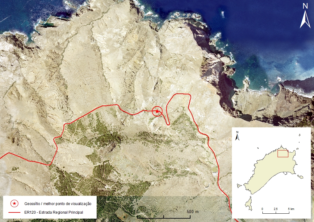 |
Municipality: Porto Santo Civil parish: Porto Santo Location area: 0.1-10 ha Coordinates(1):33°05'42.60'' N 16°19'01.60'' W Altitude: 220 m Accessibility: Easy Distance to nearest paved road: 0 m Conditions of observation: boas (1) Coordinates of the geosite and / or the best viewpoint |
Brief description
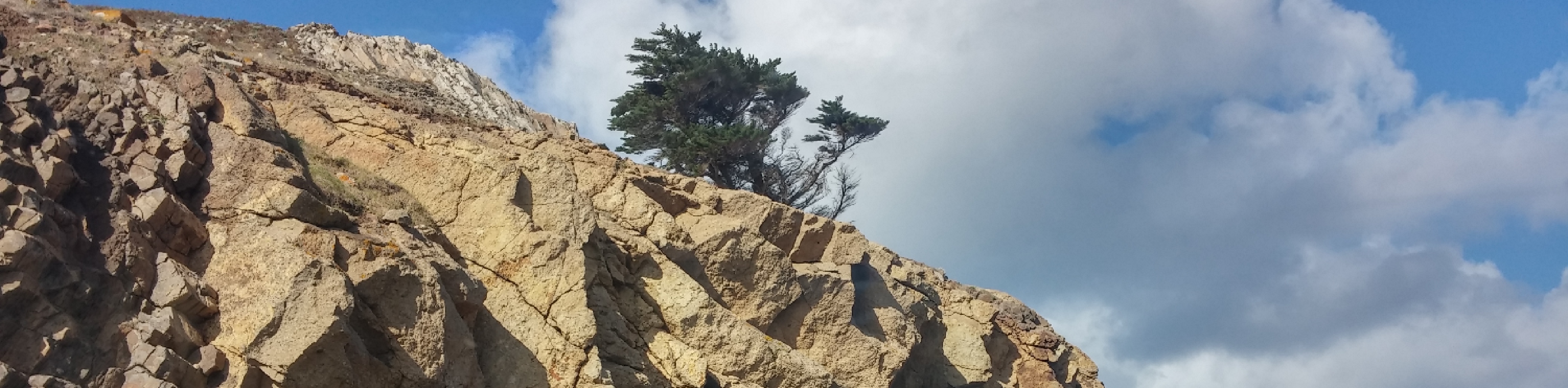
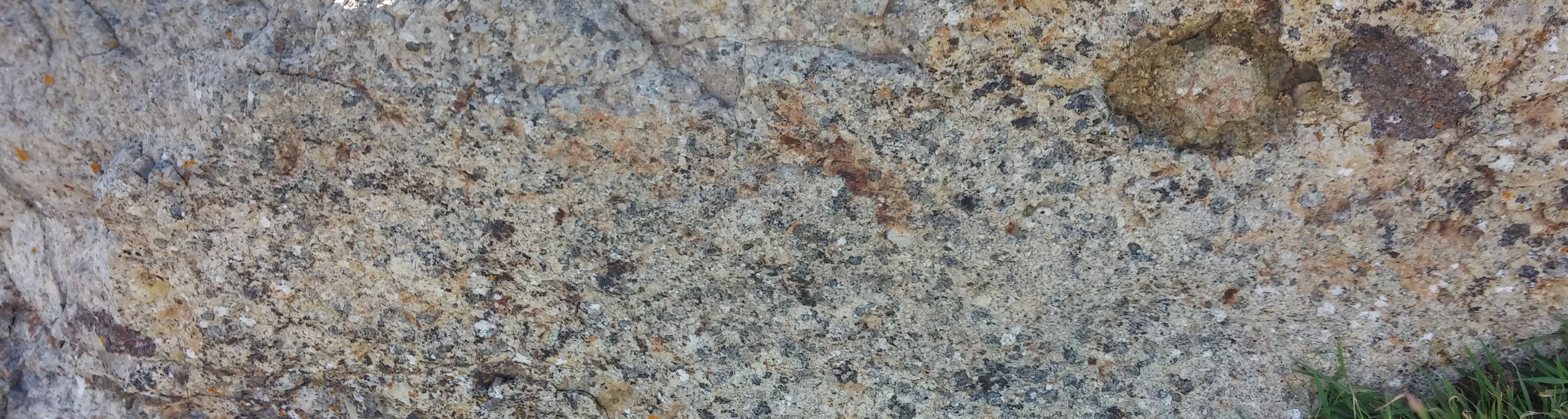
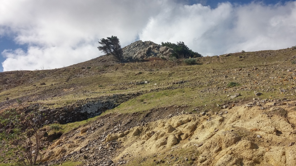
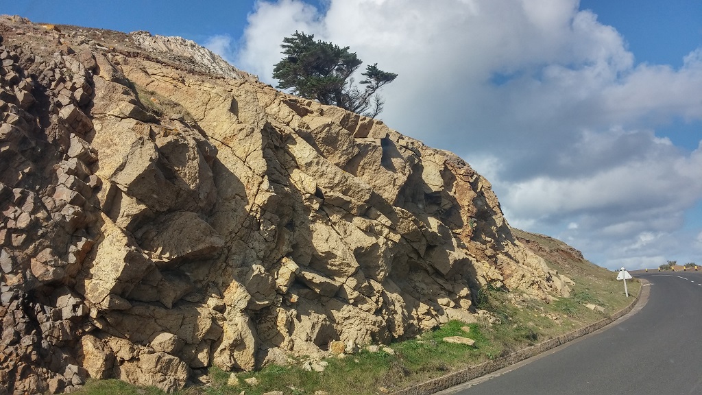
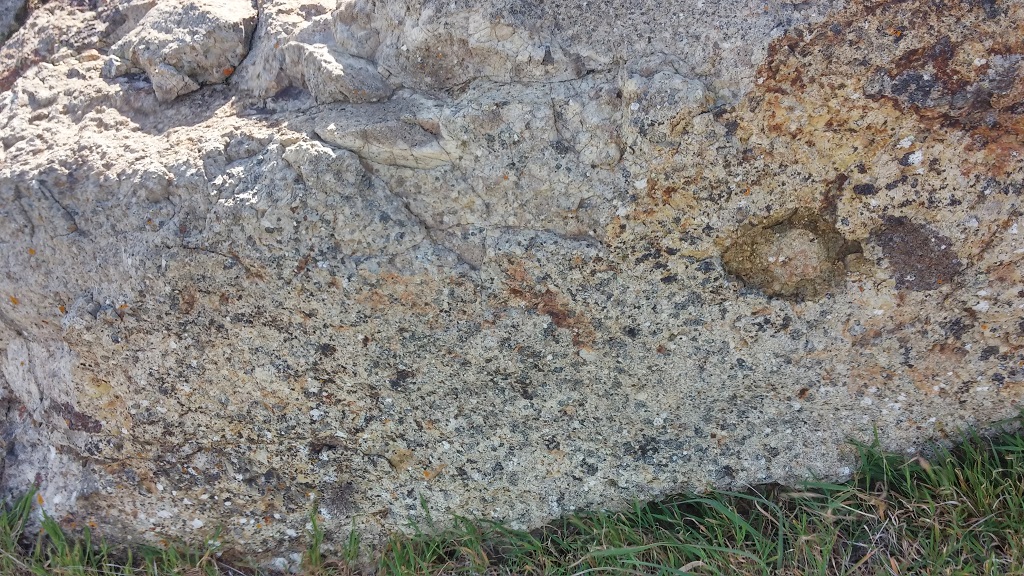
In this peak, there are outcrops of materials that correspond to the seamount stage of the island, namely submarine volcanoclastic deposits (hyaloclastites), intersected by basaltic dykes essentially. The hyaloclastic deposits are formed by angular fragments of basaltic rock shaped by the sudden contact of the lava with seawater. This interaction gave rise to a volcanic glass denominated sideromelane that evolved to palagonite, a weathered yellowish product that results from the hydration of basaltic glass. They form a breccia with an apparent stratification and a vitreous and porous texture. This submarine deposit is currently at an altitude of 200 meters, as a consequence of the uplifting of the island, and posterior tilting from N to S and shoaling by the volcanic activity in the more recent peaks. These materials are locally designated as "black stones" and were explored for several decades, in the production of pozzolan.
Relevant notes
Visiting a site of geological interest is the sole responsibility of the user.
The user must take precautions when visiting the site, taking into account the conditions of the terrain, weather conditions and other hazards, so that they do not create situations that put themselves or others at risk.
The user must respect private property. Access to private areas requires prior authorization from the owners.
The user must respect natural heritage, keeping it intact. The impact of your actions should be minimal.
Protection status
Forest Areas, according to the Municipal Master Plan.
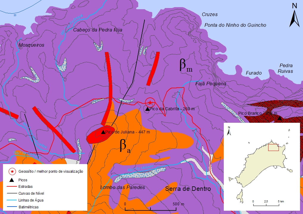
Simplified geological map of Porto Santo Island detail - PSt06
Bibliography
FERREIRA, M. R. (2014). Património Geológico da Ilha do Porto Santo e Ilhéus Adjacentes (Madeira): Inventariação, Avaliação e Valorização como Contributo para a Geoconservação. Dissertação de Mestrado em Vulcanologia e Riscos Geológicos. Departamento de Geociências da Universidade dos Açores.
MATA, J., FONSECA, P., PRADA, S., RODRIGUES, D., MARTINS, S., RAMALHO, R., MADEIRA, J., CACHÃO, M., DA SILVA, C.M. & MATIAS, M.J. (2013) - O Arquipélago da Madeira. In: R. Dias, A. Araújo, P. Terrinha & J.C. Kullberg (Eds) – Geologia de Portugal, Vol. II, Escolar Editora, Lisboa, pp. 691-746.
RIBEIRO, M. L. Carta Geológica Simplificada das Ilhas da Madeira e do Porto Santo, na escala 1:80.000 in RIBEIRO, M. L. & RAMALHO, M. (2009). Uma visita geológica ao Arquipélago da Madeira, Principais locais Geo-turísticos. Edição da Direção Regional do Comércio, Indústria e Energia e do Laboratório Nacional de Energia e Geologia, I. P, pp. 55, 82. ISBN: 978-989-96202-0-9.
SOARES, A., CALLAPEZ, P. & MARQUES, J. (2006). Aprender em Viagem – Geologia de Porto Santo (notas para uma viagem de estudo). Revista da Associação Portuguesa de Professores de Biologia e Geologia, n.º 27, pp. 7-45.
Photo gallery
How to Cite
FERREIRA, M. R. (2014). Património Geológico da Ilha do Porto Santo e Ilhéus Adjacentes (Madeira): Inventariação, Avaliação e Valorização como Contributo para a Geoconservação. Dissertação de Mestrado em Vulcanologia e Riscos Geológicos. Departamento de Geociências da Universidade dos Açores. In: https://geodiversidade.