")
")
 |
Geosite ID: M03 Name: Miradouro do Pico do Facho Thematic category: Volcanology and Stratigraphy |
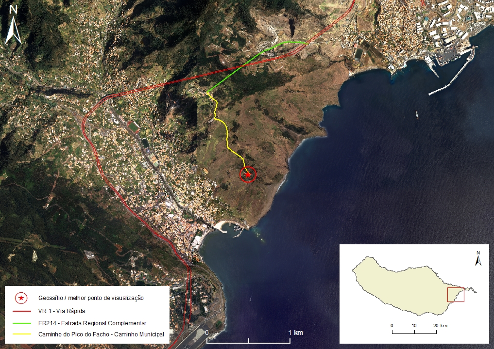 |
Municipality: Machico Civil parish: Machico Location area: 0,1 -100 ha Coordinates(1):32°43'26.2'' N 16°45'31.6'' W Altitude: 280 m Accessibility: Easy Distance to nearest paved road: 1 m Conditions of observation: good (1) Coordinates of the geosite and / or the best viewpoint |
Brief description
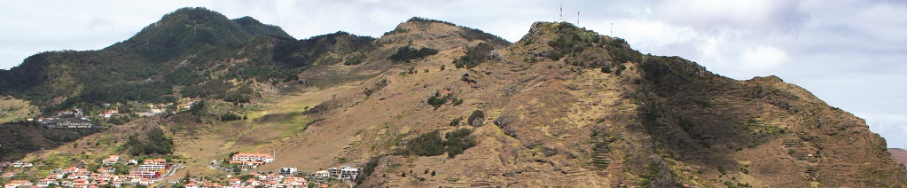
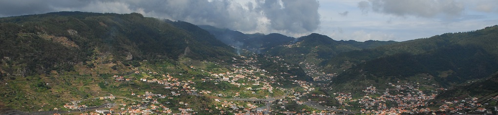
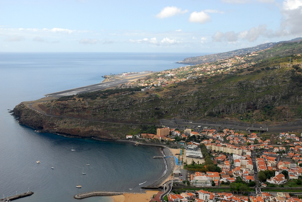
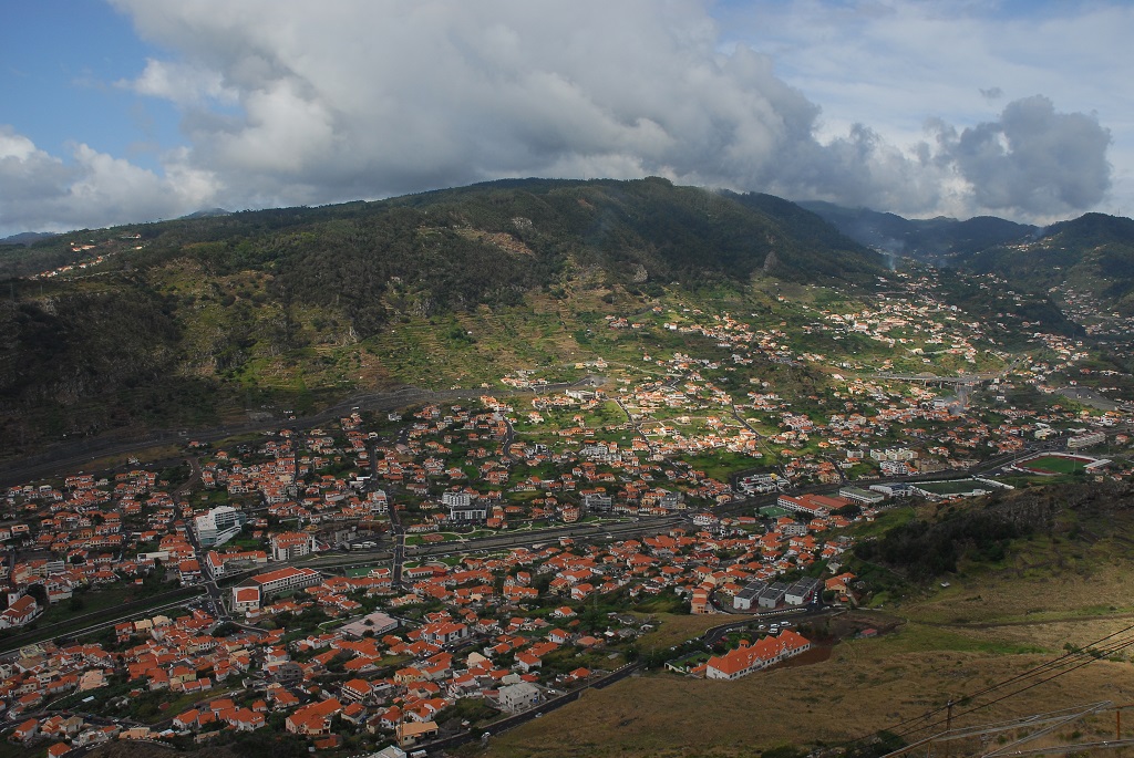
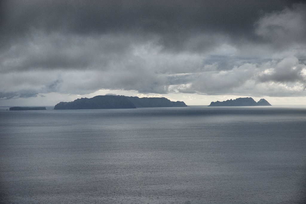
The Miradouro do Pico do Facho geosite presents high geological and geomorphological diversity. From this belveder it is possible to understand the relation between Madeira Island’s relief and the volcanic structure that composes it. In fact, looking towards the airport area, one observes towards a continuous and smooth sloped hillside; It is a structural slope that corresponds to the top surface of a pile of lava flows (volcanic construction surface) of the Upper Volcanic Complex (CVS). To the W and NW there is a panoramic view of the Machico valley, with a U-shaped cross-section and asymmetrical slopes. In the downstream sector, the flat bottom of the valley stands out, resulting from the Ribeira de Machico alluvial filling. In an upstream section, we can see the relief created by the Maroços lava flow from Santo da Serra, which ran into the Machico valley. To the SE you can see the Desertas Islands.
Relevant notes
Visiting a site of geological interest is the sole responsibility of the user.
The user must take precautions when visiting the site, taking into account the conditions of the terrain, weather conditions and other hazards, so that they do not create situations that put themselves or others at risk.
The user must respect private property. Access to private areas requires prior authorization from the owners.
The user must respect natural heritage, keeping it intact. The impact of your actions should be minimal.
Protection status
Agroforestry spaces - forest spaces - wasteland (Article 49 and 56), according to the Municipal Master Plan, and Madeira Natural Park.
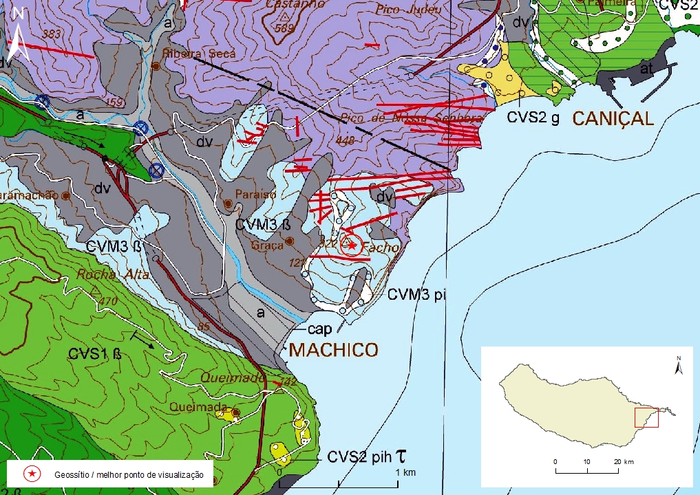
Geological map of Madeira Island detail, Sheet b - M03

Bibliography
BRUM DA SILVEIRA, A.; MADEIRA, J.; RAMALHO, R.; FONSECA, P., PRADA, S. (2010) - Notícia Explicativa da Carta Geológica da ilha da Madeira, na escala 1:50.000, folhas A e B. Edição da Secretaria Regional do Ambiente e Recursos Naturais, Região Autónoma da Madeira e Universidade da Madeira: 47 p. ISBN: 978-972-98405-2-4. (Editado em 2011).
BRUM DA SILVEIRA, A.; MADEIRA, J.; RAMALHO, R.; FONSECA, P.; RODRIGUES, C., PRADA, S. (2010) Carta Geológica da ilha da Madeira na escala 1:50.000 - Folha A e B. Edição da Região Autónoma da Madeira, Secretaria Regional do Ambiente e Recursos Naturais; ISBN: 978-972-98405-1-7 (Editado em 2011).
BRUM DA SILVEIRA, A.; PRADA, S.; RAMALHO, R.; MADEIRA, J.; FONSECA, P.; CANHA, E.; BRILHA, J. (2012). Inventariação do Património Geológico da ilha da Madeira. Secretaria Regional do Ambiente - Relatório Final, 414 p.
Photo gallery
How to Cite
BRUM DA SILVEIRA, A.; PRADA, S.; RAMALHO, R.; MADEIRA, J.; FONSECA, P.; CANHA, E.; BRILHA, J. (2012). Inventariação do Património Geológico da Ilha da Madeira. Secretaria Regional do Ambiente e Recursos Naturais - Relatório Final, 414 p. In: https://geodiversidade.