")
")
 |
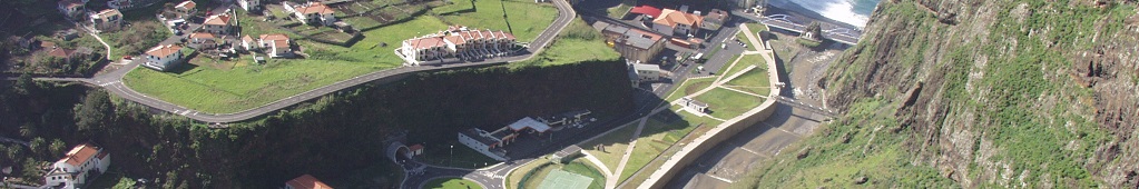
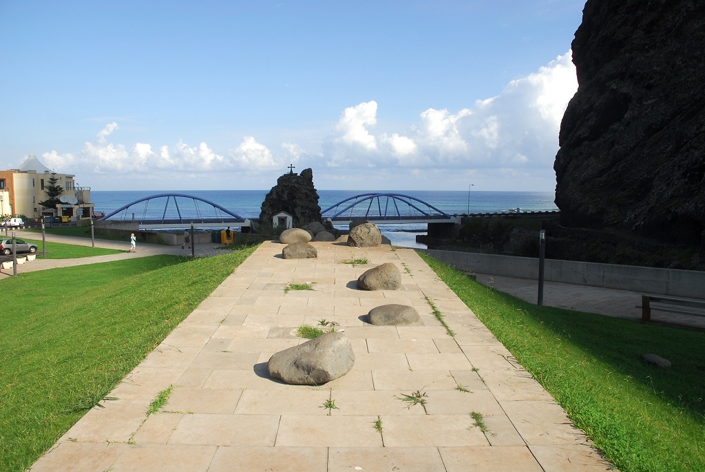
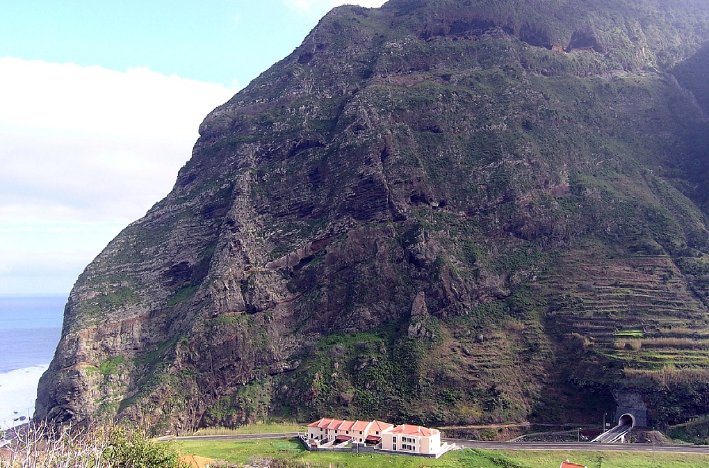
Geosite ID: SV01 Name: Foz da Ribeira de São Vicente Thematic category: Stratigraphy and Geomorphology |
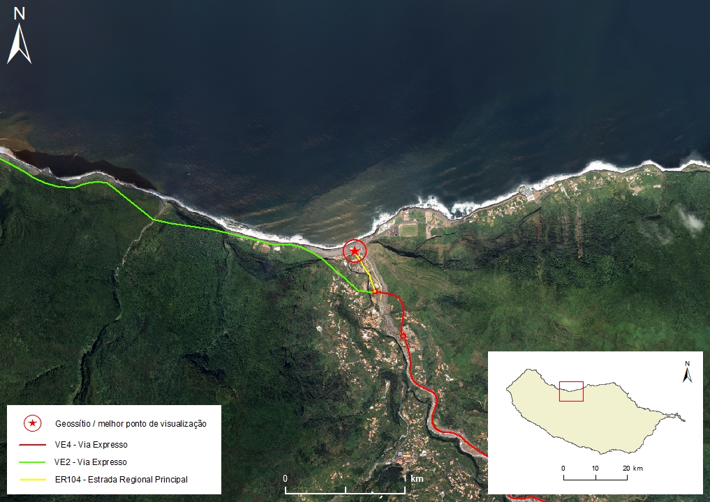 |
Municipality: São Vicente Civil parish: São Vicente Location area: 0,1 - 10 ha Coordinates(1):32°48'28.4'' N 17°02'50.4'' W Altitude: 18 m Accessibility: Easy Distance to nearest paved road: 20 m Conditions of observation: Good (1) Coordinates of the geosite and / or the best viewpoint |
Brief description
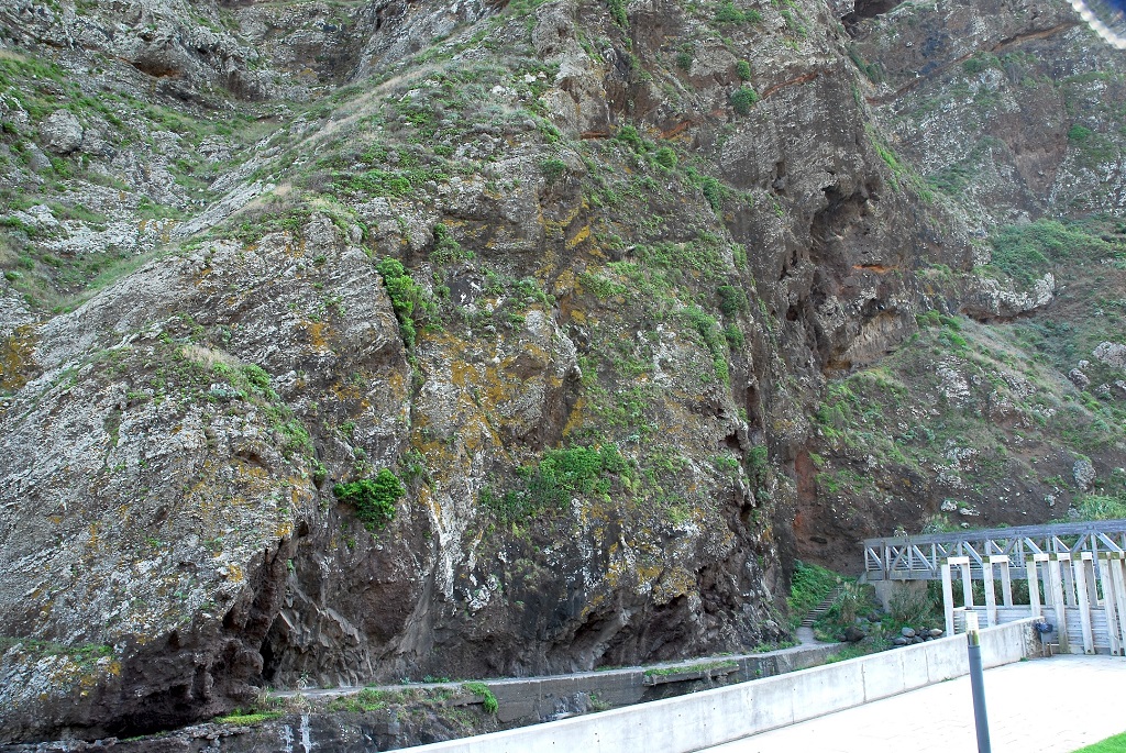
This geosite allows one to observe in detail, or in an overview, the sequences of subaerial basaltic flows and conglomeratic and breccioid deposits (lahar type) of the Penha d'Águia Formation, that belong to the Intermediate Volcanic Complex (CVM). Due to its integrity and representativeness, this set of outcrops should be used as a reference when characterizing this stratigraphic formation.
This site was chosen over the one located in the Penha d’Águia region (the place that gives the name to the stratigraphic formation and defines its simple stratotype), for its easy access and excellent visibility conditions. Here, the diversity of geological elements is also of superior value.
Relevant notes
Visiting a site of geological interest is the sole responsibility of the user.
The user must take precautions when visiting the site, taking into account the conditions of the terrain, weather conditions and other hazards, so that they do not create situations that put themselves or others at risk.
The user must respect private property. Access to private areas requires prior authorization from the owners.
The user must respect natural heritage, keeping it intact. The impact of your actions should be minimal.
Protection status
Natural spaces – Natural spaces of very conditioned use – scarp zone (Article 50º), according to the Municipal Master Plan.
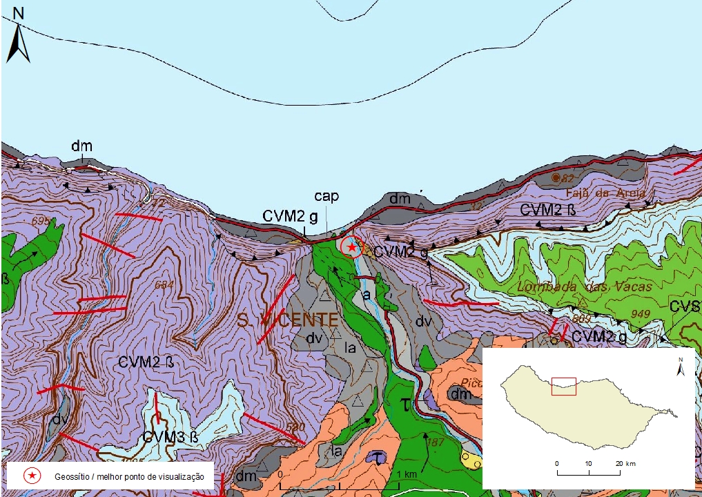
Geological map of Madeira Island detail, sheet a - SV01

Bibliography
BRUM DA SILVEIRA, A.; MADEIRA, J.; RAMALHO, R.; FONSECA, P., PRADA, S. (2010) - Notícia Explicativa da Carta Geológica da ilha da Madeira, na escala 1:50.000, folhas A e B. Edição da Secretaria Regional do Ambiente e Recursos Naturais, Região Autónoma da Madeira e Universidade da Madeira: 47 p. ISBN: 978-972-98405-2-4. (Editado em 2011).
BRUM DA SILVEIRA, A.; MADEIRA, J.; RAMALHO, R.; FONSECA, P.; RODRIGUES, C., PRADA, S. (2010) Carta Geológica da ilha da Madeira na escala 1:50.000 - Folha A e B. Edição da Região Autónoma da Madeira, Secretaria Regional do Ambiente e Recursos Naturais; ISBN: 978-972-98405-1-7 (Editado em 2011).
BRUM DA SILVEIRA, A.; PRADA, S.; RAMALHO, R.; MADEIRA, J.; FONSECA, P.; CANHA, E.; BRILHA, J. (2012). Inventariação do Património Geológico da ilha da Madeira. Secretaria Regional do Ambiente - Relatório Final, 414 p.
FERREIRA, M.P.; MACEDO, C.R. & FERREIRA, J.F. (1988) K-Ar geochronology in the Selvagens, Porto Santo and Madeira Islands (Western Central Atlantic): a 30 m. y. spectrum of submarine and subaerial volcanism: Lunar Planetary Institute (Abst.) 19: 325-326.
GELDMACHER, J.; VAN DEN BOGAARD, P.; HOERNLE, K. & SCHMINCKE, H-U. (2000) Ar age dating of the Madeira Archipelago and hotspot track (eastern North Atlantic) Geochemistry, Geophysics, Geosystems 1, [Paper number 1999GC000018].
MATA, J. (1996) Petrologia e Geoquímica das lavas da ilha da Madeira: implicações para os modelos de evolução mantélica. Tese de Doutoramento, Universidade de Lisboa, 471 p.
Photo gallery
How to Cite
BRUM DA SILVEIRA, A.; PRADA, S.; RAMALHO, R.; MADEIRA, J.; FONSECA, P.; CANHA, E.; BRILHA, J. (2012). Inventariação do Património Geológico da Ilha da Madeira. Secretaria Regional do Ambiente e Recursos Naturais - Relatório Final, 414 p. In: https://geodiversidade.