")
")
 |
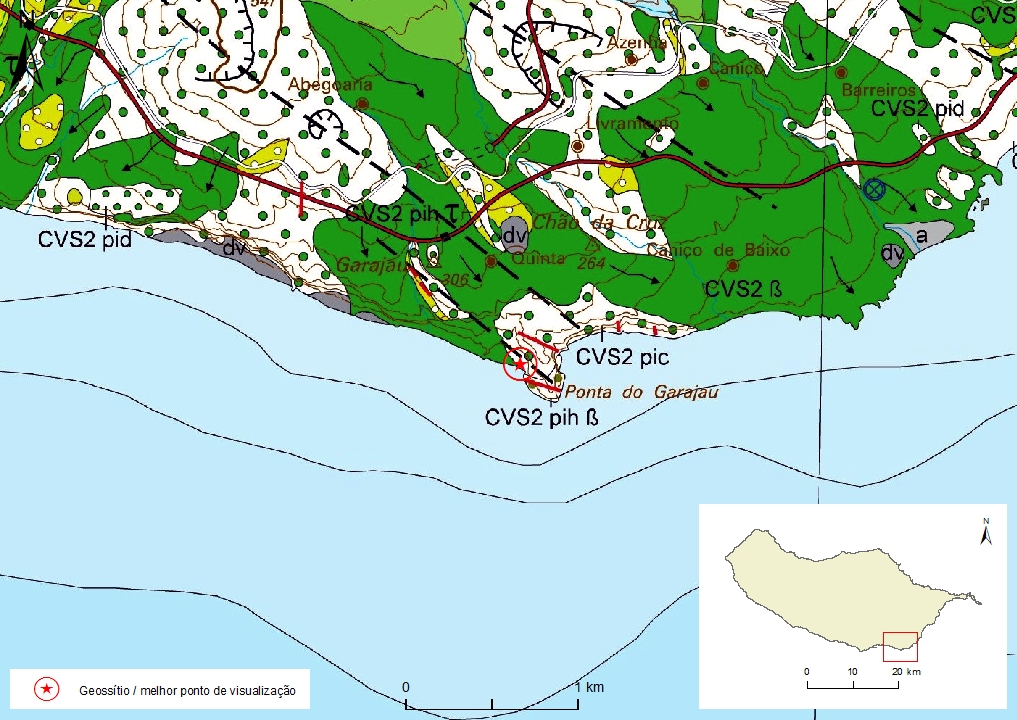
Geosite ID: SC01 Name: Ponta do Garajau Thematic category: Volcanology and Stratigraphy |
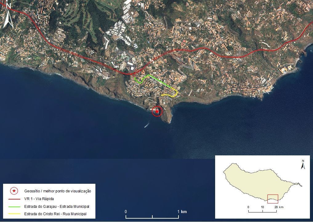 |
Municipality: Santa Cruz Civil parish: Caniço Location area: 0,1 -10 ha Coordinates(1):32°38'17.2'' N 16°51'07.5'' W Altitude: 3 m Accessibility: Easy Distance to nearest paved road: 100 m Conditions of observation: good (1) Coordinates of the geosite and / or the best viewpoint |
Brief description
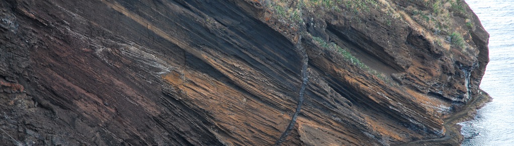
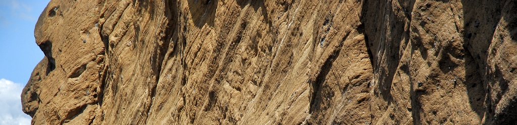
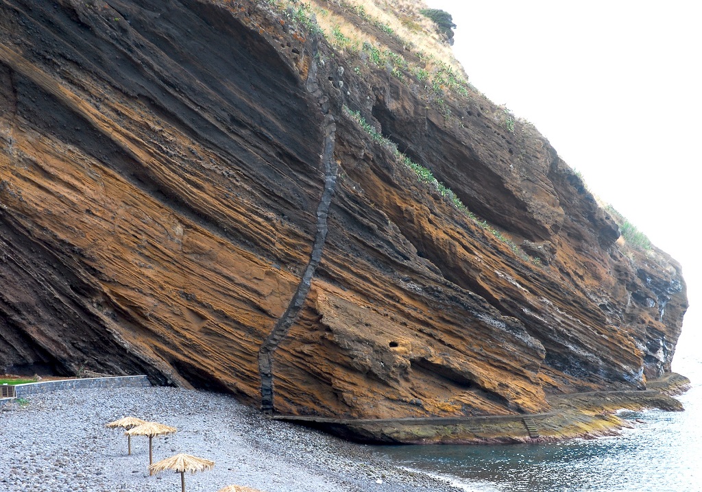
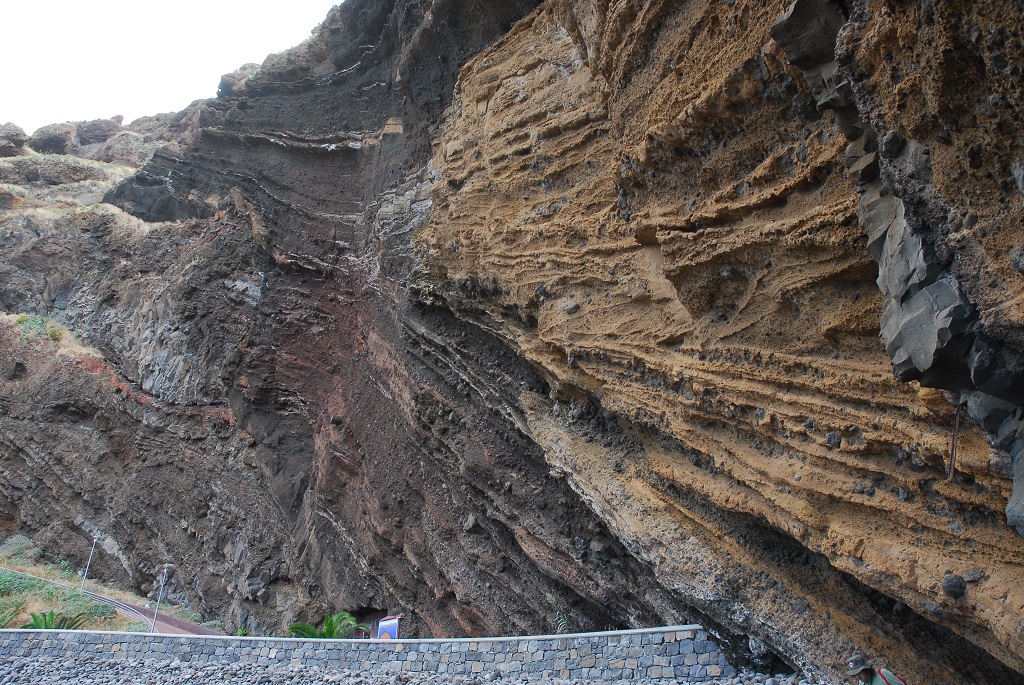
Ponta do Garajau presents great geological diversity, of high scientific value, the most notable of which is the Garajau surtseyan cone. It is a tuff cone formed by ash and block deposits (yellowish) associated with hydrovolcanic activity, alternating with lapilli deposits and bombs (black to reddish) associated with strombolian subaerial activity stages. The cone was built on a coastal cliff previously cut out in a succession of basaltic spills in the Funchal Formation, Upper Volcanic Complex (CVS). At the site, there are also two lodes that will have fed the later stages of the eruption.
Relevant notes
Visiting a site of geological interest is the sole responsibility of the user.
The user must take precautions when visiting the site, taking into account the conditions of the terrain, weather conditions and other hazards, so that they do not create situations that put themselves or others at risk.
The user must respect private property. Access to private areas requires prior authorization from the owners.
The user must respect natural heritage, keeping it intact. The impact of your actions should be minimal.
Protection status
Natural spaces of strongly conditioned use - Ups and cliffs (article 58º), according to the Municipal Master Plan, and the surrounding marine area is part of the Garajau Partial Natural Reserve.
Geological map of Madeira Island detail, Sheet b - SC01

Bibliography
BRUM DA SILVEIRA, A.; MADEIRA, J.; RAMALHO, R.; FONSECA, P., PRADA, S. (2010) - Notícia Explicativa da Carta Geológica da ilha da Madeira, na escala 1:50.000, folhas A e B. Edição da Secretaria Regional do Ambiente e Recursos Naturais, Região Autónoma da Madeira e Universidade da Madeira: 47 p. ISBN: 978-972-98405-2-4. (Editado em 2011).
BRUM DA SILVEIRA, A.; MADEIRA, J.; RAMALHO, R.; FONSECA, P.; RODRIGUES, C., PRADA, S. (2010) Carta Geológica da ilha da Madeira na escala 1:50.000 - Folha A e B. Edição da Região Autónoma da Madeira, Secretaria Regional do Ambiente e Recursos Naturais; ISBN: 978-972-98405-1-7 (Editado em 2011).
BRUM DA SILVEIRA, A.; PRADA, S.; RAMALHO, R.; MADEIRA, J.; FONSECA, P.; CANHA, E.; BRILHA, J. (2012). Inventariação do Património Geológico da ilha da Madeira. Secretaria Regional do Ambiente - Relatório Final, 414 p.
ZBYSZEWSKI, G.; VEIGA FERREIRA, O.; CÂNDIDO DE MEDEIROS, A.; AIRES-BARROS, L.; CELESTINO SILVA, L.; MUNHÁ, J.M. E BARRIGA, F. (1975). Carta Geológica de Portugal na escala 1:50.000. Notícia Explicativa das Folha A e B da Ilha da Madeira. Serviços Geológicos de Portugal: 53 p.
Inventory sheet
Photo gallery

How to Cite
BRUM DA SILVEIRA, A.; PRADA, S.; RAMALHO, R.; MADEIRA, J.; FONSECA, P.; CANHA, E.; BRILHA, J. (2012). Inventariação do Património Geológico da Ilha da Madeira. Secretaria Regional do Ambiente e Recursos Naturais - Relatório Final, 414 p. In: https://geodiversidade.