")
")
 |
Geosite ID: SV04 Name: Vale de São Vicente Thematic category: Geomorfology, Mass movements and Sedimentology |
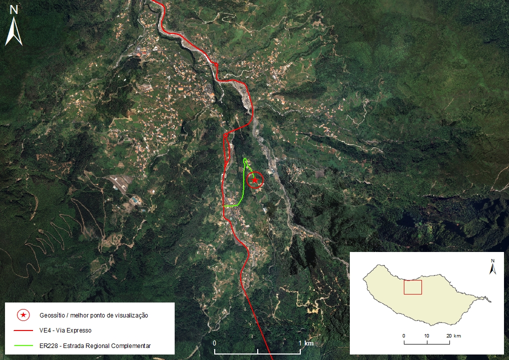 |
Municipality: São Vicente Civil parish: São Vicente Location area: 10 -1000 ha Coordinates(1):32°46'47.5'' N 17°01'45.2'' W Altitude: 386 m Accessibility: Easy Distance to nearest paved road: 1 m Conditions of observation: Good (1) Coordinates of the geosite and / or the best viewpoint |
Brief description
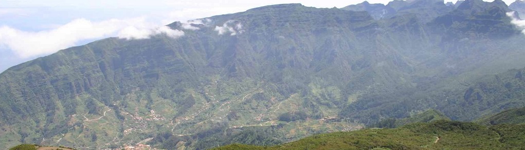
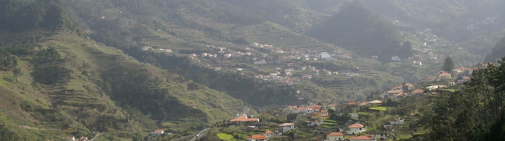
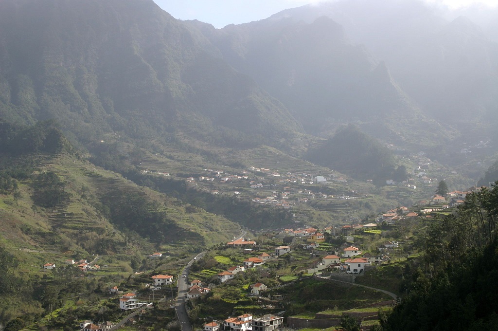
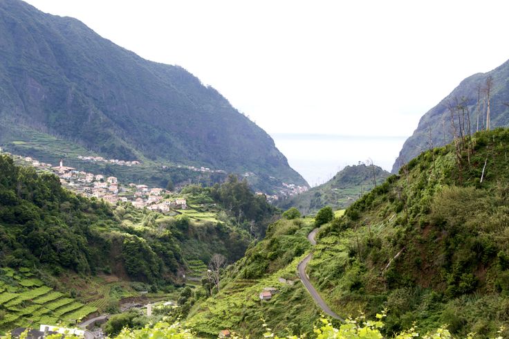
The São Vicente valley is one of the most evolved valleys on Madeira Island, showing a complex genesis characterized by differential remontant erosion processes, mass movements, and by various episodes of sedimentary and volcanic filling.
On this geosite, located on the edge of Regional Road 101, in Lombo da Vargem, it is possible to observe, inside the hydrographic basin of the Ribeira de São Vicente, a set of landforms characterized by top flattened interfluves. These landscape elements correspond to relics of old sedimentary filling surfaces constructed by alluvial fan systems from torrential drainage channels that drained into the river basin. These Alluvial fans are constituted by deposits of associations of conglomerate / breccioid facies, of the debris-flow type.
Relevant notes
Visiting a site of geological interest is the sole responsibility of the user.
The user must take precautions when visiting the site, taking into account the conditions of the terrain, weather conditions and other hazards, so that they do not create situations that put themselves or others at risk.
The user must respect private property. Access to private areas requires prior authorization from the owners.
The user must respect natural heritage, keeping it intact. The impact of your actions should be minimal.
Protection status
Agroforestry spaces - Agricultural spaces (article 44º), according to Municipal Master Plan.
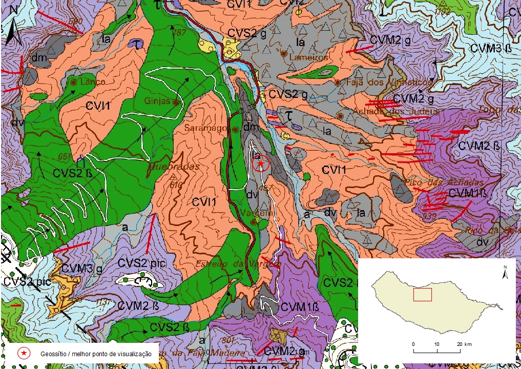
Geological map of Madeira Island detail, Sheet a - SV04

Bibliography
BRUM DA SILVEIRA, A.; MADEIRA, J.; RAMALHO, R.; FONSECA, P., PRADA, S. (2010) - Notícia Explicativa da Carta Geológica da ilha da Madeira, na escala 1:50.000, folhas A e B. Edição da Secretaria Regional do Ambiente e Recursos Naturais, Região Autónoma da Madeira e Universidade da Madeira: 47 p. ISBN: 978-972-98405-2-4. (Editado em 2011).
BRUM DA SILVEIRA, A.; MADEIRA, J.; RAMALHO, R.; FONSECA, P.; RODRIGUES, C., PRADA, S. (2010) Carta Geológica da ilha da Madeira na escala 1:50.000 - Folha A e B. Edição da Região Autónoma da Madeira, Secretaria Regional do Ambiente e Recursos Naturais; ISBN: 978-972-98405-1-7 (Editado em 2011).
BRUM DA SILVEIRA, A.; PRADA, S.; RAMALHO, R.; MADEIRA, J.; FONSECA, P.; CANHA, E.; BRILHA, J. (2012). Inventariação do Património Geológico da ilha da Madeira. Secretaria Regional do Ambiente - Relatório Final, 414 p.
Photo gallery
How to Cite
BRUM DA SILVEIRA, A.; PRADA, S.; RAMALHO, R.; MADEIRA, J.; FONSECA, P.; CANHA, E.; BRILHA, J. (2012). Inventariação do Património Geológico da Ilha da Madeira. Secretaria Regional do Ambiente e Recursos Naturais - Relatório Final, 414 p. In: https://geodiversidade.