")
")
 |
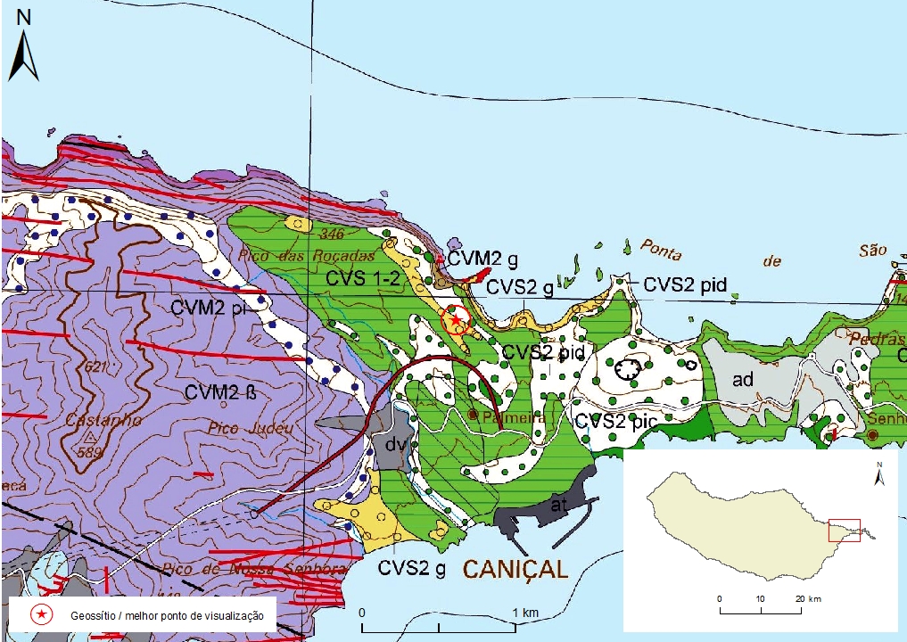
Geosite ID: M01PSL02 Name: Ponta do Bode 2 Thematic category: Sedimentology |
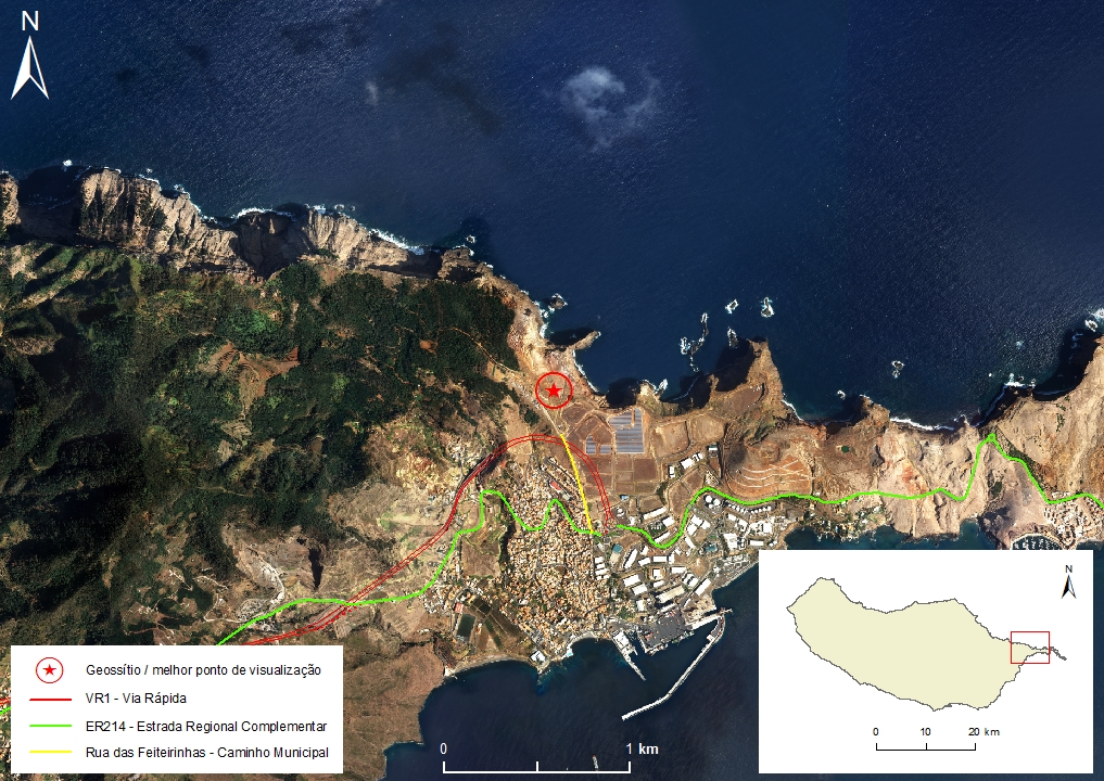 |
Municipality: Machico Civil parish: Caniçal Location area: 0,1 -10 ha Coordinates(1):32°44'55.6'' N 16°44'23.8'' W Altitude: 164 m Accessibility: Easy Distance to nearest paved road: 450 m Conditions of observation: Good (1) Coordinates of the geosite and / or the best viewpoint |
Brief description
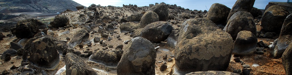
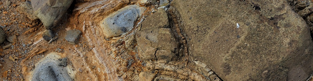
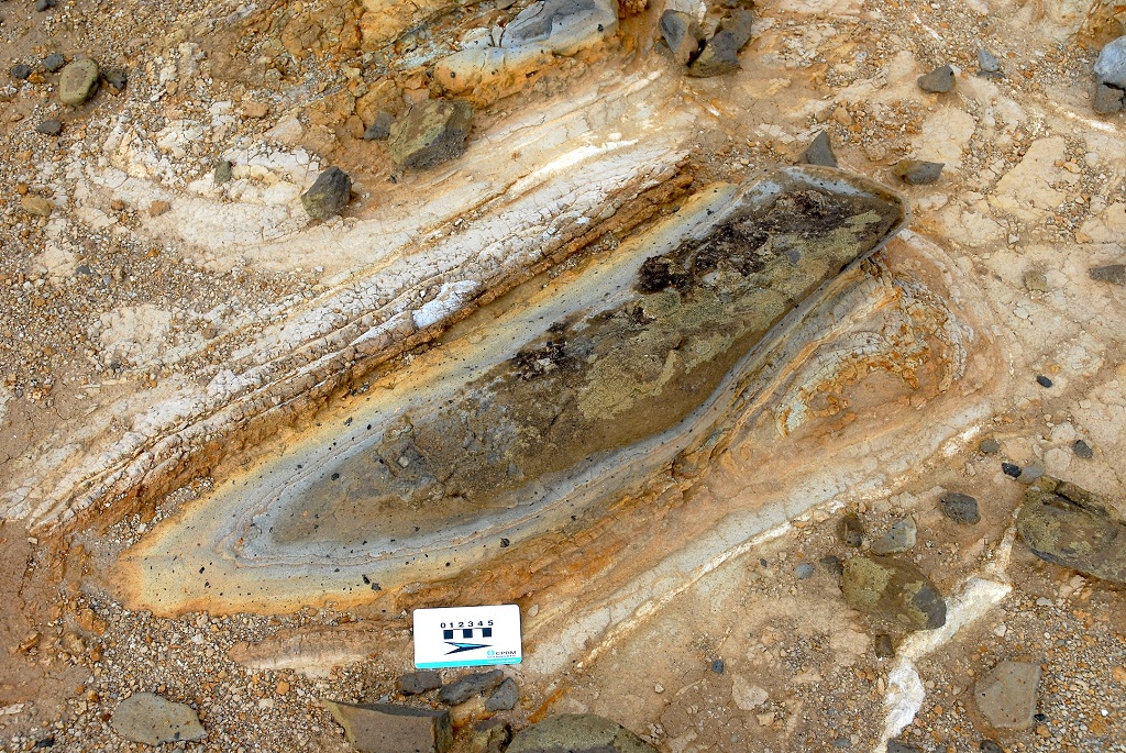
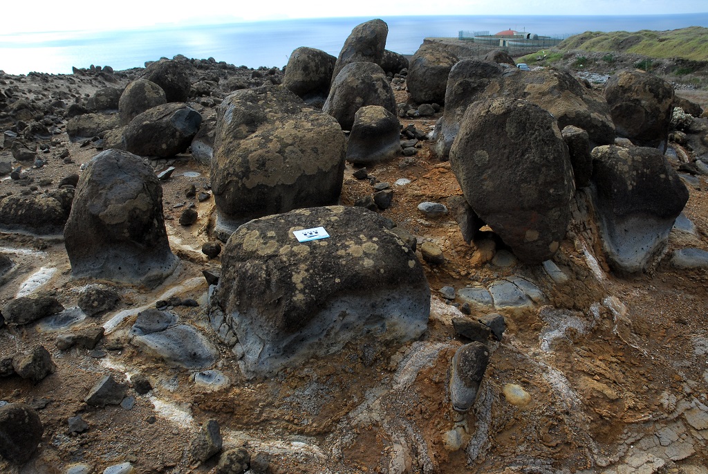
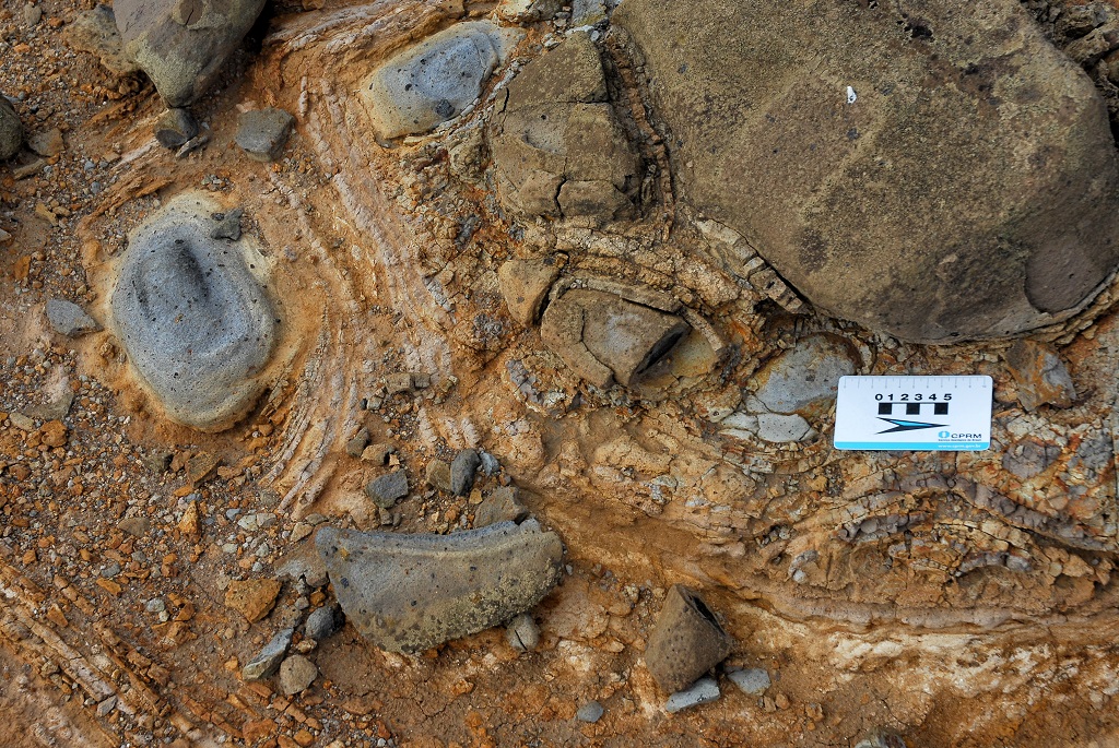
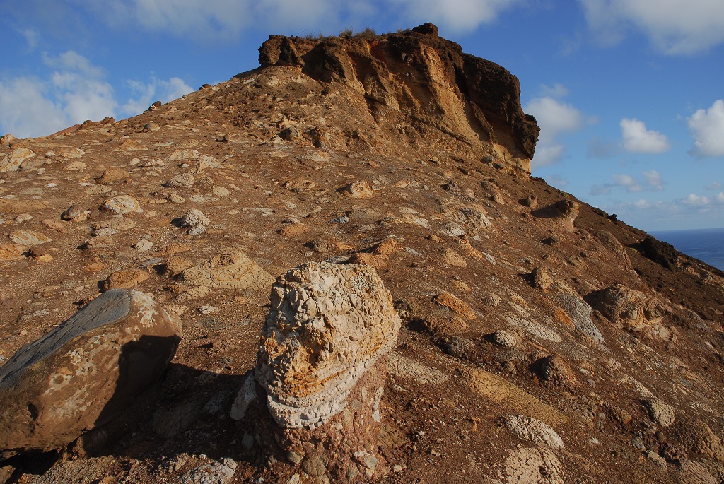
To the west of Ponta do Bode and north of the water reservoirs of Caniçal, it is possible to observe spheroidal alterations, as well as other aspects associated with weathering and differential erosion that formed in the thick basaltic outcrops of the Upper Volcanic Complex (CVS), that is represented here by the undifferentiated Lombos and Funchal Formations. Despite the degradation that is subject, to this site has a high aesthetic value due to the forms and colours that it exhibits.
Relevant notes
Visiting a site of geological interest is the sole responsibility of the user.
The user must take precautions when visiting the site, taking into account the conditions of the terrain, weather conditions and other hazards, so that they do not create situations that put themselves or others at risk.
The user must respect private property. Access to private areas requires prior authorization from the owners.
The user must respect natural heritage, keeping it intact. The impact of your actions should be minimal.
Protection status
Natural spaces of very conditioned use - Natural meadows (Article 55.º), according to the Municipal Master Plan, and Natural Park of Madeira.
Geological map of Madeira Island detail, Sheet b - M01PSL02

Bibliography
BRUM DA SILVEIRA, A.; MADEIRA, J.; RAMALHO, R.; FONSECA, P., PRADA, S. (2010) - Notícia Explicativa da Carta Geológica da ilha da Madeira, na escala 1:50.000, folhas A e B. Edição da Secretaria Regional do Ambiente e Recursos Naturais, Região Autónoma da Madeira e Universidade da Madeira: 47 p. ISBN: 978-972-98405-2-4. (Editado em 2011).
BRUM DA SILVEIRA, A.; MADEIRA, J.; RAMALHO, R.; FONSECA, P.; RODRIGUES, C., PRADA, S. (2010) Carta Geológica da ilha da Madeira na escala 1:50.000 - Folha A e B. Edição da Região Autónoma da Madeira, Secretaria Regional do Ambiente e Recursos Naturais; ISBN: 978-972-98405-1-7 (Editado em 2011).
BRUM DA SILVEIRA, A.; PRADA, S.; RAMALHO, R.; MADEIRA, J.; FONSECA, P.; CANHA, E.; BRILHA, J. (2012). Inventariação do Património Geológico da ilha da Madeira. Secretaria Regional do Ambiente - Relatório Final, 414 p.
RAMALHO, R. (2004) Cartografia Geológica da Madeira. Estratigrafia e Tectónica do Sector a Leste de Machico. Universidade de Lisboa. Faculdade de Ciências. 146 p.
RAMALHO, R.; BRUM DA SILVEIRA, A.; MADEIRA, J.; FONSECA, P.E.; PRADA, S.; RODRIGUES, C. F. (2005b) Fracture pattern and structural control of Madeira Island Volcanism (Portugal). Volume de abstracts do International Workshop on Ocean Island Volcanism, Sal, Cabo Verde, 2 – 8 Abril 2005: p.33.
RAMALHO, R.; MADEIRA, J.; FONSECA, P.E.; BRUM DA SILVEIRA, A.; PRADA, S.; RODRIGUES, C. F. (2005a) Tectónica da Ponta de São Lourenço, Ilha da Madeira. Cadernos Lab. Xeolóxico de Laxe, Coruña. Vol. 30, pp. 223-234.
Photo gallery
How to Cite
BRUM DA SILVEIRA, A.; PRADA, S.; RAMALHO, R.; MADEIRA, J.; FONSECA, P.; CANHA, E.; BRILHA, J. (2012). Inventariação do Património Geológico da Ilha da Madeira. Secretaria Regional do Ambiente e Recursos Naturais - Relatório Final, 414 p. In: https://geodiversidade.